A widely anticipated El Nino is predicted to bring a welcome change for our rain-weary north this winter – but not before more bouts of “potentially high-impact” weather, a forecaster says.
Niwa’s just-issued outlook for winter offers a mixed bag of climate trends around New Zealand which, under a rare “triple-dip” La Nina, has experienced consecutive record-warm winters since the start of the decade.
While a forming El Nino was waiting in the wings – and there were some early signs it could be a strong one, with major global implications – New Zealand was still feeling the faded La Nina’s lagged, warm-and-wet influence as it entered the first week of meteorological winter.
“For the last couple of months, we’ve been talking about how winter could be a pivot-point towards more El Nino-like patterns, which tend to bring more westerlies and drier conditions in the east,” Niwa meteorologist Ben Noll said.
“However, as we sifted through the data for this outlook, we found that the warm ocean water that has been so persistent in the West Pacific during La Nina over the last three years is moving very slowly to the east.”
Because of that slow shift – particularly the fact that it was keeping in place a reservoir of warm water to fuel big rainmakers approaching from the north - New Zealand remained exposed to the kind of unsettled, La Nina-like weather that’s lingered over autumn.
“It’s kind of like a delayed atmospheric response to the building El Nino pattern, and what we have in June, over the next couple of weeks, is pretty similar to what we’ve experienced this year,” Noll said.
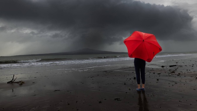
As at late May, Auckland had already been drenched with nearly an entire year’s rainfall in less than five months, with totals running almost three times above average.
It’d also been a miserably wet 2023 for many other centres: the weather station at Whangārei Airport registered more than 1300mm – three times its mean for this time of year – while Tauranga Airport had received double the usual.
Those rainfall totals would only grow with “potentially high-impact” weather events expected this fortnight, Noll said, including snow at high elevation in parts of the South Island this weekend, and possible heavy downpours for the east of both islands next week.
“While many of us may have been wanting better news, in terms of things trending a bit drier, I think we’re going to have to wait on that a bit longer.”
That change could finally come over July and August: and Niwa’s outlook indicated equal odds for normal to below normal rainfall for the northern North Island over the season as a whole.
/cloudfront-ap-southeast-2.images.arcpublishing.com/nzme/VVXKNXIXEJFJNKZUWUV7K4Q7UY.png) Source / Niwa
Source / Niwa
“What we think is going to happen, later in winter, is that we’ll begin to have more high-pressure systems building in the Tasman Sea and migrating towards the upper part of the North Island,” he said.
“And that can also mean that fronts die out before they reach places like Waikato, Auckland, Northland and Bay of Plenty.
“So, there may be a trend through the season for northern areas - and perhaps the eastern part of both islands - towards drier weather, over the back half of winter.”
/cloudfront-ap-southeast-2.images.arcpublishing.com/nzme/ZBYCXC2OXRHOPGQ42OCSHARG6I.png) Source / Niwa
Source / Niwa
While a colder-than-average winter was still thought unlikely, Noll said people still might notice the season to be chillier than our past few.
“That’s because of an increase in southerly air flows, including southeasterlies early on, which can bring cooler conditions to east of both islands, in particular,” Noll said.
“Then, later in the season, we might see more southwesterlies, which may put wind flow patterns on the West Coast on the cooler side, while also having a big influence on rainfall.
“In either case, it may be the top of the North Island that sees some decrease in typical rainfall, over what’s normally the wettest season of the year.”
Noll added that seas around New Zealand were still running warmer than average – and while those anomalies wouldn’t be as stark as previous winters, even sea temperatures at 0.5C above normal could take some of the cold sting out of incoming southerly air masses.
As for the coming El Nino, Noll said it was too early to say whether we’d be in the throes of a historically severe one by summer – when previous systems have plunged swathes of the north and east into drought.
“We are actively monitoring how this event stacks up with the previous three big ones, in 2015, 1997 and 1982,” he said.
“At this point, the warming we’re seeing in the equatorial Pacific is pretty well aligned with what we saw in 2015.”
But he stressed that each El Nino was different, with varying impacts for different parts of the world.
“What we are seeing for New Zealand, at least, is that our pattern-switch is likely to be delayed because of all that excess warmth lingering in the West Pacific,” he said.
“So, again, we’re probably going to have to wait a few months as we get closer to spring, for that El Nino pattern to really settle in here.”
Globally, El Nino is known to bring warmer temperatures – and it’s almost certain that one of the next few years will prove the planet’s hottest on record, with the big driver arriving with a climate change tail-wind.
Last month, the World Meteorological Organisation (WMO) warned that a combination of ongoing climate heating and El Nino may push global temperatures into “uncharted territory”.
For at least one of the next five years, the UN agency gave a 66 per cent chance of the annual global surface temperature temporarily exceeding 1.5C above pre-industrial levels – a symbolic threshold the UN Paris Agreement aspired to limit warming to.
While scientists are still debating whether climate change is skewing the cycle toward El Nino, La Nina or neither, a newly published study found that events under each regime were becoming more frequently strong as our planet continues to heat.
Take your Radio, Podcasts and Music with you
Get the iHeart App
Get more of the radio, music and podcasts you love with the FREE iHeart app. Scan the QR code to download now.

Download from the app stores
Stream unlimited music, thousands of radio stations and podcasts all in one app. iHeart is easy to use and all FREE


