A late winter storm is set to hit New Zealand in the coming days bringing gales, heavy snow and rain.
MetService has issued heavy rain watches and strong wind watch for a few parts of South Island already and later this morning, more severe weather warnings are likely to be forecasted.
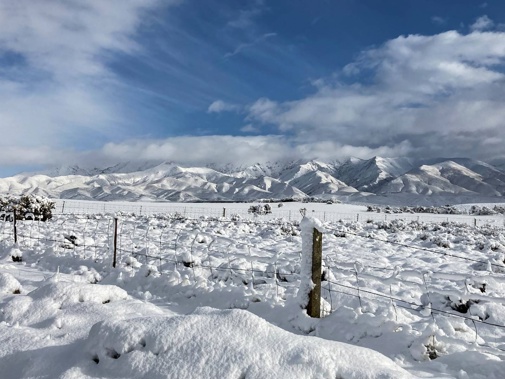
The forecaster’s Severe Weather Outlook showed a risk of heavy rain, strong winds and heavy snow for parts of the country starting tomorrow till mid-next week.
MetService meteorologist David Miller said people should prepare for a series of weather fronts hitting New Zealand in the coming days.
These weather systems would bring strong winds, gales and cold nights to the country.
“We have issued heavy rain watches for Fiordland and ranges of Westland already, it comes into effect this afternoon. The forecast would be updated later this morning for areas impacted by storm.”
Although this cold storm was not unusual for the time of the year, “people should be aware of and prepare for it”, Miller said.
“At this stage, we are looking at snow of about 400-500 metres in the south for later tonight and Wednesday.
“Winds are likely to be quite strong. We are looking for strong wind warnings for areas like Canterbury high country and the south coast of South Island.”
Miller said a burst of rain was set to come tomorrow.
“In North Island, typically Wellington would experience some of the system as northwesterly winds pick up tomorrow. At this stage we are not looking at Auckland or Hawke’s Bay for warnings. It is not the right set-up.
“As we head into Wednesday, eastern parts of North Island are likely to see some strong winds but not heavy rain.”
Miller said this storm was due to fronts spreading around the country followed by cold airness.
“It is normal. We have been having such systems coming through for the last few weeks.
“All of these systems when we have heavy weather warnings and strong wind watches are always concerning, so you have to be prepared for them but it is not unusual at this time of the year.”
Miller said overnight temperatures for parts of the South Island were expected to remain in single digits.
For example, Invercargill could experience 1C to 2C and Christchurch 2C to 3C.
Niwa weather predicts there could be snowfall of up to 3cm and 15cm for Tuesday and Wednesday.
”The greatest amounts will fall at elevations near/above 700m,” it said in a tweet.
Niwa said the combination of strong wind and snow could make road travel dangerous.
This morning fog had blanketed Auckland slowing ferries and resulting in regional flights being cancelled.
Auckland Transport said “extreme fog” in the harbour meant the ferry to and from Beach Haven was running up to 15 minutes late.
Drivers on motorways were also being warned to take extra care due to the foggy conditions.
It’s the second day running that thick fog has descended across Auckland and affected public transport.
Approximately 10 domestic flights were cancelled, and one was delayed, an Auckland Airport spokesperson said.
Fog restrictions were in place since before 4am but were lifted just before 7am. International flights, and domestic flights to Wellington, Christchurch, Dunedin and Queenstown were affected by the fog.
Akula Sharma is an Auckland-based reporter who joined the Herald in 2022. She has previously worked at the Gisborne Herald.
Take your Radio, Podcasts and Music with you
Get the iHeart App
Get more of the radio, music and podcasts you love with the FREE iHeart app. Scan the QR code to download now.

Download from the app stores
Stream unlimited music, thousands of radio stations and podcasts all in one app. iHeart is easy to use and all FREE


