A thunderstorm warning has been issued for parts of Bay of Plenty and may bring heavy rain to the region.
MetService says that a line of “severe thunderstorms” is on the move and is expected to lie from Mayor Island to Te Aroha in the next hour.
The agency has issued a warning for Hauraki, Western Bay of Plenty and Matamata Piako, and say “these thunderstorms are expected to be accompanied by very heavy rain”.
“Very heavy rain can cause surface and/or flash flooding about streams, gullies and urban areas, and make driving conditions extremely hazardous.”
A severe thunderstorm watch remains in force for Coromandel Peninsula and Bay of Plenty.
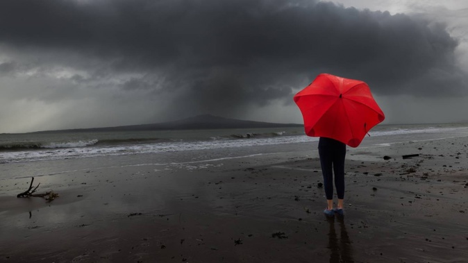
MetService meteorologist Mmathapelo Makgabutlane earlier warned long-weekend holidaymakers to take “extra caution” when travelling on roads.
“It is wet and slippery today with some roads in the South Island already collecting snow.”
Makgabutlane said yesterday and today, the weather was “pretty active.
“Rain is expected in many areas. People on the roads definitely need to take care, it is wet and slippery today, especially those in Eastern North Island we have yellow heavy rain watches for regions there.”
Makgabutlane said strong gusts were expected in both islands.
“Just take extra care.”
MetService was looking at rain intensity and as any updates come, they would update the warnings, Makgabutlane said.
“It is a chilly day... the first reality check is that we are officially in winter now. The daytime temperature would be chilly, a little different than what we have had recently.”
Holidaymakers travelling on roads should check the Waka Kotahi NZ Transport Agency website for weather-related disruptions, she said.
Four heavy rain and strong wind watches have been issued for regions in the North and the South by MetService, some lasting for up to 30 hours.
Some main routes in the South Island are expected to have 3cm of snow.
Showers will begin for people in Hawke’s Bay, Coromandel, Gisborne and Canterbury north of Arthur’s Pass and Marlborough east of Awatere Valley from midday today.
A heavy rain watch has been issued for these regions for the next 24-30 hours.
Those in Taranaki, Nelson, Buller and Marlborough west of Wairau Valley but excluding the Sounds, Wellington and Marlborough Sounds, Westland including the Grey District can expect strong gusts for most of today slowly easing as evening approaches.
In the South, Lewis Pass (SH7), Arthur’s Pass (SH73), and Porters Pass (SH73) had been placed under road snowfall warnings overnight by MetService, with a forecast saying up to 3cm of snow could collect.
Heavy showers are also expected in Northland and Auckland.
Those in the Coromandel Peninsula and Bay of Plenty should prepare for periods of rain, with some heavy falls and possible thunderstorms.
Gisborne and Hawke’s Bay remain cloudy, with rain spreading south this morning.
Some possibly heavy and thundery falls are forecast in Gisborne from the afternoon.
Whanganui to Wellington, also Wairarapa, could experience scattered showers, turning to rain in Wellington and Wairarapa this morning, then easing in the afternoon and clearing north of Wellington later.
Rain with snow of up to 600m is possible for Marlborough about the Kaikōura ranges.
For Nelson, Buller, Westland, and Fiordland, it is a fine day with any remaining showers in Nelson clearing this morning.
Canterbury remains cloudy with a possibility of showers.
There will be cloudy periods, with isolated showers in Southland, Clutha and Dunedin.
In the Chatham Islands, the sky is partly cloudy, with a few showers developing this morning.
Take your Radio, Podcasts and Music with you
Get the iHeart App
Get more of the radio, music and podcasts you love with the FREE iHeart app. Scan the QR code to download now.

Download from the app stores
Stream unlimited music, thousands of radio stations and podcasts all in one app. iHeart is easy to use and all FREE


