Scientists are warning that disastrous, once-in-a-century flood events today could be happening annually in our two biggest cities, within just two decades.
That's on the back of new data which, for the first time, incorporates the added effect of sinking and rising land across more than 7400 different sites – and under different time-points and climate change scenarios.
Victoria University climate scientist Professor Tim Naish, who co-leads the NZ SeaRise programme that carried out the work, said factoring in land movement explained why projections at most places had just changed dramatically.
While around 30cm of baked-in sea level rise was already locked in around the country by mid-century, Wellington, Auckland, Napier, Marlborough and Nelson could get double that global average.
"This means 60cm by 2060 and 1.2m by 2100 in some places," he said.
"This means if you're a coastal user you halve half the time you thought you had before sea level-impacts become disruptive.
"An example of this is that with 30cm of sea level rise the 100-year-coastal storm surge and flood will become an annual event for many places.
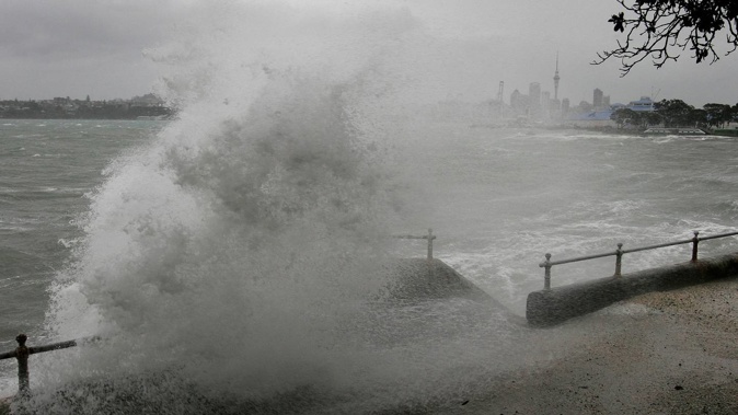
"In these regions where the land is going down at more than 3mm per year, such as parts of Wellington and Auckland, this threshold will be exceeded as soon as 2040."
And in an Auckland harbour that was 80cm higher, by 2100 that could be happening with every high tide.

This map shows vertical land movement in Auckland, which is contributing to sea level rise levels. Image / Supplied
In Auckland, a city spread between two harbours and surrounded by 3100km of coastline, previous estimates have put the number of residents vulnerable to rising seas at 43,000.
Buildings at risk include Auckland Airport, Middlemore Hospital, much of the CBD area – while as much as $7.1b of ratepayer-owned infrastructure is at risk with just 1.5m of rise.
In the heart of Auckland, at the Viaduct Harbour, the sea could rise by 35cm by mid-century, 86cm by 2100, and 1.4m by 2150.
Elsewhere around the city, seas could rise by 76cm near Auckland Airport, 80cm at Devonport, and 63cm at Glen Innes this century – and to 1.2m, 1.3m and 1m by mid next century.
If the world could rein in warming to within the bounds of the Paris Agreement target, those values shift significantly.
A low-emissions future could mean 72cm of rise at the Viaduct by 2100, along with 62cm at the airport, 67cm at Devonport and 50cm at Glen Innes.
In Wellington – a harbourside city already grappling with worsening storm surge and high tides swamping stormwater pipes and infrastructure – the sea could rise by 41cm and 43cm at Oriental Bay, under low and medium emissions scenarios respectively, by 2050.
Those figures could shoot up to 87cm and 1m by 2100, and 1.3m and 1.6m by 2150.

Wellington. Image / Supplied
The medium emissions projections put potential century-end rise at Wellington Airport at nearly a metre; 79cm at Titahi Bay; and 85cm at Petone.
Further south, around Christchurch, the same scenario would lock in 85cm in Akaroa – and 1.3m by 2150.
While Sumner might only experience just over half a metre this century – or as little as 37cm in a low-emission future – Lyttleton Port could see 65cm, and Woodend 79cm.

Christchurch. Image / Supplied
Away from cities, the places projected to experience the highest rises included Wairarapa's wild coastline, where the sea level at Oroi Stream could rise by 50cm, 1.3m and 2.1m by 2050, 2100 and 2150 respectively – assuming emissions continued to climb at current rates.
Other national hot spots for sea level rise included Tasman Bay at Whangaroa River (1.2m by 2100 under a status-quo climate trajectory); Kaikoura Peninsula (1.1m by 2100 and 1.7m by 2150); Napier Airport (1.6m by 2150); and Rununder Point in eastern Marlborough (nearly a metre by 2100 and 1.6m by 2150).
In contrast, and under the same scenario, Pikowai near Matata in the Bay of Plenty might see just under 30cm this century – with similarly low levels projected for Fiordland (29cm at Hāwea/Bligh Sound); Whakatete Bay in the Firth of Thames (32cm); Stewart Island (31cm at Horseshoe Bay); and the North Island's East Cape (32cm).
Existing estimates show 675,500 Kiwis live in areas already prone to flooding, with a further 72,065 living in the firing line of where some of the most dramatic effects of sea level rise could hit.
One recent report warned thousands of seaside homes around New Zealand could face soaring insurance premiums – or even have some cover pulled altogether – within a decade and a half.
International experience and indications from New Zealand's insurance industry suggest companies start pulling out of insuring properties when disasters like floods become one-in-50-year events.
By the time that exposure has risen to one-in-20-year occurrences, the cost of insurance premiums and excesses will have climbed sharply - if insurance could be renewed at all.
The report found about 540 exposed homes in Auckland, with current median coastal flood premiums for once-in-a-century events of $2000, could reach that one-in-20-year threshold with just 15cm of sea-level rise.
If insurance was still available at that point, the report found, premiums would have soared to $10,000.
For the 1740 Wellington homes modelled, median premiums could jump from $1800 to $8700 with seas 12cm higher.
In the South Island, 4850 properties in Christchurch and 3100 in Dunedin, could see premiums leap from $1600 to $7600 and $7900, with 13cm and 14cm of sea-level rise respectively.
The research also suggested that just small increases in sea level would likely cause at least partial retreat by insurers for most of those 10,000 homes, within only 15 years.
Insurance remained a requirement for residential mortgages, and failing to maintain it could trigger defaults.
Asked about the new projections today, Prime Minister Jacinda Ardern said sea level rise and its impacts was a "complex issue".
"We need to look at how we can ensure we're protecting any future infrastructure, but also how we deal with any issues of existing infrastructure being impacted by ... sea level changes."
The Government's draft National Adaptation Plan, put out for consultation last week, aimed to determine how the country should meet climate-driven impacts, and fund the costs that came with them.
- by Jamie Morton, NZ Herald
Take your Radio, Podcasts and Music with you
Get the iHeart App
Get more of the radio, music and podcasts you love with the FREE iHeart app. Scan the QR code to download now.

Download from the app stores
Stream unlimited music, thousands of radio stations and podcasts all in one app. iHeart is easy to use and all FREE


