Almost a full day of rain is likely for parts of New Zealand today and tonight, with the upper North Island and the west of the South Island in for heavy rain through to tomorrow.
Hikers, campers and New Year’s Eve revellers are being warned to take care as thunderstorms, slips and flooding - including flooded rivers - are possible in the worst-hit areas.
A warm, moist northwesterly flow is bringing rain or showers to all parts of the country, with thunderstorms possible in northern and western parts of both islands and the Deep South.
Flood risk north of Auckland
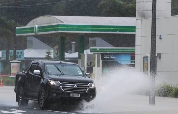
This afternoon MetService added heavy rain watches for Northland, Coromandel and Auckland, where rain has already been bucketing down since lunchtime. Those regions are now set for periods of heavy rain with possible thunderstorms.
Rain levels could approach or even exceed warning criteria in localised areas, the forecaster warned. Downpours of 25-40mm per hour were possible.
Thunderstorms and “very heavy, slow moving rain” meant there was a risk of pockets of flooding around the Northland-Auckland boundary this afternoon, according to forecaster Weatherwatch.co.nz.
MetService last night put weather watches and warnings in place from Waikato and Bay of Plenty down to Fiordland, with 100-160mm of rain possible in some warning areas.
The west of the South Island is bearing the brunt of the bad weather, along with Taranaki, which has been hit by torrential rain since this morning. A heavy rain warning is in place for Taranaki Maunga through till 3am with a peak of 15-25 mm/h expected until mid-afternoon today.
The Westland ranges are under a 21-hour heavy rain warning until 6am Saturday, with 100-140 mm of rain expected over that time and peak rates of 20-30mm/h. Nelson has a heavy rain warning until 7pm tonight with up to 90mm of rain in total.
Heavy rain watches lasting 22 hours are in place for Buller, Waikato, Waitomo, Taumarunui, Taupō, Tongariro National Park and the Kaimanawa Mountains, while Fiordland’s watch lasts for 20 hours.
In the Bay of Plenty including Rotorua a heavy rain watch is in place till 10am Saturday.
Rainfall amounts could reach warning criteria in all those areas, with thunderstorms also possible in many areas.
Heavy rain means streams and rivers can rise rapidly and driving conditions may be hazardous, with possible surface flooding and slips. Thunderstorms are also possible in many areas, bringing intense localised downpours, according to MetService.
The national forecaster’s meteorologist John Law said those thinking of going camping should keep an eye on the forecasts to avoid being stranded by sudden floods or slips.
With heavy rain also expected across the Tararua Ranges and the Tongariro Crossing, keen hikers should also take care, Law said.
New Year’s Day to bring drier weather for 2024
The fast-moving weather system should improve by mid-Saturday but another front will bring more rain on Sunday, MetService says.
But there’s good news as 2024 dawns - both MetService and private forecaster WeatherWatch expect the weather to clear for New Year’s Day.
WeatherWatch head forecaster Philip Duncan said a big block of high pressure coming in from the Tasman Sea and Southern Ocean will bring clearing, cooler weather on January 1, with the recent high humidity taking a break.
Take your Radio, Podcasts and Music with you
Get the iHeart App
Get more of the radio, music and podcasts you love with the FREE iHeart app. Scan the QR code to download now.

Download from the app stores
Stream unlimited music, thousands of radio stations and podcasts all in one app. iHeart is easy to use and all FREE


