- 20 severe weather warnings and watches in place. Heavy rain and strong winds warnings upgraded to red alert for Northland, Auckland, Coromandel and Gisborne
- A state of emergency has been declared for Northland for seven days
- Thousands of properties are without power across parts of Northland and Auckland and lines company says people need to prepared for days without power
- Coromandel residents have been urged to consider evacuating early - the region is under the heaviest red rain warning
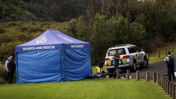
- Damage already felt across Northland
- Grab and go: A list of what to pack in a ‘grab bag’
- Cyclone’s latest track, region-by-region warnings, shelter locations and all you need to know
- Advice for how to cope with stress and anxiety
The impacts of Cyclone Gabrielle are already being felt, with gales wreaking havoc across the top of the North Island this evening.
The Auckland Harbour Bridge has been closed to all traffic as Gabrielle tracks closer, creating waves over 11m high in the Bay of Islands.
Air New Zealand has today cancelled all turboprop flights to, from or through Auckland, Hamilton, Tauranga and Taupo airports from midday today until midday Tuesday.
The airline is also cancelling all domestic jet services in, out and through Auckland Airport tomorrow.
Meanwhile, a state of emergency has been declared for Northland as MetService warns the worst is yet to come.
Twenty severe weather warnings and watches have been upgraded for the North Island.
The whole North Island was put under a severe weather warning for strong wind - and Northland, Coromandel and Auckland have the highest red warning.
MetServce’s Lisa Murray, head of weather communications, said: “I can’t remember a time when the whole of the North Island was on a wind warning.
“This is a huge sprawling weather system affecting the country,” Murray said.
“The worst affected areas can expect 350-450mm of rain, 120-140km/h wind gusts, and dangerous waves and coastal inundation, especially at high tide.”
- Tropical Cyclone Gabrielle: All you need to know
- Why this storm could be worse: High winds to cause power cuts, downed trees, more slips and surges
- Cyclone Gabrielle warnings: Residents told to 'prepare for worst' - and to stock up on essentials
- Cyclone Gabrielle: Air New Zealand asks all passengers to reconsider travel
STORY CONTINUES AFTER LIVE BLOG:
STORY CONTINUES:
Prime Minister Chris Hipkins has urged people to “take the severe weather warning seriously”.
“Make sure you’re prepared. There is no need for panic buying,” he said at a press conference in Auckland this afternoon.
Thousands of homes across Northland and Auckland are without power and one lines company has told customers to be prepared for prolonged outages.
“Some properties may be without power for days if damage is severe,” Counties Energy said.
More than 5000 households across the Far North were without power at 5pm on Sunday.
Fullers has cancelled all its Auckland ferry services from 8.45pm on Sunday, Countdown will close several supermarkets early in affected areas and SH1 over the Brynderwyns is again closed overnight from 6pm Sunday.
Several schools across Auckland have announced they will be closed tomorrow.
Northland Emergency Management group controller Graeme MacDonald requested the region’s state of emergency so emergency powers could be used.
The declaration was made as a precaution to enable evacuations.
The Hawke’s Bay Emergency Management was also preparing for heavy rain, potentially damaging winds and large waves due to the cyclone there.
Lines company Vector’s outage map showed extensive power cuts across northern Auckland areas and Waiheke Island.
Waka Kotahi NZ Transport Agency is advising motorists that the section of SH1 Brynderwyn Hills to Waipu will be closed overnight from 6pm tonight.
”Due to the amount of rainfall today and forecasted overnight, and the risk of slips, the decision has been made to close the road overnight to keep everyone, including our crews, safe. The road may be closed earlier if deemed unsafe.”
Waka Kotahi crews will reassess the road in the morning to check if it is safe to open again.
Detours will be in place overnight for light vehicles via Mangawhai and Waipū, and for heavy vehicles via SH12 and SH14.
The closure of the Brynderwyns comes only two days after the highway reopened in both directions after being closed for two weeks by storm-induced slips.
Ferries around Auckland this evening have been cancelled as ocean conditions in the Hauraki Gulf worsened.
Meanwhile, a tree has fallen on a house in Mangawhai.
Fire and Emergency shift manager Colin Underdown said one fire appliance attended the incident on Cames Rd, Mangawhai, and staff were assisting the occupants.
Auckland and Coromandel are under MetService’s highest severe weather warnings possible as Cyclone Gabrielle tracks closer to New Zealand bringing strong winds and heavy rain.
MetService has issued red warnings for both heavy rain and strong winds for these regions.
Red heavy rain warnings are also in place for Northland and Gisborne, while orange warnings for heavy rain and strong winds are active for most other regions across the North Island.
“Gabrielle has lost its tropical characteristics, this doesn’t mean it is weaker,” MetService said on Sunday morning.
“It will be a very intense system as it moves closer to our shores in the coming days. Widespread severe weather is forecast, with the worst expected on Monday/Tuesday.”
In a social media post this morning, Auckland Emergency Management said residents should consider evacuating early if they are in flood-prone or isolated areas.
Some Coromandel residents have been given the same advice from local authorities.
“We are now confident to say that a very severe and destructive cyclone is descending on Coromandel. It is now going to arrive earlier than anticipated, Sunday ... later in the afternoon,” said Thames Coromandel District council Civil Defence controller Garry Towler.
“We are going to have over 400mm of rain, with wind gusts in excess of 140 to 150km/h ... seriously consider preparing to evacuate if you are in areas that are prone to flooding or areas that are going to be inundated with coastal surge.”
Take your Radio, Podcasts and Music with you