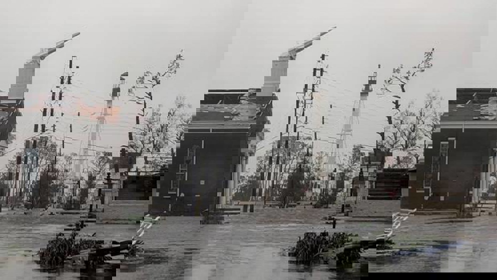


Hurricane Michael barrelled into the Florida Panhandle with winds of 155mph (250km/h) Wednesday, leaving a trail of devastation in its wake, as it became the most powerful storm to ever hit the region - and the fourth strongest to make landfall in the United States.
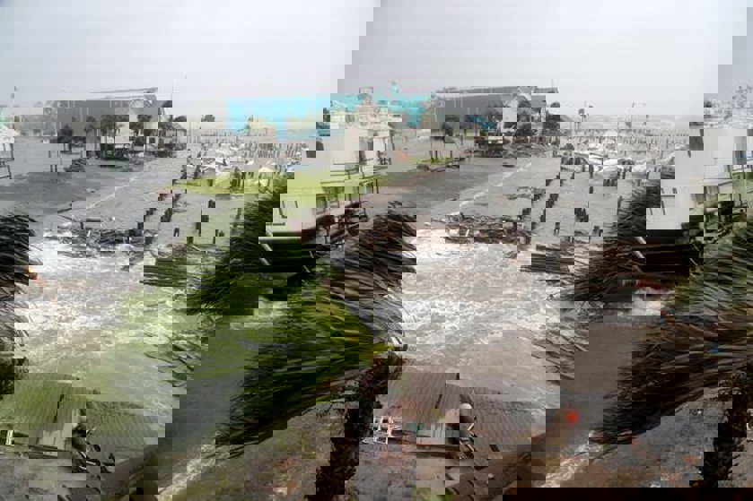
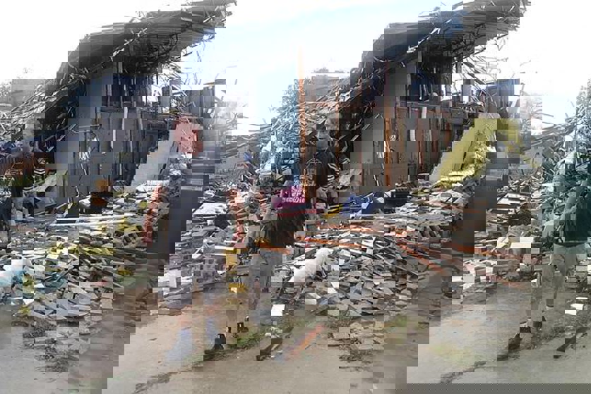
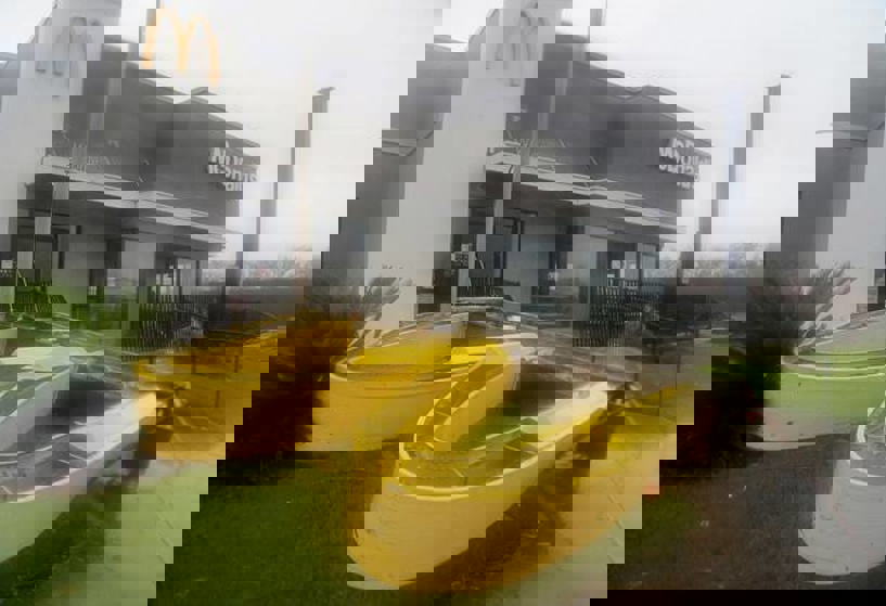
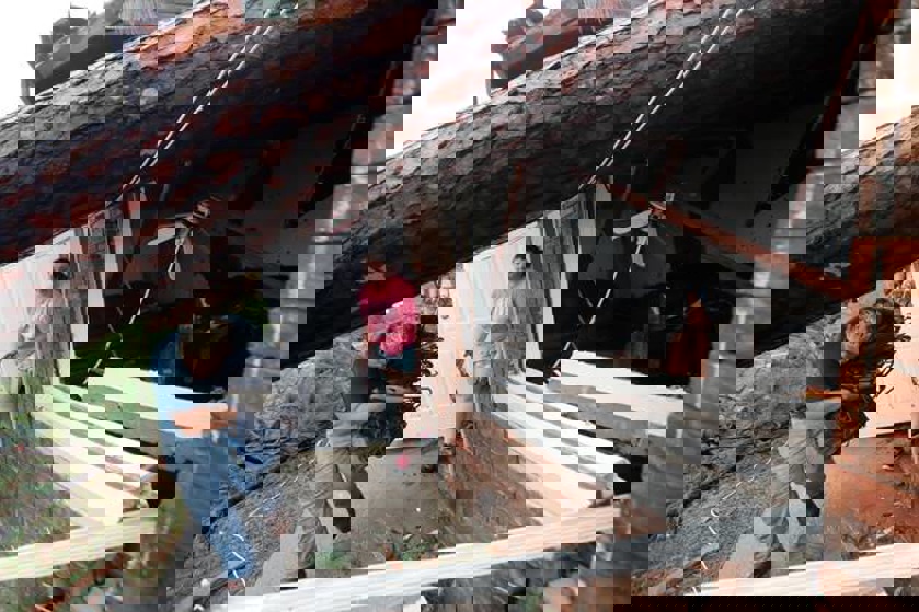
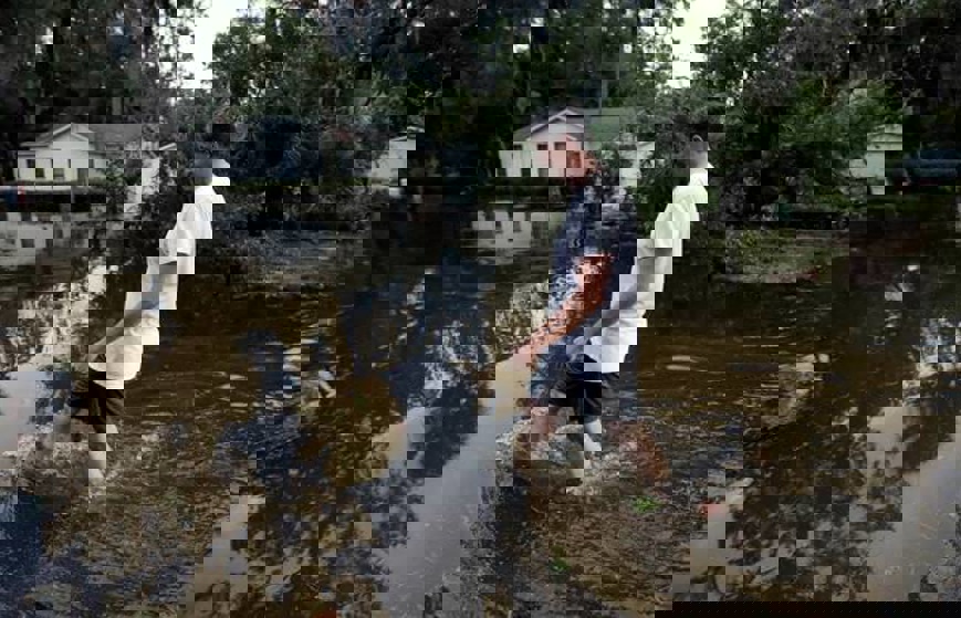
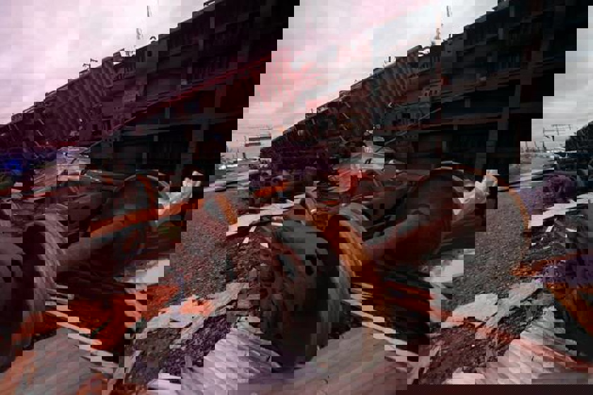
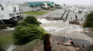
Roads were flooded, trees uprooted and homes were destroyed after the "monstrous" storm ploughed into Mexico Beach at just before 2pm local time and swept across the state.
At least one man has been killed after a tree crashed through the roof of his Greenboro home and trapped him. Emergency crews were heading to the home, but downed power lines and blocked roads were making the trip difficult. Officials hadn't immediately confirmed the man's name.
And Seminole County Emergency Management Agency Director Travis Brooks was reported as saying a tree fell onto a home in Georgia Wednesday afternoon and killed an 11-year-old girl. Authorities have not released her identity.
More than 311,000 homes and businesses in Florida, Georgia and Alabama have also been left without power, according to local power companies.
The storm came ashore as a category 4 hurricane on the five-step Saffir-Simpson wind scale, before it was downgraded to a category 3. By 8pm, it was down to a category 1.
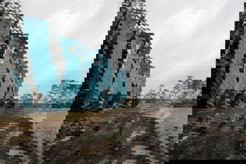
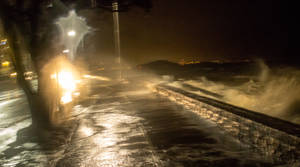
The winds were so strong they brought down a billboard in Florida's Panama City, tore down a Texaco gas pumping station canopy in Inlet Beach, and the storm surge completely knocked a house of its foundations in Mexico Beach. Beachfront structures could be seen collapsing and metal roofing materials were blown away amid the heavy rain.
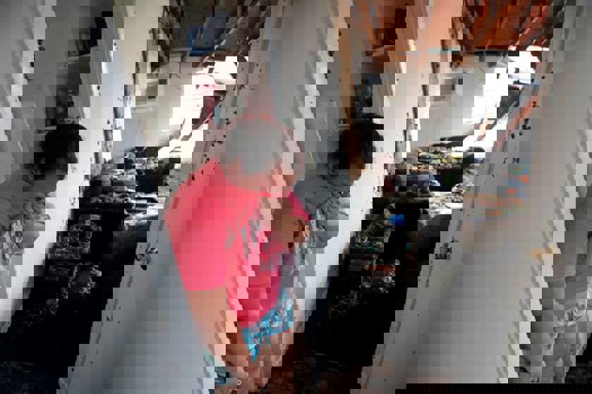
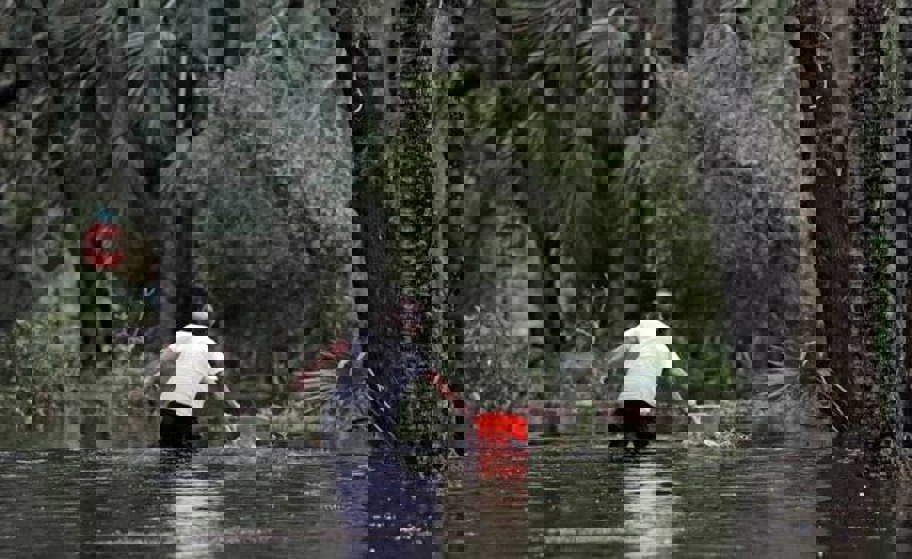
Footage shows other homes and cars submerged in flood waters as the hurricane battered the Sunshine State.
Michael had top sustained winds of 150 mph as its core moved over Florida's Panhandle earlier in the afternoon as forecasters warned rain could reach up to a foot and the life-threatening storm surge could swell to 14 feet (4m).
Mexico Beach councilwoman Linda Albrecht told CNN she fears she won't have a home to go back to after the hurricane sweeps through the state.
"It is extremely emotional," she said, fighting tears. "It's like a nightmare. You just want somebody to shake you and wake you up. How can this happen?
"I am hearing on TV, as all of us go home, it will be like a war zone," she added. "That's the only thing I can imagine."
Reid Garrett warned that every single building he'd seen in Panama City, had damage.
The National Weather Service says tornadoes are possible across the Florida Panhandle, southeast Georgia and southern South Carolina through Thursday morning as the hurricane now moves inland.
Authorities told residents along the affected areas of Florida's Gulf of Mexico coast on Wednesday morning that they had run out of time to evacuate and should hunker down. More than 375,000 people had been urged or ordered to evacuate, but emergency authorities lamented that many people ignored the warnings and seemed to think they could ride it out.
A Red Cross official said it's possible that as many as 320,000 people on Florida's Gulf Coast did not evacuate and are likely riding out the storm. Emergency managers say they don't know how many left the area, but there were about 6000 people in 80 shelters in five states, including nearly 1200 who are still in shelters following Hurricane Florence.
After the hurricane made landfall, Florida Governor Rick Scott urged those who didn't evacuate to stay in place.
"We are still in the midst of a Category 4 catastrophic and historic storm. I urge all Floridians in the Panhandle to continue sheltering in place, and listening to local authorities. Stay inside until directed further so that our recovery teams can move in as quickly as possible," he tweeted.
Scott had earlier said the hurricane would bring "unimaginable devastation" and said he was "scared to death" for those who ignored evacuation orders.
"Our biggest concern is… the people that chose not to evacuate," he told CNN. "I worry about them every second and I hope there're no children there who didn't have the choice on their own to make these decisions.
"I'm just praying for them and, as soon as this passes, we will be out there doing everything we can to rescue everybody… We will take care of each other."
The head of the Federal Emergency Management Agency, Brock Long, told President Donald Trump in a briefing shortly before the eye of the storm hit that it was the "worst kind" of hurricane.
"Storm surge estimates are anywhere between nine and 14 feet. Storm surge is going to be the worse where eye makes landfall - just to the east or south of where the eye makes landfall… Coupled with that you have over 145 mph winds. Structures built before 2001 are not designed to handle that type of wind, typically," Long said.
Florida Republican Senator Marco Rubio told CNN it would be a "killer hurricane" and warned anyone in the path of the storm surge: "You're going to die".
Residents and tourists were told to flee low-lying areas in at least 22 counties along the shore in Florida's Panhandle and adjacent Big Bend region.
Meteorologists said it had the potential to become one of the worst storms in the history of the region as they watched satellite imagery in complete awe while the storm intensified.
"I guess it's the worst-case scenario. I don't think anyone would have experienced this in the Panhandle," meteorologist Ryan Maue of weathermodels.com said. "This is going to have structure-damaging winds along the coast and hurricane force winds inland."
National Hurricane Center Meteorologist Dennis Feltgen added: "We are in new territory. The historical record, going back to 1851, finds no Category 4 hurricane ever hitting the Florida Panhandle."
A satellite image of Michael took the terrifying shape of a skull as it roared closer to the Florida Panhandle as a fierce Category 4 storm on Tuesday. The sinister-looking red and gray skull appeared briefly on the National Oceanic and Atmospheric Administration infrared satellite images.
Trump declared a state of emergency for the entire state of Florida, freeing up federal assistance to supplement state and local disaster responses.
About 2,500 National Guard troops were deployed to assist with evacuations and storm preparations, and more than 4,000 others were on standby. Some 17,000 utility restoration workers were also on call.
Trump was briefed on the hurricane on Wednesday prior to it making landfall and said he would visit the area early next week. He acknowledged that a lot of the residents in the area were poor and said it was probably tough to leave.
Multiple airports were closed on Wednesday, including Tallahassee International Airport, Northwest Florida Beaches International Airport, Pensacola International Airport and Destin-Fort Walton Beach Airport.
A total of 453 flights had been cancelled on Wednesday across the country, with many occurring in the Florida area. Amtrak has also modified its service and is waiving fees for passengers who change their reservations.
Michael has now weakened to a tropical storm over south-central Georgia but is forecast to dump torrential rain over Florida, Alabama and Georgia, as well as the Carolinas and into Virginia. Up to a foot of rainfall was forecast for some areas, still recovering from Hurricane Florence's flooding.
How Michael turned into a monster
Hurricane Michael was barely a hurricane Tuesday morning local time, with winds of 90mph (145km/h). A little over a day later, it had transformed into a monster.
When it made landfall Wednesday afternoon, it was blowing at 155mph (250km/h). That's a 72 per cent increase in wind speed in less than 33 hours.
Meteorologists first got a sense something big could be happening by watching how Michael's eye changed shape.
Moist air, warm waters in the Gulf of Mexico, and ideal wind patterns supercharged Hurricane Michael in the hours before it smacked Florida's Panhandle.
Warm water is the energy that fuels hurricanes, and the Gulf water is 4 to 5 degrees warmer than normal.
It has now weakened to a tropical storm over south-central Georgia.