Communities are preparing to be cut off as flooding and slips from overnight torrential rain are expected to make roads impassable as ex-Tropical Cyclone Fili passes down the east coast of the North Island today.
Over the coming hours parts of the North Island are due to feel the wrath of the significant weather event which will bring violent wind and heavy rain.
There are multiple heavy rain and strong wind warnings in place – including for northern Hawke's Bay and the sodden Gisborne region that was battered by wild weather just two weeks ago.
MetService has this morning updated its forecast with both Gisborne and Wairoa now under a red heavy rain warning.
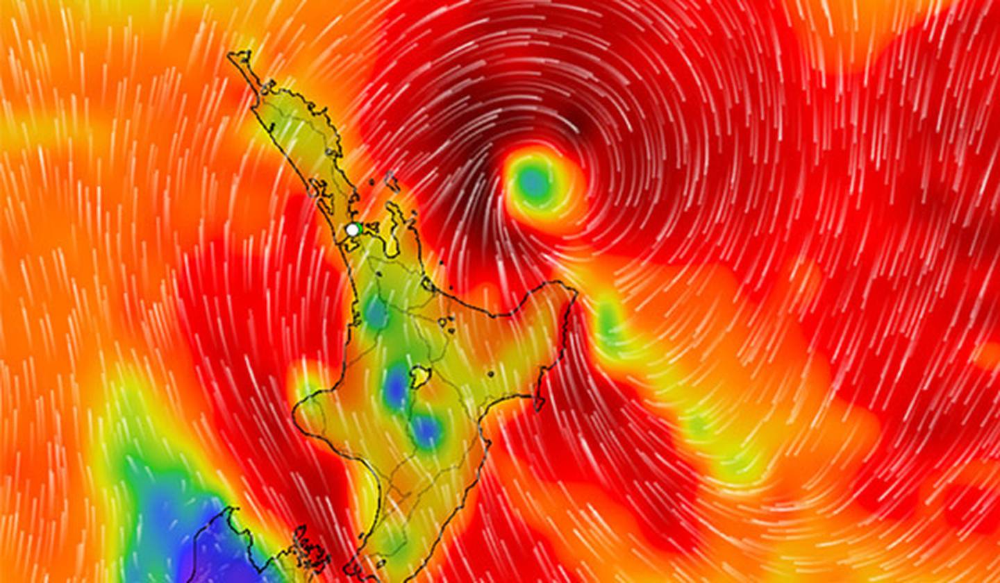
Wind map showing the forecast passage of Tropical Cyclone Fili as the clearly-defined centre lies to the east of the north island of New Zealand at midday 13 April 2022. Photo / Supplied
Gisborne can expect between 200 and 300mm of rain from 10pm tonight until 10pm tomorrow with up to 35 to 50mm/h of rain likely in some parts of the region on Wednesday afternoon.
Wairoa will get even more soaked with 250 to 350mm of rain likely to fall from 1am on Wednesday until 4am on Thursday. It will be the hardest hit late Wednesday afternoon and evening with between 35 and 50mm/h of rain possible.
MetService has warned that the amount of rain could lead to dangerous river conditions and significant flooding.
Gisborne District Council warned that "very large waves and coastal inundation" could occur.
Wairoa District Council chief executive Kitea Tipuna told residents to make sure they were prepared.
"Our district is already recovering from a massive saturation and further rain could potentially cause more flooding, slips and road closures. Heavy rain may cause streams and rivers to rise rapidly, surface flooding and slips are also possible and driving conditions may be hazardous," said Tipuna.
"People need to be aware they may lose their power, and trees and landslides already impacted from the end of March weather event could now be further compromised."
East Coast Labour MP Kiri Allan shared similar messages of preparedness to her followers on social media.
"Please stay safe whānau, I know that it's been tough but we will get through this together," she said.
MetService said this morning that Cyclone Fili had shifted slightly east with a "narrower cone of uncertainty".
"Cyclone Fili is approaching the North Island from the subtropics on Tuesday, tracking southeastwards close to, or across, eastern parts of the North Island during Tuesday and Wednesday."
MetService warned widespread impacts to the North Island with heavy rain, severe gales and very large waves are likely to affect northeast and eastern coasts.
There is a heavy rain watch in place for Auckland and orange rain warnings in place for Great Barrier Island, Coromandel, Bay of Plenty, Rotorua, Hawke's Bay (excluding Wairoa District) and Northland east of Kaikohe.
Orange wind warnings are in place for Auckland, Great Barrier Island, Coromandel Peninsula, Bay of Plenty, Rotorua, Gisborne, Hawke's Bay and southeast Taupō including higher parts of the Desert Road.
Wind gusts could reach up to 120km/h in most of those areas and damaging gusts of 130 to 140 km/h are likely east of Whakatāne during Wednesday afternoon and evening.
Meanwhile, Waka Kotahi NZ Transport Agency has advised motorists to avoid unnecessary travel between late today and Thursday morning - and have warned the weather could lead to state highways being closed.
NZTA Waikato/BOP regional maintenance and operations manager Rob Campbell said both the forecast of wind and heavy rain were of concern.
"Stay alert for unreported hazards, such as surface flooding, slips, fallen trees and branches, and downed powerlines.
"If you must travel, slow down and maintain a greater following distance between your vehicle and the one in front. Treat all powerlines as live."
Those in Northland were warned that conditions on the road could change quickly and to be alert.
"If you must travel, please slow down and maintain a greater following distance. Remember vehicles need three times more stopping distance in wet conditions," said NZTA Northland regional maintenance and operations manager Mark Owen.
New Zealand Civil Defence told people to stay inside during severe weather. "Don't walk around outside. Don't drive unless absolutely necessary."
MetService Severe weather: April 12th - 14th
MetService was also instructing people to tie down or bring inside anything that wind could break or uplift. Trampolines should be turned upside down to minimise the surface area exposed to the wind.
Power companies around the North Island have teams ready to respond if the bad weather causes chaos.
Counties Energy has storm response teams on standby south of Auckland and Powerco field crews are also ready to go should severe wind gusts hit Coromandel and Western Bay of Plenty from early evening today and Taranaki from tomorrow morning.
Customers are also being urged to secure outdoor objects that can blow into power lines.
Powerco network operations manager Scott Horniblow said trampolines, outdoor furniture and other loose items such as sheets of iron should be securely fixed to the ground.
"Wind-blown trampolines and loose roofing iron have caused multiple power outages in previous storms and are a major threat to people's safety."
Counties Energy general manager of operations Dale Carline said the company was preparing for a large-scale event and urged residents to do the same. It had already cancelled planned outages for the next two days.
"Please start your storm preparations now to lessen the impact on the electricity network and on your loved ones."
In the event of large-scale power outages, Counties Energy crew will move around the region isolating power to any damaged or downed lines and electrical equipment before working on restoring the network.
Take your Radio, Podcasts and Music with you