Heavy rain has eased on the West Coast and the clean-up is underway after the region suffered serious damage.
Some houses have had water through them as Westport experiences its wettest February in 78 years.
The heavy rain overnight arrived as the trough weather system was set to move northwards across the South Island before weakening over central New Zealand today, MetService said.
Coast to Coast curve ball
High river levels in the Waimakariri Gorge have forced a course change to the 70-kilometre paddle ahead of the event on Saturday.
The original course saw paddlers put in at Mt White Bridge just off State Highway 73 near the Arthurs Pass National Park and paddle through the narrow gorge before exiting at the Gorge bridge, between Sheffield and Oxford.
However, they'll now bypass the gorge by bike, turning the original second cycle leg from a 17-kilometre jaunt into a 112 km grind from Klondyke, over the Porters Pass and down to Thompsons Road, just off the Old West Coast Rd.
There they'll slip into their kayaks and dash 30 kilometres in the lower reaches of the Waimakariri down towards the motorway bridge in Kaianga, before getting back on their bike for an all-out sprint to the finish line in New Brighton, 12 km away.
Race director Glen Currie said as always athlete safety came first.
"We've been monitoring the weather for the best part of two weeks now and while we hoped we could have run the original course, especially while celebrating the 40th Anniversary of the race, it's simply not feasible."
A spokesperson for Buller Emergency Management said yesterday was a challenging day with extensive flooding throughout the region causing damage to homes, property, roads and slips.
"We know this is a stressful time for our community but we also know the region has the ability to adjust, adapt and work together.
"Big thanks go to the Police, Fire and Emergency NZ, a host of other agencies throughout the town, including LandSAR and the team from Bathurst who both provided support during this latest weather event."
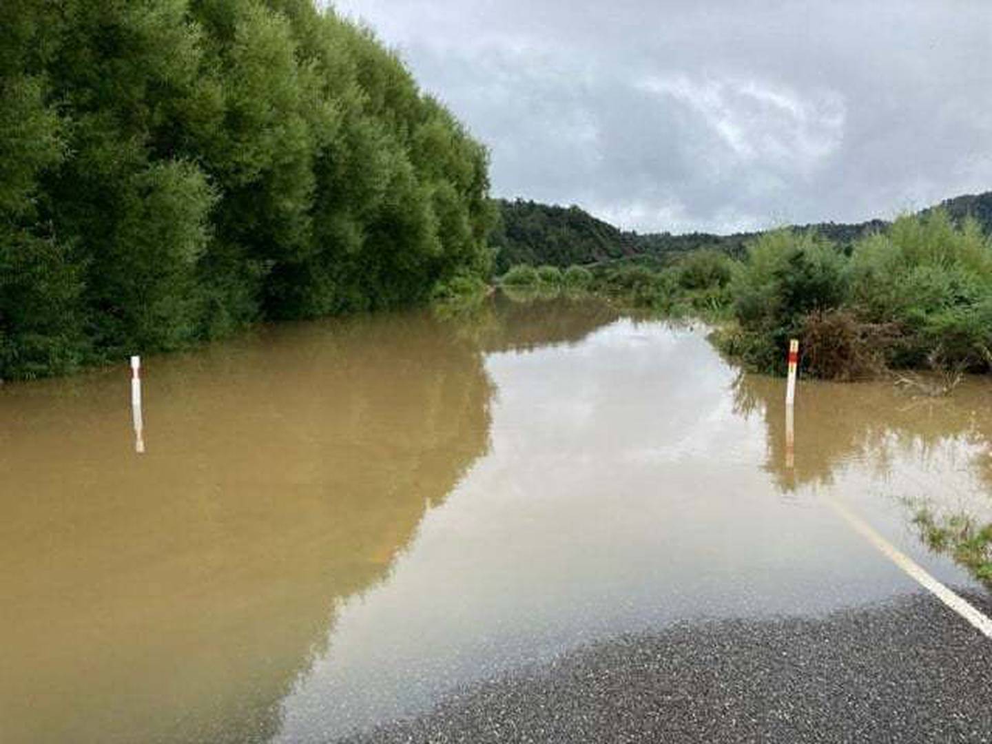
The West Coast was battered again by heavy rain this week. Photo / Supplied
Residents whose houses did not flood were able to return home on Friday.
Karamea Highway
State Highway 67 between Karamea and Mokihinui is currently closed while road crews work to clear more than 30 slips on the 23km stretch of road.
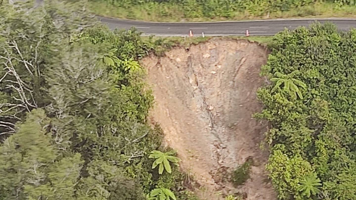
State Highway 67 between Karamea and Mokihinui is currently closed while road crews work to clear more than 30 slips on the 23km stretch of road. Photo / Supplied
Helicopters are being used to support St John Ambulance and the District Health Board to transport residents requiring medical attention to hospital.
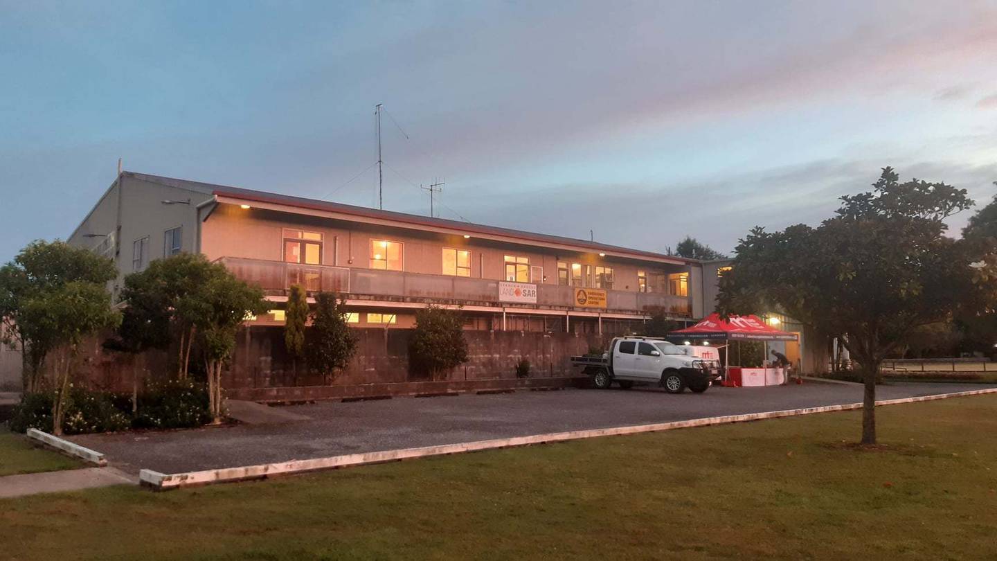
Blue skies over the Emergency Operations Centre in Buller on Friday morning. Photo / Supplied
Helicopters moving tourists out of the area are returning with essential supplies to ensure the town does not run out.
Buller District Council Roading and Transport Coordinator Neil Hateley said the council expects to open to the road at 9am on Saturday.
"However, the opening will depend on geotechnical assessment, and any potential rain and wind issues may delay this."
A number of other highways were still closed at midday on Friday.
- SH 6 Inangahua to Westport
- SH6, 65 Murchison to Springs Junction
- SH67 Westport to Mokihinui
- SH67 Mokihinui to Karamea
- SH7 Springs Junction to Reefton
Rubbish spilling from landfill
The severe weather has caused issues at the historic Reefton Landfill site.
The front has reportedly had major impacts on Buller water catchments, resulting in extreme river flows throughout the district.
A spokesperson for West Coast Emergency Management said the Reefton Landfill site, located to the west of the town adjacent to the Inangahua River, was impacted by high river levels on Thursday night, causing a breach in the rock wall defence.
The West Coast was battered again by heavy rain this week. Photo / Supplied
Erosion has caused rubbish to be released, travelling downstream from the site.
"Work is currently underway to re-train the river from around 100m upstream, to allow time for remediation works to be undertaken.
"Once river levels have dropped, the site will be assessed for an engineered response. Clean-up is planned to be undertaken once the site is safe to access."
Protection measures for this inactive legacy landfill site were put in place in 2014, to protect against events such as this, said Eric de Boer, Buller District Council's infrastructure delivery manager.
"However, increasingly extreme weather is exposing how vulnerable some of these historic sites are.
Heaphy Track closure
Repairs to the Heaphy Great Walk are likely to affect the May mountain biking season. Photo / Supplied
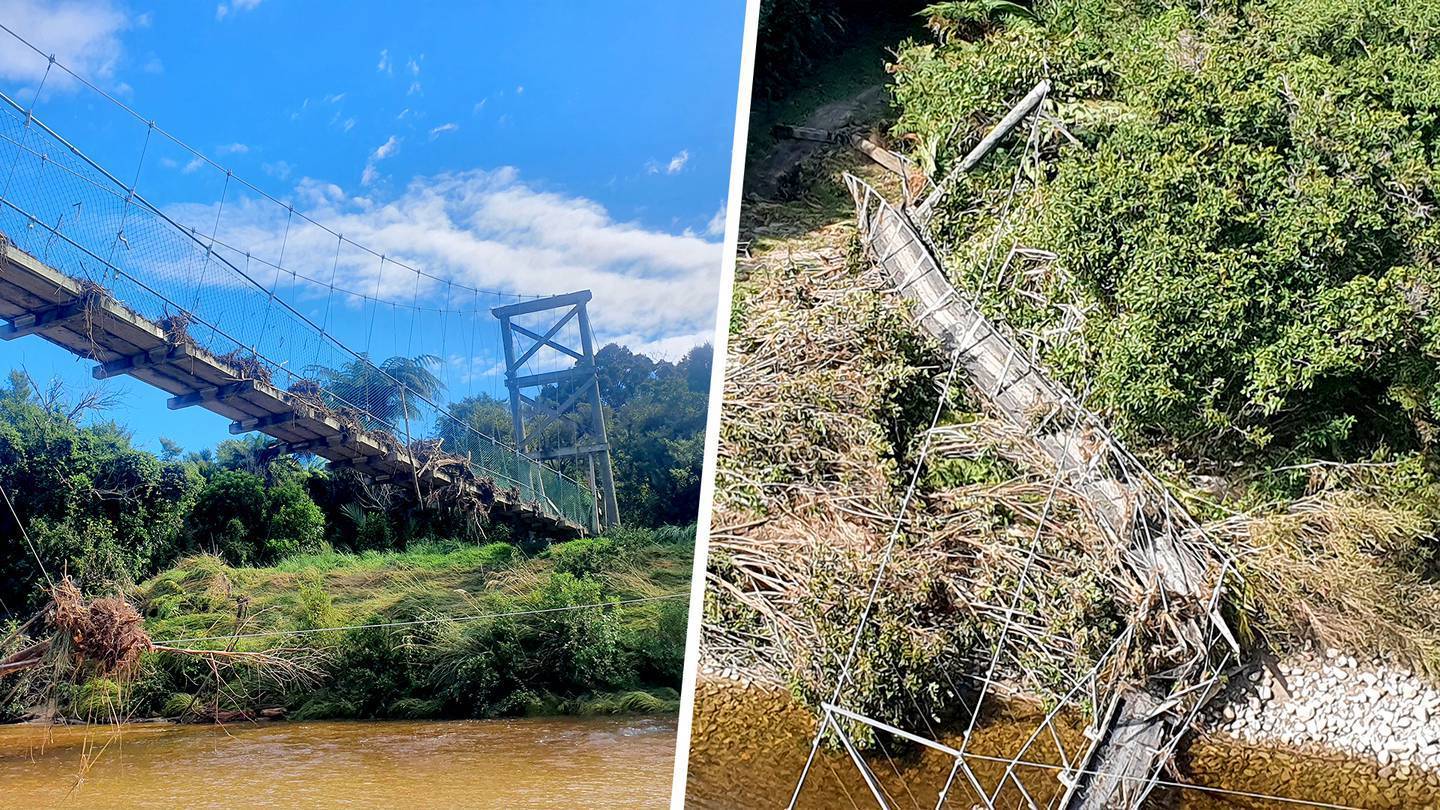
The Department of Conservation says the Heaphy Track may be out of action for months following flood damage.
The Great Walk from Golden Bay was closed to walkers on February 2, during severe MetService warnings.
DoC rangers inspecting the track on Wednesday made the decision to further extend the closure after the extent of damage to bridges and tracks was made clear.
But the fine weather seen in the region this morning is expected to be short-lived.
An orange heavy rain warning has been issued for Tasman west of Motueka and the Marlborough Sounds from 9pm on Friday. A heavy rain watch is in place for the ranges of Buller and Nelson Lakes from midnight on Saturday.
Take your Radio, Podcasts and Music with you
Get the iHeart App
Get more of the radio, music and podcasts you love with the FREE iHeart app. Scan the QR code to download now.

Download from the app stores
Stream unlimited music, thousands of radio stations and podcasts all in one app. iHeart is easy to use and all FREE