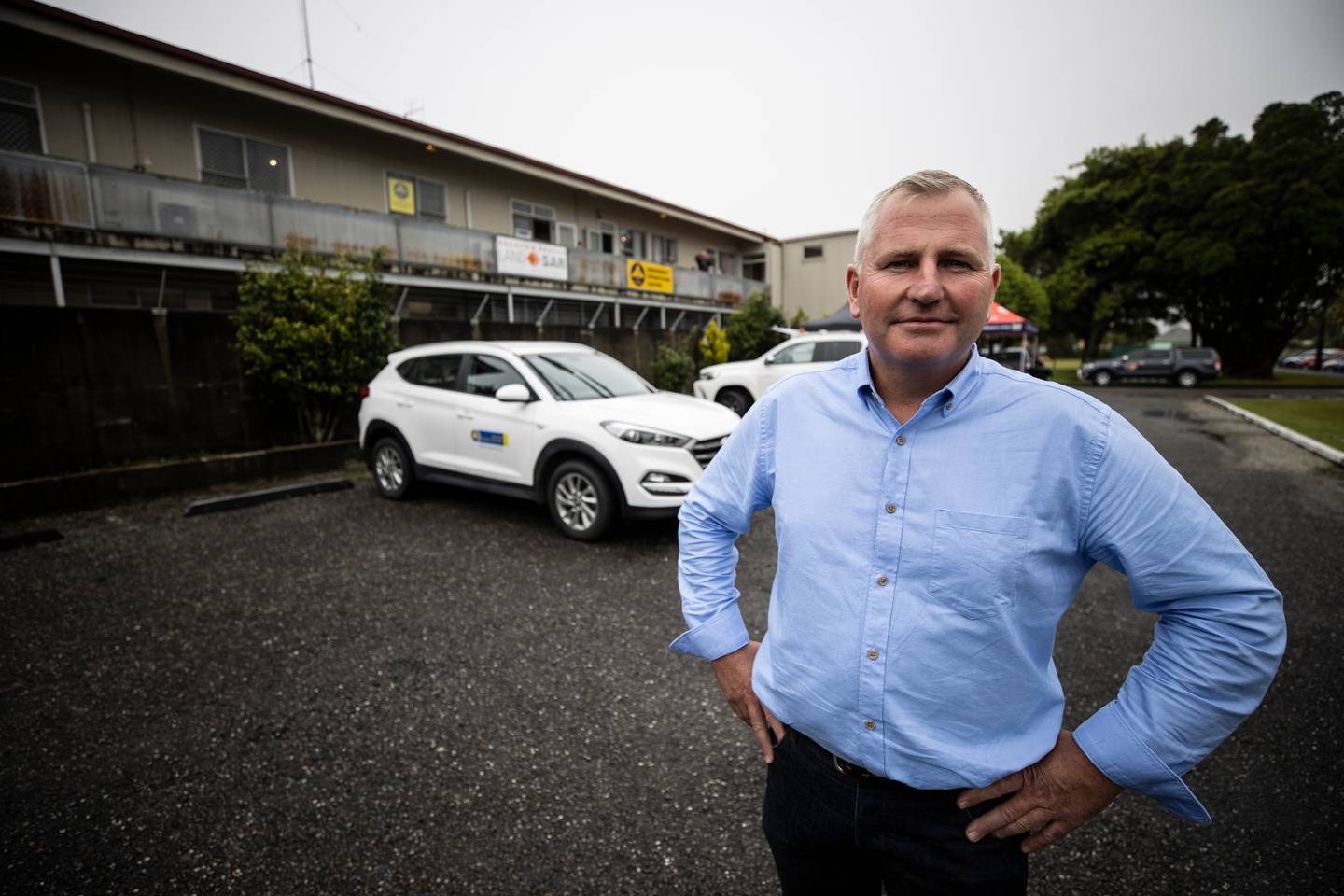
Buller district mayor Jamie Cleine has announced partial evacuations for areas of Westport that are at risk from flooding, with a severe rainstorm set to hit the West Coast today.
The decision has been made to safeguard lives, he said, and based on the "best available information" about the risk of high rainfall and high tides, combined with the experience of previous floods.
A complete town evacuation would not be ruled out either, the mayor said, with another announcement likely after 3pm.
"People should leave as soon as possible."
He said people should be prepared to be away from home for up to three days.
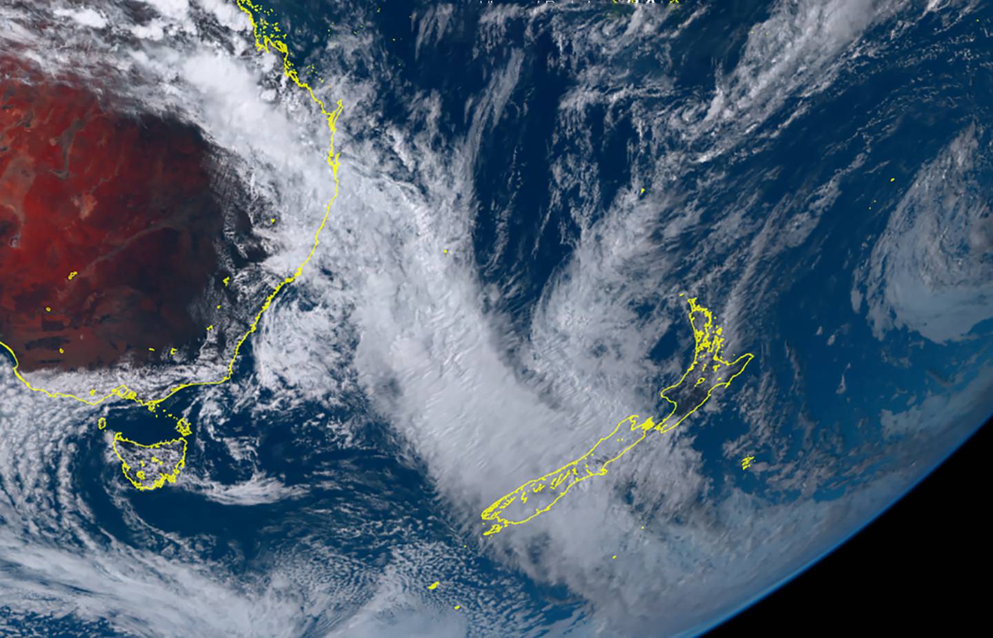
Satellite image shows an atmospheric river of cloud flowing from the tropical region funneling down over the west coast of New Zealand bringing heavy rain to the region. Photo / Supplied
They should take a grab bag of clothes, essential medicines, and personal documents. People with pets should also take their animals.
"We advise people to go to friends or relatives on high ground if at all possible," Cleine said.
A "very basic" evacuation facility at the former Holcim cement plant at Cape Foulwind Rd, just out of Westport will provide food and shelter for people with no other option. They should take sleeping bags or bedding and be prepared to sleep in their vehicles, he said.

Buller district mayor Jamie Cleine. Photo / George Heard
There is significant potential for a flooding event tonight or tomorrow morning.
Cleine didn't know exactly how many properties would be affected at this stage.
Compulsory evacuation orders cover Snodgrass Rd, Coates St, Derby St and the area between Cobden St and the beach, Roebuck St, Menzies St, Marrs Beach area, Martins Creek, Kawatiri Pl and Colvin St.
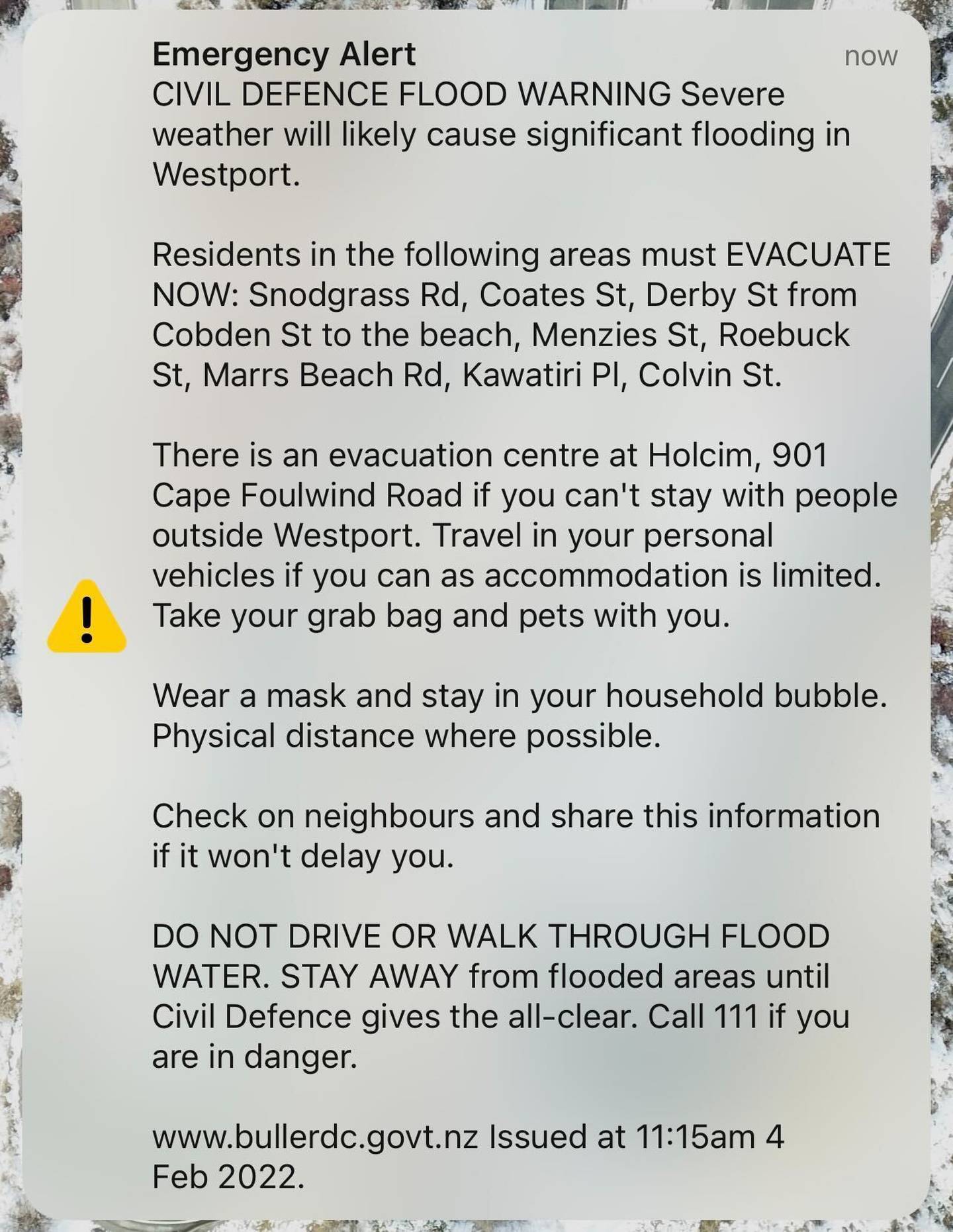
The emergency text alert for the people of Westport.
It's not predicted that the town would be cut-off at this stage.
An emergency text alert sounded off during the press conference.
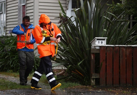
Local Jim McKinlay packed up his car today after being told he needed to evacuate.
He hoped that his property avoids getting flooded like last July when he "lost everything".
"I'd like to have been able to stay here a bit longer but when they say they're going to do something, you'd better do it," he said.
"We got prepared yesterday but we didn't think we'd have to leave until later this afternoon."
He's booked a motel and taking his dog with him.
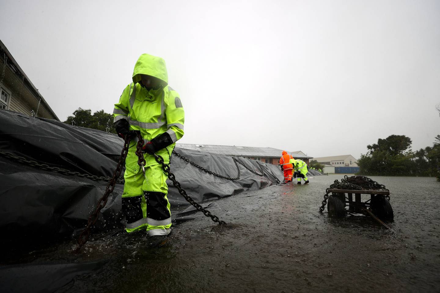
Flood protection barriers were installed around Buller Health today. Photo / George Heard
Heavy rain has slowly moved up the West Coast of the South Island over the last few days, causing surface flooding, slips, closing roads and schools, and knocking out power and phonelines.
The Army has been scrambled to help while an NZDF NH90 Air Force helicopter was scheduled to fly into Westport this morning to help with getting supplies to cut-off communities. Locals with helicopters are also understood to be on standby.
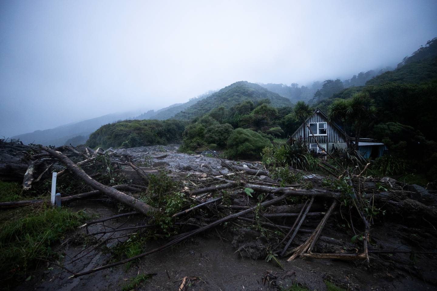
'The old slaughterhouse accommodation' has been damaged after a slip has gone through its property north of Granity. Photo / George Heard
Work to clear away a large slip blocking the Seddonville settlement wasn't possible during the night – and this morning Waka Kotahi NZ Transport Agency says crews are working in continual rain trying to move heavy soil.
But Buller district controller Chris Hawker this morning said Emergency Management hadn't received any more major reports, other than surface flooding.
Red warnings remain in place for parts of Westland and Buller as the second phase of the rain hits.
"For Buller until 1am Saturday, extended periods of heavy rain will continue. Expect 250 to 350mm of rain to accumulate about the ranges on top of what has already fallen, and 120 to 220mm near the coast. Peak rates of 20 to 30mm/h about the ranges are anticipated," Westland District Council said.
"For Westland to Midnight Friday expect another 150 to 250mm of rain to accumulate near the ranges about and north of Fox Glacier, and 80 to 120mm near the coast. Peak intensities of 20 to 30mm about the ranges are anticipated.
Te Aroha Cook, West Coast group controller, said that there was still a significant amount of rain to fall in this event.
The West Coast is preparing for a huge amount of rain in the coming days. Westport has declared a local state of emergency. Photo / George Heard
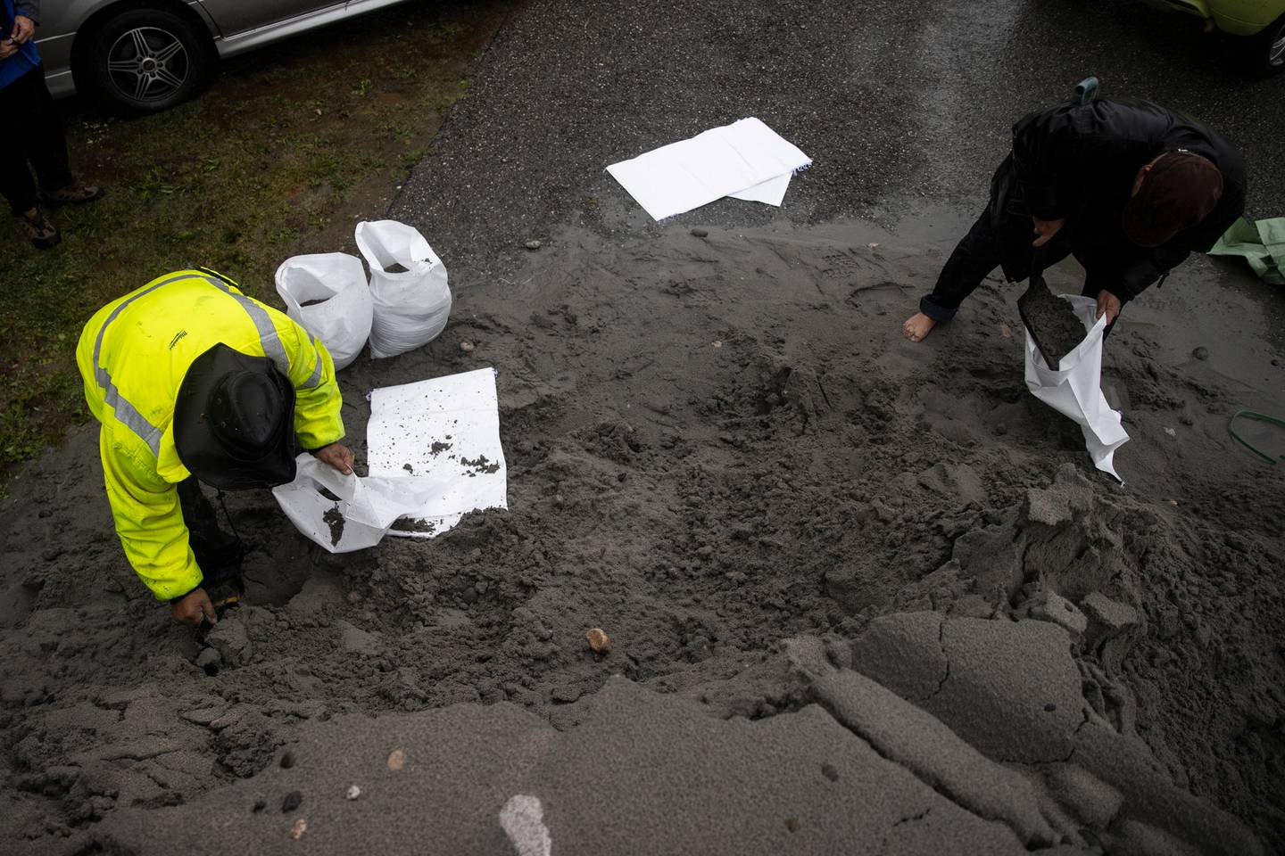
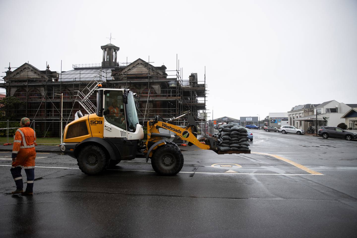
Council workers and locals have been out sandbagging and preparing for the worst, with fears of another major flood like the one that devastated the town last winter.
Yesterday, authorities asked residents to self-evacuate if they can easily do so to friends and family outside of Westport.
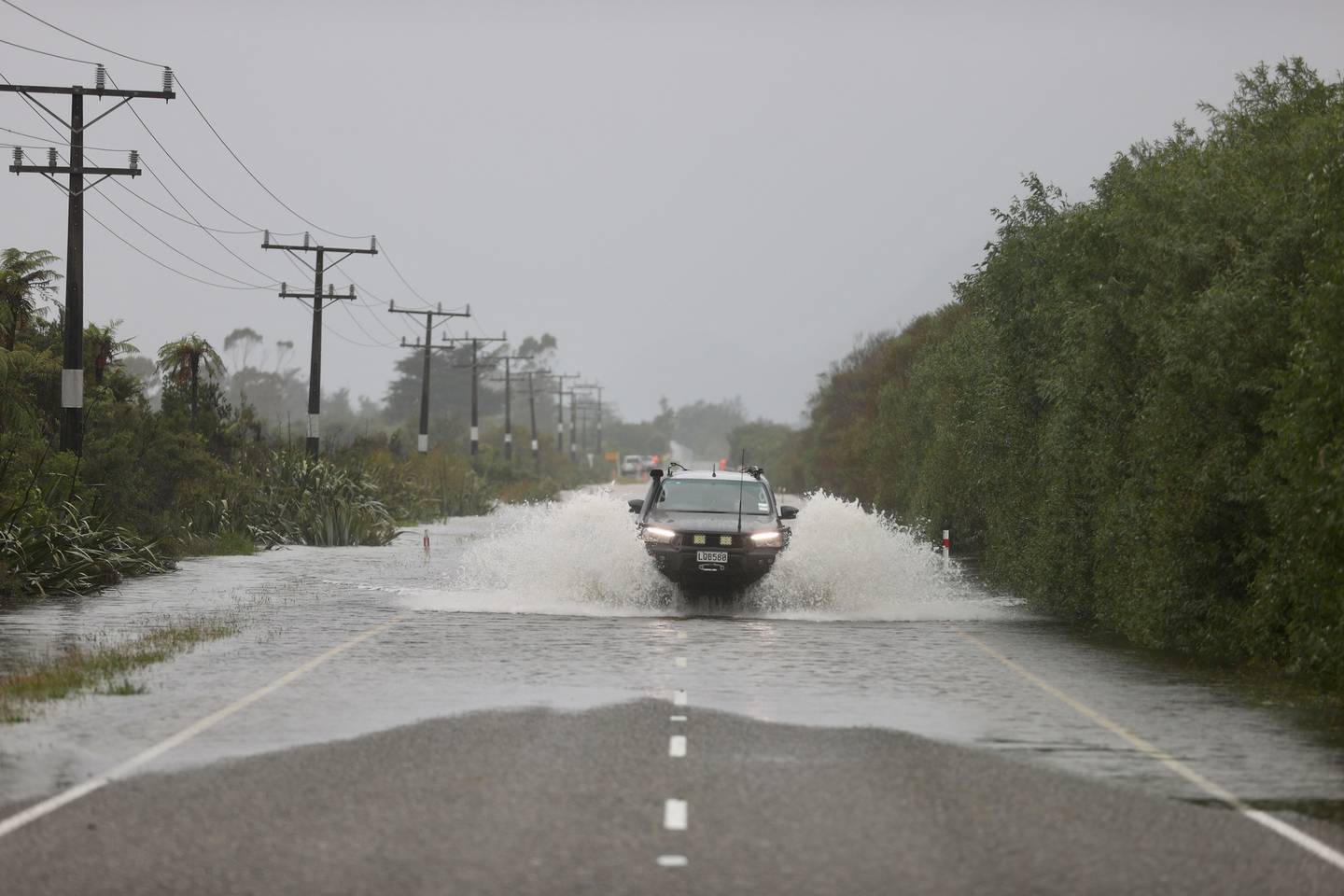
State Highway 67 this morning. Photo / George Heard
Police say they will be running 24/7 patrols of evacuated properties.
"Self-evacuation is encouraged for those who experienced flooding in July last year as a precaution," said local controller Bob Dickson said yesterday.
"The coast road and the Buller Gorge are open, so moving east and south out of town are still safe options. The forecast is showing significant rain for northern Buller, so residents should avoid travelling north."
MetService extended the timing of the red warnings for heavy rain in Buller and Westland as an "atmospheric river" of warm and moist air continues to bring heavy rain to the West Coast.
Buller district mayor Jamie Cleine. Photo / George Heard
Meteorologist Andrew James said there has already been significant rainfall in the region.
"This weather system brought 123mm to Westport airport in the 24 hours to 9am Thursday, the wettest February day there since records began in 1944," he said.
"The severe weather is still ongoing for some areas and people in these areas need to remain alert and keep up to date with the forecasts."
Severe weather warning on the West Coast. Photo / George Heard
Westland District's Emergency Operations Centre (EOC) remains operational today, with the MetService lowering the heavy rain warning to orange for Westland south of Otira.
Peak intensities are expected about the ranges on Friday morning.
"EOC staff in coordination with the WCRC have been checking the river levels and Waiho, Whataroa and Wanganui River are currently fine," local controller Simon Bastion said.
The West Coast is preparing for a huge amount of rain in the coming days, with towns like Hokitika (pictured here) preparing for the deluge. Photo / George Heard
"We are aware that the capacity in the headwaters of the Hokitika is rising and we will be keeping a watch on this throughout the day.
"Based on the current conditions and discussions with the MetService, we do not predict any significant flooding in low lying areas. There may be intermittent surface flooding dependent on isolated rainfall intensity.
Our advice to business owners and residents remains the same, if they feel unsafe, please make plans to evacuate to higher ground."
The Country's Rowena Duncum told Gold AM six weeks without rain on the coast equates to about 18 weeks for the rest of the country.
She says it's positive the dry spell has broken, but there are big concerns for Westport.
Duncum says they're still considering mass evacuations in the coming days - and if there's a lot of flooding, this will be the second time in six months.
Take your Radio, Podcasts and Music with you
Get the iHeart App
Get more of the radio, music and podcasts you love with the FREE iHeart app. Scan the QR code to download now.

Download from the app stores
Stream unlimited music, thousands of radio stations and podcasts all in one app. iHeart is easy to use and all FREE