Authorities are warning of more extreme weather heading into Labour Day, with much of the country expected to be battered by a “significant storm”.
The storm is forecast to bring severe winds, heavy rain, snow and large swells, just days after severe weather caused chaos across the country and left thousands without power, causing a local state of emergency in Canterbury, Southland and Clutha.
Heavy rain watches have today been upgraded to orange warnings.
The warnings cover the central North Island hill country, Taranaki maunga, the Tararua Range, the Richmond and Bryant ranges, headwaters of the Canterbury lakes and rivers near and north of Arthur’s Pass, the ranges of the Westland district north of Haast, and ranges of Grey and Buller as well as Tasman west of Motueka.
All will come into force throughout Monday.
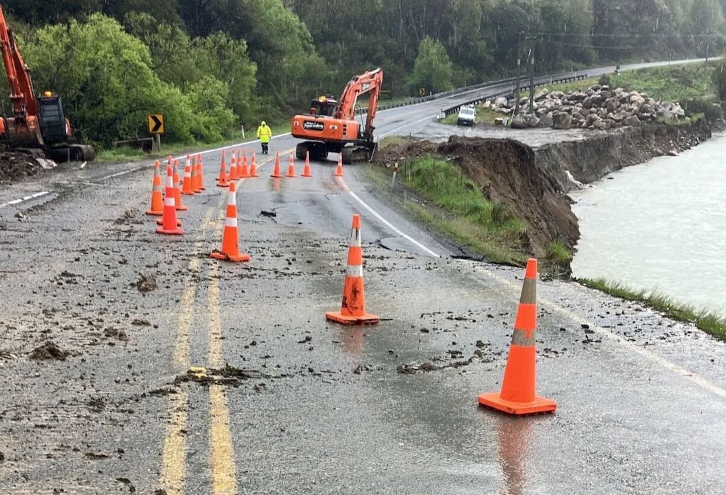
The West Coast was cut off this week following closures on State Highways due to damage from the severe weather. Photo / supplied, NZTA
An orange heavy snow warning is in place for the Canterbury High Country south of State Highway 73 from 2pm to 9pm Monday with locals told to prepare for 10 to 15cm of snow settling above 500m and possible power outages.
Severe wind is also expected, with Wellington, Wairarapa and the Tararua district told to brace for northwest gales up to 120km/h in exposed places.
The orange wind warning comes into force from 2pm to 11pm on Monday, but winds are expected to start strengthening from this afternoon.
Snow is expected to fall on a number of key routes on Monday, including Arthur’s Pass, the Crown Range, Dunedin to Waitati Highway (SH1), Haast Pass, Lindis Pass, Milford Rd (SH94), and Milford Rd (SH94).
Those near the Kāpiti-Porirua Coast are being told to brace for extreme swells, with waves rising to up to 5.5m.
The weather is the result of an active low pressure system moving over the country from the Tasman Sea throughout Monday and Tuesday.
Manawatū-Whanganui Emergency Management said staff across the region are monitoring the situation and are ready to activate the Emergency Co-ordination Centre if required.
Emergency Management Southland said it is working with farmers and others in the rural sector to identify locations in need of generators for milking sheds and stock water.
Fire and Emergency New Zealand warned of a “high fire danger” this weekend, with even a small spark in windy weather capable of causing a fast-spreading fire.
The severe winds that helped fan flames in the Bay of Plenty and Canterbury this week have subsided, but a ban on fireworks and open-air fires is still in place in Hawke’s Bay, Wellington, Wairarapa, Marlborough and Canterbury until 9am Monday, Fire and Emergency said.
Take your Radio, Podcasts and Music with you