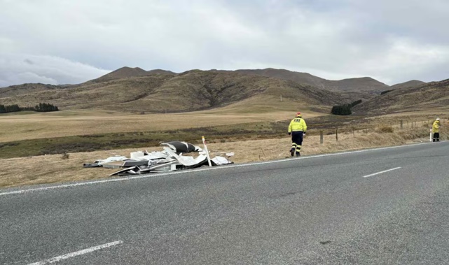
Emergency services rushed to a caravan obliterated by the high winds which ripped through the Canterbury region today.
Police received a report of a caravan having tipped over on the Fairlie-Tekapo Rd about 10.05am.
A Fire and Emergency spokesperson said wind was “definitely a contributing factor” in the destruction.
A photo of the rolled caravan shows its shattered remains, torn apart by severe gales and now barely recognisable as a vehicle.
“We actually came across it on the way to another job, so we found out about it that way.
“We diverted some resources to it,” the Fire and Emergency spokesperson said.
Fire and Emergency NZ crews assisted with securing the vehicle and managing traffic.
There are no reported injuries.

Emergency services rushed to a caravan obliterated by the high winds that have ripped through the Canterbury region today. Photo / Lake Tekapo Volunteer Fire Brigade
Wild South Island weather
The Canterbury High Country has been under a strong wind watch from 9 am, which is expected to lift at 4pm.
Northwest winds were forecast to approach severe gales in exposed places.
Gusts reached 116km/h for Mt Cook Airport, 112km/h for Roxburgh Airport and 98km/h for Wallacetown this morning.
The chance of thunderstorms with heavy rain and hail continues for the remainder of the day for Nelson, Buller, Grey and Westland.
Temperatures are expected to drop tomorrow over southern New Zealand, and snow may affect some elevated parts of the South Island, including some of the higher roads.
Take your Radio, Podcasts and Music with you
Get the iHeart App
Get more of the radio, music and podcasts you love with the FREE iHeart app. Scan the QR code to download now.

Download from the app stores
Stream unlimited music, thousands of radio stations and podcasts all in one app. iHeart is easy to use and all FREE