The wild weather that claimed the life of a Cambridge woman yesterday has passed, but blustery and wintry conditions are sticking around for the weekend.
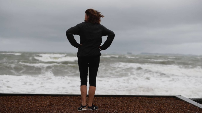
"Freakishly high winds" in Cambridge have been blamed for ripping a healthy oak tree from the ground and crushing an elderly woman – who tragically later died from her injuries.
The death came as bad weather – including strong winds – wreaked havoc in areas of the North Island; including a tornado that hit Levin on Friday morning.
Winds of more than 95km/h closed the Auckland Harbour Bridge, snarling up traffic on the Southern Motorway and on CBD streets.
Today, strong to gale-force winds are persisting in coastal areas, with MetService reporting a thunderstorm in Westport this morning from a southeasterly airflow crossing the country.
MetService said snow has eased or is not expected on the Desert Rd, Lewis Pass, Arthur's Pass, Milford Rd and Crown Range Rd, and warnings have been lifted.
Weather Watch said conditions are set to clear a little for South Westland this afternoon, with some sun breaking through.
Eastern parts of the country will be mainly sunny, but winds are expected to strengthen along the east coast of the South Island later this evening. Cloud and a few showers should move into Wellington and the Wairarapa overnight.
The southwesterly airflow is expected to last for a while and bring frosty conditions if and when the winds drop, especially in the South Island.
Along with frosty mornings, daytime temperatures over the next seven days are looking fairly cool, said Weather Watch.
It said Northland, Auckland and Waikato will have cloudy areas and occasional showers today and the Bay of Plenty will be mainly dry with the chance of a shower. Temperatures will be in the mid-teens.
Wellington will have a mix of sun and cloud with fresh westerlies and Canterbury will be sunny after a cold start.
Otago and Southland can expect shows with snow flurries to about 600-700m with gales about the coast.
Queenstown and parts of Central Otago may get morning showers then sunny spells accompanied by wind.
Take your Radio, Podcasts and Music with you