Thunderstorms and potentially destructive gales are expected to blast central New Zealand today as an intense cold front sweeps up the country, bringing rain to many areas.
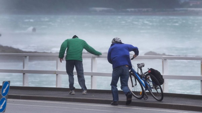
And wet and windy conditions expected tomorrow have prompted warnings about large waves and tricky driving conditions.
Heavy rain and strong wind warnings are in place for central New Zealand and the West Coast today, with thunderstorms likely.
Severe gales gusting up to 120km/h are expected in Wellington, Wairarapa and the Marlborough Sounds, with warnings of damage to trees, powerlines and unsecured structures.
“Driving may be hazardous, especially for high-sided vehicles and motorcycles,” MetService says.
Niwa Weather is warning the cocktail of heavy showers and thunderstorms might fuel the strong wind gusts when they passed over the region during rush hour this evening.
It also said some of the gusts may be damaging.
Wellington Region Emergency Management has advised people to secure any outdoor furniture, wheelie bins and trampolines and to take care in the blustery conditions.
The rest of Marlborough and Nelson are under a strong wind watch.
Orange heavy rain warnings for the Buller, Westland and Grey district ranges have been in place since early this morning. Streams and rivers could rise rapidly, surface flooding and slips are possible and driving may be hazardous, the forecaster says.
Thunderstorms could also bring hail in the area, which has already been hammered by rainfall well above the January average. MetService says more than 1000mm fell last month in Milford Sound, which normally gets 647mm of rain on average.
The weather is calmer for the upper North Island but showers are still expected to become widespread this evening between Northland and Kāpiti, with “squally thunderstorms” possible this evening south of Whanganui.
Rain will spread north through Canterbury, Otago and Southland this morning with possible thunderstorms and hail this afternoon before easing to a few showers tonight.
The bout of autumn-like weather is due to a strong, fast-moving cold front that’s heading northeast from the bottom of the South Island, ahead of hot air arriving from Australia next week for Waitangi Day.
Last night in its thunderstorm outlook, MetService said the front would be moving over the lower and central South Island this morning, while an upper cold pool would move on to the lower South Island, bringing “increased instability”.
Its severe weather warnings and watches are due to be updated at 10am.
MetService says the atmosphere is going to have a “weekend like a festival-goer – wild on Friday and Saturday but worn out and sedate by Sunday”.
Saturday is expected to be “wet and windy” across the country, the forecaster says, and will also be cool for this time of year.
“These strong winds do bring the potential for some tricky driving conditions, especially on our exposed roads like the Auckland Harbour Bridge, so are worth factoring in for your travel plans over the weekend.
“They also bring the possibility for large waves along the western coastlines of the North and South Island.”
Take your Radio, Podcasts and Music with you
Get the iHeart App
Get more of the radio, music and podcasts you love with the FREE iHeart app. Scan the QR code to download now.

Download from the app stores
Stream unlimited music, thousands of radio stations and podcasts all in one app. iHeart is easy to use and all FREE


