While New Zealand summers are typically associated with outdoor barbecues and beach trips, parts of Canterbury are experiencing the opposite, with snow falling on Mt Hutt.
Photos from the base of Mt Hutt ski area show a fresh dumping of snow, with thick cloud wrapping around the slopes, conditions more commonly seen in winter when the area is packed with skiers and snowboarders.
Meanwhile, air travellers in the middle of the country have had their plans scuppered after low cloud disrupted flights at Wellington Airport.
By 2.45pm, about 28 flights had been cancelled or diverted because of the weather, the airport said.
“We advise passengers to check directly with their airlines for the latest information on their flights.”
In the last half-hour, flights due from Nelson and Christchurch had been cancelled, and two due from Melbourne and Brisbane in the next hour have been diverted, according to the airport’s website.
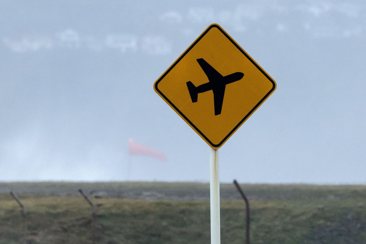
It's not been a great day for air travellers coming and going from Wellington Airport. Photo / Marty Melville
Flights bound for Christchurch and Napier this afternoon have been cancelled.
On the summer snow, MetService meteorologist Mmathapelo Makgabutlane said while it was “a bit unusual”, it wasn’t uncommon at higher elevations such as Mt Hutt.
“We’ve got a low-pressure system sitting west of the country at the moment, and that’s bringing a lot of rain to many parts of New Zealand,” she said.
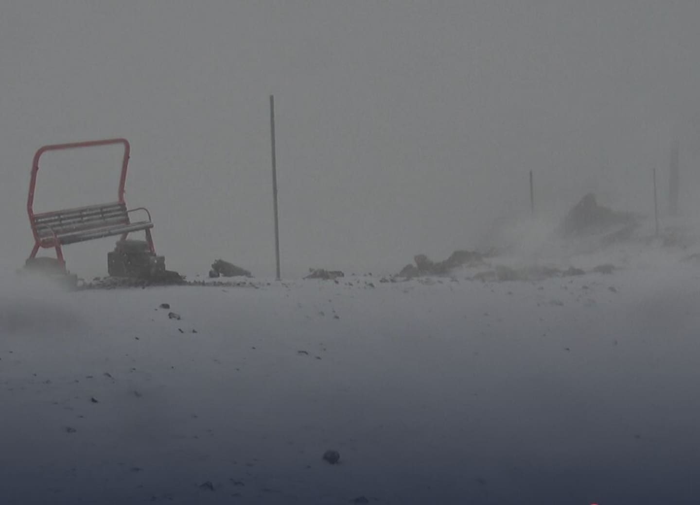
Snow is falling at the base area of Mt Hutt today.
Makgabutlane said lower-lying areas were experiencing the same system as rain.
“At those higher levels, it’s not too uncommon to see snow, even at this time of year. At lower levels, we experience it as rain,” she said.
“It’s quite a cold day in Canterbury, even closer to sea level, and that colder air near the ground means conditions higher up are conducive to snow.
“Temperature does play a part – the higher you go, the colder it gets.”
Parts of the South Island are set to be battered by heavy rain today as a two-day wet spell begins, with thunderstorms, hail, gales and even tornadoes and snow possible in some regions.
MetService overnight upgraded to an orange heavy rain warning for part of the Tasman District, with slips, rising rivers and flooding on the cards.
The warning covers the area northwest of Motueka from 4am to 7pm, with up to 110mm of rain and included localised downpours with peak rainfall rates of 25-40mm/h this morning.
It's going to be a wet day across much of the country, but most especially in parts of the top of the South Island. Photo / Michael Craig
Thunderstorms were also possible under the heavy rain warning, which has been extended to 8pm.
“Expect 65-90mm of rain on top of what has already accumulated, especially about the ranges. Peak rates of 15-25mm/h with thunderstorms possible,” MetService wrote at 9.30am.
That amount of rain means “streams and rivers may rise rapidly”.
“Surface flooding, slips and difficult driving conditions [are also] possible,” the forecaster said.
“Clear your drains and gutters to prepare for heavy rain. Avoid low-lying areas and drive cautiously.”
Thunderstorms and even “one or two localised tornadoes” could also hit Buller and west of Nelson this morning, the forecaster said.
Those areas have a “moderate risk” of thunderstorms, while there is a low risk for the rest of Nelson, Grey, northern and central Westland, and much of Marlborough.
This afternoon, northwest Nelson to the Marlborough Sounds has a “moderate risk” of thunderstorms, with heavy rain, possibly hail and “small localised tornadoes”.
The spell of wet weather is forecast to soak New Zealand during the next two days; however, it is forecast to improve for Aucklanders on Thursday, just in time for the Laneway music festival at Western Springs.
The temperature would reach a maximum of 25C with very little wind, Makgabutlane said.
At 6am, it was 21C in Auckland, 22C in Whangārei, Tauranga and Napier, and 24C in Gisborne, in contrast to some South Island centres, where temperatures barely reached double digits.
Heavy rain watches are in place for Marlborough, south of Seddon and Canterbury, north of the Rangitata River, until 10pm.
“Amounts may approach warning criteria or possibly exceed them, especially in North Canterbury and the Kaikōura District,” MetService said.
There is a high chance this watch will be upgraded to a warning.
A heavy rain watch has also been issued for Wairarapa, south of Masterton, from 7pm tonight until 3am tomorrow.
A strong wind watch is in place for the Westland and Grey Districts until 7pm today, and in the Marlborough Sounds from 7pm to 1am.
Christchurch is headed for 12C, Dunedin and Invercargill 13C, and Timaru 10C.
“A cold day expected, with the rain and the wind ... it’s not going to feel like a summer’s day.”
Makgabutlane said “waves of rain” were expected to hit the North Island throughout today.
“It doesn’t look like enough to warrant a warning, but it does look like a wet day.
“We also have some strong winds expected by the end of the day, especially in the lower half of the North Island.”
Take your Radio, Podcasts and Music with you
Get the iHeart App
Get more of the radio, music and podcasts you love with the FREE iHeart app. Scan the QR code to download now.

Download from the app stores
Stream unlimited music, thousands of radio stations and podcasts all in one app. iHeart is easy to use and all FREE