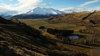
The North Island is now feeling the brunt of a cold wintry snap with temperatures across much of the country expected to feel sub-zero.
The mercury has dropped significantly overnight as a cold front makes its way up New Zealand, following days of warm and humid air.
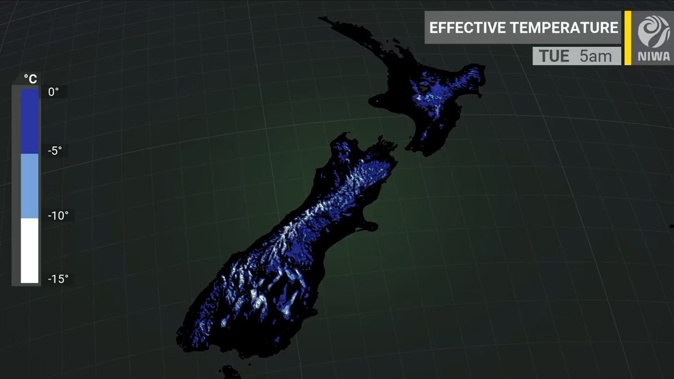
Niwa said New Zealanders should bundle up over the next 24 hours as the temperature would feel as if it’s near or below zero.
The inland regions of the South Island were most likely to feel the cold as well as the North Island, which would experience strong winds, showers and much cooler temperatures.
MetService said on Monday morning the cold southwesterly change had swept up the South Island and reached the central North Island.
The “strong” southwesterly change has prompted MetService to issue road snowfall warnings and strong wind watches across the South Island on Sunday afternoon.
The forecasts are a noticeably chilly change to the sticky humidity that’s been hanging about New Zealand.
The cold temperatures are likely to continue overnight and inland parts of both the North and South Islands may have a frost tomorrow morning.
MetService has issued a strong wind watch for several parts of the country as it forecasts another front will move northwards across the country on Tuesday and Wednesday bringing westerly gales to some places.
Areas with a wind watch include Wairarapa north of Pahiatua and Hawke’s Bay south of Hastings, Tasman west of Motueka, Canterbury High Country and Coastal parts of Southland, Clutha, also Stewart Island.
MetService meteorologist Alwyn Bakker said the wintery weather was being caused by a cold front moving across the lower South Island late on Sunday.
“With that cold front, there’s a lot of cold air following it – which is what’s triggering those two road snowfall warnings.”
Motorists driving those routes should be mindful of the weather conditions, he said, and ensure they had snow chains.
“If you’re not confident driving in it, then don’t until it’s calmed down.”
On Anzac Day, MetService was forecasting partly cloudy weather in the west of the North Island, with isolated showers developing north of Kāpiti, and cloud in the east clearing to fine conditions.
The South Island could expect mainly fine weather in the east on Tuesday, apart from showers developing in the south and others spreading north of Fiordland.
Take your Radio, Podcasts and Music with you