Sunnier skies are on the horizon for much of the country after heavy rain and thunderstorms lashed parts of the North Island.
A band of rain which sat over the central North Island yesterday, bringing heavy downpours and thunderstorms with it, was set to move northeast of New Zealand overnight, but will likely tail back around throughout Monday.
“By the time people are first getting up in the morning, it might still be a bit wet then but the showers that will be around are forecast to clear through the morning and afternoon,” said MetService meteorologist Clare O’Connor.
The eastern North Island is still in the firing line however, as a low pressure system forming to the east will pull back the rain band, bringing rain to Gisborne and Hawke’s Bay regions throughout today and into Tuesday.
“They’ll have a wetter start to the week there but most of the rest of the North Island will finish off Monday fairly dry, especially into comparison to what they got on Sunday,” said O’Connor.
O’Connor said humidity around the country also wouldn’t be as intense as of late.
“It will feel a bit warm as well as wet in the eastern North Island area and that will continue right into Tuesday.”
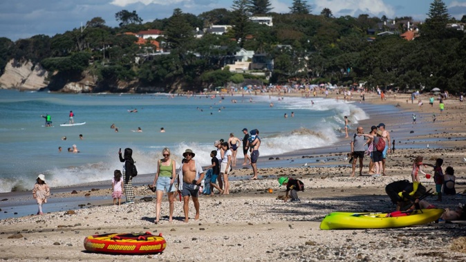
After overnight rain, today is set to be the driest day of Auckland’s Anniversary Weekend, despite a few showers this morning.
Temperatures around the region are expected to remain high, in the mid to high 20s for the rest of the weekend and the return to school.
“The highest could be 28C on Tuesday and Wednesday during the day - as soon as you go back to school, everything starts getting warm again,” O’Connor said.
O’Connor said it was shaping up to be a nice anniversary weekend for Nelson as well with the region looking at quite a dry forecast today.
Thousands evacuated at Hamilton concert due to extreme weather
Thousands of people at Hamilton’s Summer Concert series yesterday evening were forced to evacuate after extreme weather hit during the final act’s performance.
One of the evacuated concert-goers told the Herald she was near the front of the crowd when a security guard came on stage and interrupted Simple Minds frontman Jim Kerr.
There was an announcement that the concert, which was held at Claudelands Oval, was being stopped and people should get out and leave their belongings behind.
She said the crowd left the ground in a calm, sensible fashion as the rain began bucketing down, interspersed with lightning.
In a statement to the Herald, the event organisers said; “Due to an isolated thunder and lightning storm beyond the control of event organisers, and for the safety of all people involved, including concert goers, staff and artists, today’s Summer Concert – Claudelands Oval was brought to a close five-10 minutes earlier than scheduled”.
Yesterday, MetService said heavy rain watches had been issued for central parts of the North Island covering Waitomo, Taumarunui, Taupō and Tongariro National Park, as well as the Bay of Plenty’s eastern ranges.
The watches were forecast to come into effect from about 1pm yesterday until early this morning.
- NZ Herald
Take your Radio, Podcasts and Music with you
Get the iHeart App
Get more of the radio, music and podcasts you love with the FREE iHeart app. Scan the QR code to download now.

Download from the app stores
Stream unlimited music, thousands of radio stations and podcasts all in one app. iHeart is easy to use and all FREE


