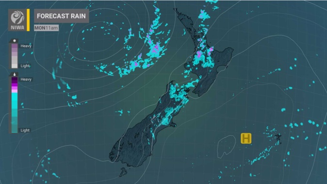
It’s likely to be a wet start to the week for parts of the North Island as heavy rain watches are in force for Northland, Auckland and the Coromandel Peninsula.
A massive 29-hour heavy rain watch begins from 10pm today for Auckland north of Orewa and Northland south of the Bay of Islands, MetService said.
The Northland region north of the Bay of Islands is also under heavy rain watch from 11am today until 3am tomorrow.
Rain and heavy falls are expected to move from the north slowly southwards towards Auckland, and thunderstorms are possible in Northland during Monday morning.
The heavy rain watch period is expected to end at 3am on Tuesday, MetService said.
MetService meteorologist Alwyn Bakker said the three heavy rain watches were at the lowest rating, yellow.
“That means we’re expecting heavy rain for those regions, and there’s a chance of seeing warning amounts (50mm within 6 hours or 100mm within 24 hours), but it’s not a high enough chance on a broad scale to issue a warning.”
Rainfall may approach the warning criteria if the rain stays in one area and gives it a pelting, especially in the east.
“It’s that slowness that’s the potential issue; slowly-moving systems have a longer period of time to rain over any particular area, so rainfall accumulations are usually higher than for faster-moving systems.”
Great Barrier Island, the Hunua Range and Coromandel Peninsula will be in the heavy rain watch path from 1am on Tuesday until 6pm.
“For people on the ground, it will essentially be a period of rain that could be quite heavy and possibly thundery, but it’s not likely to hit those totals I gave.”
MetService said people should expect generally unsettled conditions on Tuesday and Wednesday, as a large trough will lie over the country.
“Since the airmass containing all this rain is coming from the tropics, temperatures will warm up a little, but not more than a couple of degrees.”
It’s likely to get windy for the lower North Island and South Island as gale north to northwest winds may affect Wellington, Wairarapa, Marlborough and Canterbury on Wednesday and early Thursday.
“Winds will be a bit stronger than usual, but we’ve not issued any Watches or Warnings for strong wind.”
The weather is likely to finally take a turn for the better on Friday as a high is expected to move over the North Island and northern South Island.
Take your Radio, Podcasts and Music with you


