Severe weather is continuing to batter parts of the country with a front moving north across New Zealand today.
According to Metservice, 40mm of rain had fallen in Christchurch between midnight and 11am.
An orange heavy rain warning is in place for Canterbury north of Waipara, parts of Wairarapa and the Kaikoura coast and ranges.
A strong wind warning is in place for Banks Peninsula, Wellington, Wairarapa and the Kaikoura coast.
The Canterbury High Country, north of the Rangitata River, is also under a heavy snow watch with the forecaster warning snow could lower to 300 metres.
/cloudfront-ap-southeast-2.images.arcpublishing.com/nzme/2TOFHVVUBMFXHAUP2BBOUOU5EQ.jpg)
Heathcote River in Christchurch has burst its banks and threatened homes. Photo / George Heard
In Wellington, there's a strong swell warning with several sailings of the Interislander and Bluebridge ferries cancelled.
Interislander said on Wednesday night it would cancel "most" Thursday sailings.
"Swells of more than six metres are predicted and it will be very rough. Safety of our passengers and crew is very important and we have made the call to cancel most sailings."
MetService says there will be southerly-combined waves of five metres early Thursday afternoon, rising to seven metres late Thursday afternoon, failing back to five metres on Friday.
There are also snowfall warnings on Desert Rd, Remutaka Hill Range and Lewis Pass.
The Desert Rd is expected to see between 2cm-3cm of snowfall near the summit.
On the Remutaka Range, sleet is expected, and there's a chance it could turn to snow, MetService warns.
Wellington and Wairarapa will also be blasted by gale-force winds and torrential rain with gusts up to 130km/h in exposed places.
The Wellington City Council says the region has had 16 small slips over the last 24 hours, from Maupuia to Houghton Bay to Te Aro and Kaiwharawhara.
"While flooding isn't a major issue at the moment, large waves are forecast for this afternoon, and given all the adverse conditions, we recommend everyone travel safe, stay dry, and report any major weather incidents to our contact centre on 499 4444."
/cloudfront-ap-southeast-2.images.arcpublishing.com/nzme/FZCYTPW4X7ATZD3XFVNWNCEB34.jpg)
SH35, left and centre, and SH2, right, are among the roads closed in the region. Photo / Supplied
/cloudfront-ap-southeast-2.images.arcpublishing.com/nzme/WGIUUC7DONBQ3BWJC2WGV6RXLI.jpg)
State Highway 35 at Motu River collapsed along the centre line last night with the eastbound lane falling into the river. Photo / Opotiki District Council
Further north State Highway 35 and SH2 between Ōpōtiki and Gisborne are now officially closed essentially cutting off the East Coast from the Bay of Plenty.
Several state highways in Bay of Plenty and Coromandel are closed due to slips and repair work.
SH2 has been closed since 3am after an estimated 200 tonnes of earth came down on to the road between Matawai and Ōpōtiki, Waka Kotahi NZTA said.
A rockfall has closed SH6 near Murchison between the intersection with SH65 and Hinehaka Rd.
A slip has forced the closure of Dyers Pass Rd in Christchurch.
Motorists can travel as far as Summit Rd but cannot get beyond there. Contractors are on their way to try and clear the slip.
The Lewis and Porters passes were closed because of snow this morning but have since reopened.
/cloudfront-ap-southeast-2.images.arcpublishing.com/nzme/WCSAWEQ2AQ3Y2BZMGTE6T3I4TI.jpg)
Peter Timbs Butchery and Delicatessen in St Albans on Thursday morning. Photo / George Heard
/cloudfront-ap-southeast-2.images.arcpublishing.com/nzme/DRCK3VIYXNXXJYG6TZDVOERB4A.jpg)
Fitzgerald Ave in Christchurch on Thursday morning. Photo / George Heard
SH80 Ben Ohau to Mt Cook reopened at about 9am after it was closed by a slip.
Meanwhile, the Timaru District Council has declared a state of emergency for the Pleasant Pt Temuka Ward because of the risk of flooding.
A Christchurch Airport spokesperson said there is flooding on some roads around the airport and to use extra care.
Damage to a stop bank along the south side of the Opihi River between Butlers Rd and Kerrytown Rd means the flooding risk could be a threat to life and property.
/cloudfront-ap-southeast-2.images.arcpublishing.com/nzme/Y25X4GUB6SFRFQF6ZYE2T3K57Y.jpg)
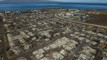
Christchurch residential red zone on Thursday morning. Photo / Matthew Sherwood
The council says residents have been doorknocked and evacuated with the help of police.
Floodwaters are starting to recede in Otago and Canterbury, but the village of Lake Ōhau could be cut off for days, RNZ reported.
Waka Kotahi has had a mammoth clean-up job to open roads again across the South Island today.
All road access to Lake Ōhau has been severed, at a time when the village is filled with visitors for the school holidays.
Floodwaters washed out the sole bridge providing access to Lake Ōhau, and the Waitaki District Council says it hopes to have access restored by the weekend.
/cloudfront-ap-southeast-2.images.arcpublishing.com/nzme/WF2V7J4XL3Z62X5W4TXXIDVQ5Q.jpg)
An aerial view of the intersection of Lake Ōhau Road and State Highway 8. Photo / Supplied
Waitaki mayor Gary Kircher said Lake Ōhau was a very popular place at this time of year, with about 150 visitors staying at the Ōhau Lodge, plus others staying in AirBnBs.
It is also a village with no shops.
"The emergency management team are looking at how they can get some supplies into Lake Ōhau village mainly for those who are staying there longer than they were planning to and don't have enough food."
This morning, Ōhau Lodge owner Mike Neilson led 19 four-wheel drives across a paddock for people who needed to leave.
"We took a convoy of guests who had finished their stay here, and did a convoy and went across the farm paddocks. [I was there] to keep them in order and make sure they didn't wander off and not quite follow the right route and get lost and stuck."
Ōhau resident Hugh Spiers said locals tend to be self-sufficient, but he was still desperate for the bridge to reopen.
/cloudfront-ap-southeast-2.images.arcpublishing.com/nzme/ZA7LAK7FDERB2AEYICPEQFS5HY.jpg)
A tractor submerged under floodwaters in Omakau on Tuesday. Photo / Shannon Thomson
On Monday he was expecting a long-awaited delivery of Gib board needed to make repairs after a massive fire in the village in 2020.
"We're just on the rebuild programme at the moment after the devastating fires of 2020. We've had floods and fires, and we just don't need locusts. Hopefully that's the next thing that's not going to happen."
Access to Omarama was also cut off yesterday because of flooding, but was restored again this morning.
/cloudfront-ap-southeast-2.images.arcpublishing.com/nzme/YMAJNMJPQJUYFEKVHVIMPOY47U.jpg)
Asphalt was lifted by the flooding at the Omarama Top 10 Holiday Park. The caravan (right) was shifted more than 4m by floodwaters. Photo / Gerard O'Brien
Omarama Top 10 Holiday park co-owner Irwin Beiboer said they were just starting to assess the extent of the damage, but at least 12 units had been damaged.
"[We] have the fire brigade here pumping the rest of the water away from us, as the water just doesn't go anywhere. The roads are all completely destroyed here at the park, units completely destroyed. There's a lot happening."
The downpour also brought down massive boulders, some the size of a car, along State Highway Six, west of Murchison.
- Additional reporting RNZ
Take your Radio, Podcasts and Music with you