Heavy rain and strong winds have hit parts of the country as a cold front moves across New Zealand.
The warm weather felt overnight by many has been short-lived today.
A moist northwesterly flow with embedded fronts is bringing periods of heavy rain to the west of the South Island and also parts of the North Island throughout the day.
Snow is possible near Otago, Southland and Southern lakes areas this evening and overnight.
Waka Kotahi NZ Transport Agency is reporting strong wind warnings are in place for SH1 Dunedin-Ashburton and Dunedin-Glenavy as well as SH85 Alexandra-Palmerston.
In Auckland, temperatures are expected to remain relatively high today but rain is forecast for the late morning and afternoon.
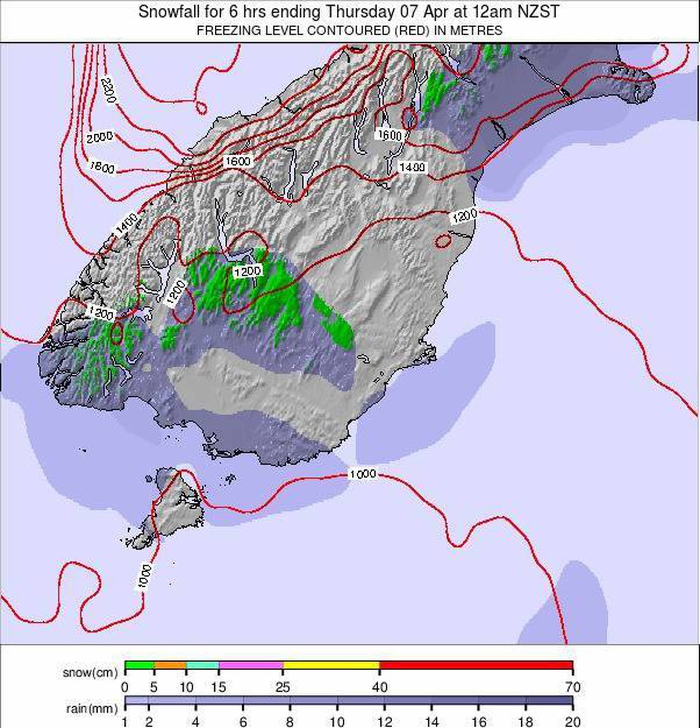
Snow is possible near Otago, Southland and Southern lakes areas this evening and overnight. Photo / snow-forecast.com
An orange heavy rain warning is in force for Westland until 11am.
Heavy rain watches are in place for Buller, the Tasman ranges and the Tararua Range until this evening.
Strong wind watches are in place for coastal Southland, Dunedin and Clutha.
It follows a warmer night for many, with temperatures barely dropping below 20C in a number of places.
The severe weather is expected to continue until at least Friday, with morning frosts possible in some places.
Temperatures are expected to drop a few degrees across the North Island from Thursday.
Take your Radio, Podcasts and Music with you