A severe dumping of rain drenching commuters in Auckland this morning is set to be accompanied by thunderstorms and blustery wind gusts of up to 80km/h.
The heaviest rain was expected to hit before dawn, which has raised concerns over surface flooding and debris as people hit the roads for their morning commute.
Motorists faced long delays heading south on Auckland’s Southern Motorway after a crash near Greenlane at 7.30am.
MetService has issued heavy rain watches for Auckland, the Coromandel Peninsula and the eastern Bay of Plenty, and a strong wind watch is in place for Northland.
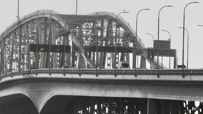
The Auckland Harbour Bridge will be under a 4x4 layout this morning during peak hour traffic due to the severe gusts.
MetService meteorologist Lewis Ferris said a low-pressure system over the Tasman Sea would roll quickly across the upper North Island today.
From mid-morning, conditions would become more unstable, he said, lifting the risk of thunderstorms in Northland, Auckland, the Coromandel and northern Waikato.
“Heavy rain is likely, and it’s going to be quite windy, and then if you have a thunderstorm in the mix, it’s just going to turn that intensity up,” Ferris said.
Thunderstorms could bring localised downpours of 10-25mm an hour and wind gusts of up to 80km/h.
“There’s more weather to come, especially around Auckland. It’s looking like quite blustery southwesterlies, especially on Saturday, but still lingering into Sunday,” he said.
Yesterday, Auckland Emergency Management (AEM) urged residents to clear drains and gutters before the wild weather.
“Take extreme care if you are driving in heavy rain, and delay trips if possible.
“Do not try to walk, play, swim or drive in floodwater,” AEM said.
Severe weather watches
Auckland and the Coromandel Peninsula are under a heavy rain watch until 9am.
The Bay of Plenty ranges east of the Ōtara River are under the same watch until 6pm.
A strong wind watch will remain in place for Northland until 9am.
Blustery start to the weekend expected
It will be a blustery start to the weekend, as a brisk west to southwest wind is expected to set in, especially for coastal parts of Southland and the Canterbury High Country.
“It’s not really looking like a picture-perfect weekend for many people, but, I mean, if you keep an eye on the forecast, you might be lucky,” Ferris said.
MetService also expects large waves this weekend, driven by strong winds on both the west and east coasts.
Another rainband will move up the West Coast in the South Island on Saturday morning before reaching the North Island in the afternoon.
Winds and showers will ease from Sunday, though they are expected to linger in Dunedin.
MetService meteorologist Michael Pawley said the “spring temperature pendulum also continues to swing” as Hastings is forecast a maximum temperature of only 11C today, but 21C early next week.
Take your Radio, Podcasts and Music with you
Get the iHeart App
Get more of the radio, music and podcasts you love with the FREE iHeart app. Scan the QR code to download now.

Download from the app stores
Stream unlimited music, thousands of radio stations and podcasts all in one app. iHeart is easy to use and all FREE


