The upper North Island is in the firing line of an active weather system bringing thunderstorms, powerful winds and marble-sized hail.
A fresh severe thunderstorm warning has been issued for Auckland City, Waitakere, Franklin, Rodney, Gulf and Albany.
These thunderstorms are expected to be accompanied by damaging wind gusts and possible tornadoes.
“Very strong wind gusts can break branches from trees, damage roofing, and make driving hazardous especially for high-sided vehicles and motorcycles,” MetService warned.
“Tornadoes can blow out windows, lift roofs, break large branches off trees, generate dangerous flying debris and blow vehicles off the road.”
These severe thunderstorms were picked up in the north-west Auckland region and were heading east.
They were expected to lie near Auckland and Albany at 8.52pm, and near Auckland and Waiheke Island at 9.22pm.
Earlier, the NZ Transport Agency urged drivers to prepare for short-notice lane closures or reduced speeds on the Auckland Harbour Bridge.
From 8pm to midnight tonight, an amber alert will remain in place with forecast wind gusts of 75-85km/h, NZTA said.
MetService meteorologist Mmathapelo Makgabutlane said a large “active” weather system looming off the coast and barrelling towards the country is due to hit at about 4pm today.
“We’re seeing kind of that band of thunderstorms and showers moving on to the country this afternoon and evening.
“With those thunderstorms, we could see very strong winds, and that’ll probably be one of the main things to look out for today.
“And as always, thunderstorms do bring the risk of pockets of isolated, very heavy rain, so that’ll be something else to keep an eye on as well as that possibility of hail.”
She said the thunderstorms will be embedded with destructive gusts of up to 110km/h in some areas and hail the size of marbles, ranging from 5-15mm.
“In addition, there is also a low risk of a small tornado, which could occur with or without a thunderstorm,” MetService reported on its website.
There is a higher risk in Auckland, Northland, northern Waikato and Coromandel Peninsula that the thunderstorms would be “severe”.
“I’d say for places for people who are in those areas, but even for people who are outside of those areas in the North Island, definitely a good day to keep a close eye on the radar and kind of track where those rain bands are and kind of see how that fits in with your plans for today,” Makgabutlane said.
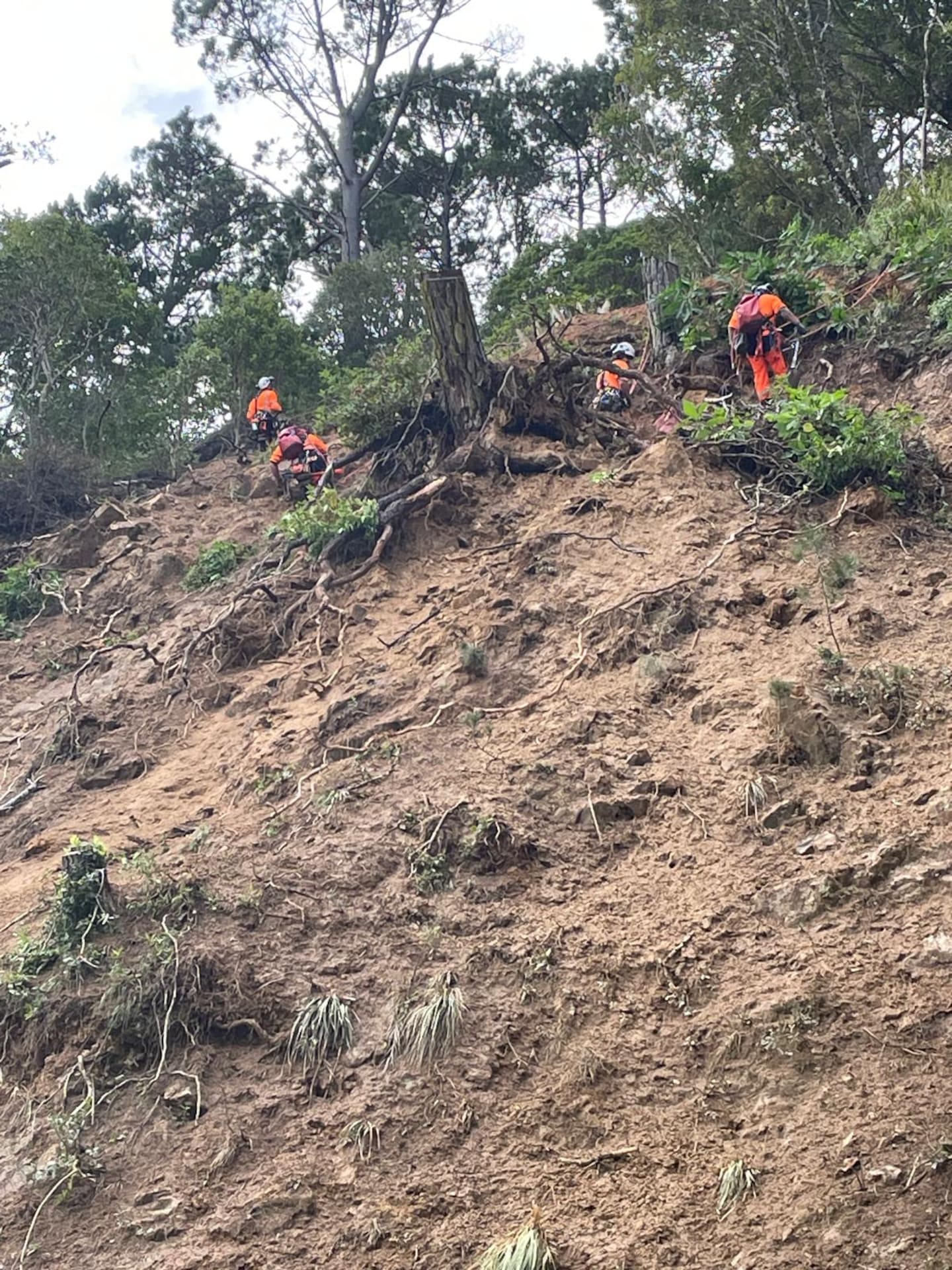
SH25 has reopened after a slip closed the Thames-Coast Rd between Ruamahunga and Tapu this morning.
NZTA said loose rocks and debris on the slip face meant it wasn’t safer to open a lane any earlier today.
“Road users are advised to take care and drive to the conditions with more rain forecast this afternoon and into the evening,” NZTA said.

SH25 has reopened after a slip closed the Thames-Coast Rd between Ruamahunga and Tapu this morning. Photo / NZTA
What’s in store for King’s Birthday weekend?
Makgabutlane told the Herald that Kiwis should expect a “noticeable cooler feeling” in the air as winter begins this weekend.
She said that would be because of a southwesterly flow over the country.
Makgabutlane said overall, the long weekend was not looking like a washout at this stage, but there would be periods of showers.
She said coastal areas in the western parts of the country, as well as the lower South Island, could have breezy southwesterlies, which might create some large waves.
“That’s maybe a bit of an early heads-up for anybody who is thinking about being near the coast in those areas.”
Take your Radio, Podcasts and Music with you


