More “significant weather” is on the way for parts of New Zealand as those in the south of the country are still impacted by power outages and water shortages from Thursday’s wild storm.
MetService has today issued new weather forecasts for the long holiday weekend that contain a number of watches but those are likely to be upgraded to warnings as conditions worsen.
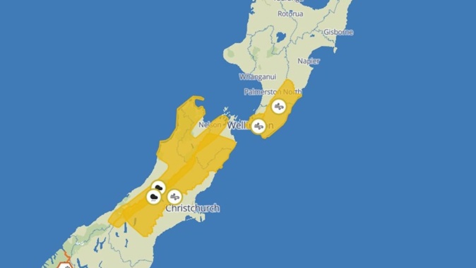
A strong wind watch has been issued for Wairarapa, Tararua, and the Canterbury high country, beginning Sunday at 1pm.
MetService said another “burst of strong winds” is expected on Monday and a warning for these will be issued closer to the time.
Wellington is bracing for strong winds starting in the early hours of Monday, while heavy rain is expected to lash the ranges of Westland, Grey, Buller, Nelson, northwest Marlborough and Tasman west of Motueka later that day from 7am and last till at least 10pm.
A heavy swell warning has also been issued for Kāpiti, Porirua Coast and Ōtaki to Cape Terawhiti with waves expected to rise as high as 5.5m.
The country is still reeling from a week of severe weather. A state of local emergency remains in place in Southland and Clutha, nearly two days after destructive winds reaching 150km/h tore through the region.
More than 17,000 homes in Southland and South Otago were still without power this morning. PowerNet chief executive Paul Blue said some outages may persist until next Friday.
Further north, Kaikōura is also under a state of emergency amid fears fires that destroyed five homes north of the township on Wednesday could reignite.
PowerCo reports nearly 900 properties across Wairarapa, Tararua, Manawatū and Taranaki are still without electricity.
While MetService has put specific watches in place, most of the country can expect bad weather in the early part of next week.
Take your Radio, Podcasts and Music with you


