Heavy snow is on the way for both islands next week, with highway closures likely, Weather Watch head analyst Philip Duncan says.
In a special update this afternoon, Duncan said it was not a major storm, but possibly the lowest snow fall of the year.
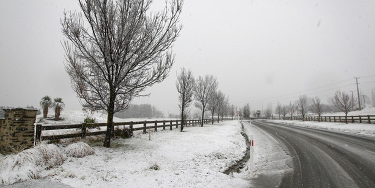
Snow will fall to low levels in the South Island, he said.
"We're into the depths of winter now with moisture meeting the cold next week ... Southland and Otago may see snow falling as low as around Dunedin and near or around Invercargill."
At this stage he believed it was unlikely snow will reach sea level, or at least not settle and cause problems.
"However the low level and heaviness of this snow may cause travel problems through the South Island and central North Island and, depending on timing, there is certainly the risk snow cause transport issues in Dunedin, even to sea level."
North Island's turn from Wednesday
The white stuff will come from a deep low a few thousand kilometres south of the South Island. On Tuesday it will send a burst of moisture and cold air from over the Southern Ocean into the South Island.
"This will push snow to very low levels in the lower half of the South Island and produce widespread heavy snow above 200m."
It will spread into the North Island on Wednesday and Thursday, where it will push into a low centred over the North Island bringing moisture rich air from just north of the country back down and into the colder air.
"This rain will be fed in via an easterly quarter flow, placing the Hawke's Bay ranges and Central Plateau areas at risk of heavy snow for a couple of days where the southerly meets."
Cities and towns in the firing line
At this stage WeatherWatch.co.nz believed the following main centres may get snow for a time on Tuesday - Dunedin, Gore, Alexandra, Queenstown, Cromwell, Arrowtown, Wanaka and possibly Ashburton overnight Tuesday and into Wednesday morning.
Christchurch - at this stage - was unlikely to get snow, but they would monitor conditions.
In the North Island, Waiouru, Ohakune and Taihape are all highly likely to receive snow, along with National Park. Stratford and Eketahuna both have some chance.
Many South Island highways will be affected around Southland, Otago, Canterbury and through and over the Southern Alps for a time.
In the North Island, State Highway 2 over the Rimutaka Ranges is likely to be impacted, potentially on Wednesday night.
Snow is highly likely on the Desert Road, along with all highways around Mt Ruapehu.
SH5 from Napier to Taupo will also likely be impacted by snow on Wednesday or Thursday with snow expected to fall down to Rangitaiki, Duncan said.
Take your Radio, Podcasts and Music with you