Great swathes of New Zealand are battening down the hatches this afternoon as a rolling line of thunderstorms and blustery gusts continue to strike the country.
There has already been 21,500 lightning strikes over land and water in 12 hours, MetService says, with more thunderstorms on their way.
Severe thunderstorm warnings have been issued by MetService for Wellington city, Porirua, Hutt City, Upper Hutt, Kapiti Coast, and South Wairarapa, and extending across a choppy Cook Strait to Marlborough. Wellington's warning was lifted just after 3pm.
At 2.15pm, MetService's weather radar detected the line of severe thunderstorms moving towards the southeast.
Forecasters expect them to be accompanied by torrential rain, large hail and damaging wind gusts.
Flooding has already closed roads and threatened properties around Porirua today and locals and motorists are being warned to watch out for surface and/or flash flooding about streams, gullies and urban areas, and hazardous driving conditions.
Heavy rain has kept emergency services busy around Porirua, with firefighters attending seven to eight callouts since midday, where water was threatening people's houses.
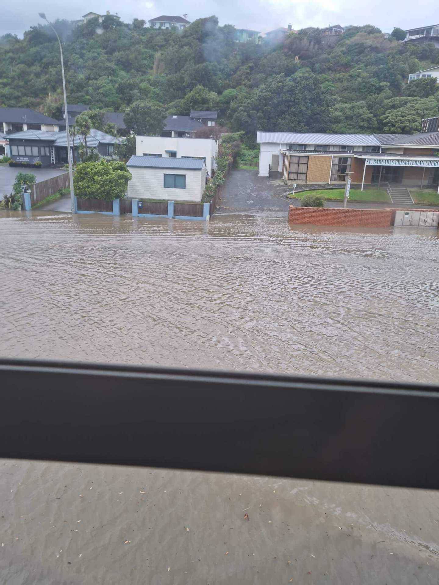
Flooding from above New World Paremata in Porirua. Photo / Brianna Banks
Fenz central shift manager Karen McDonald said the water had not managed to get inside most houses but was threatening to.
It comes as wild winter weather sweeps across the country today.

Cromwell residents woke up to a major dump of snow on Sunday morning. Photo / George Heard
Other severe thunderstorm watches also remain in force for Taranaki, Kapiti-Horowhenua, Marlborough, Nelson, Buller and the Canterbury high country.
It's still snowing in the lower South Island, though not as low as Saturday when snow was down to sea level, but it's still blocking roads in some areas.
Snow blanketed parts of Central Otago yesterday, bringing joy to the region's ski fields, with Cardrona ski field opening early and other southern mountains set to follow suit in the coming days.
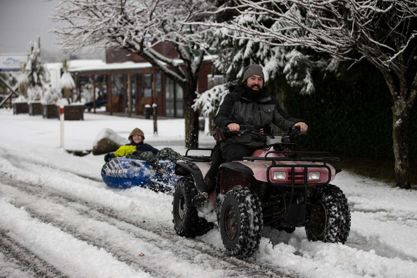
Snow continues to fall in Central Otago and provides fun weekend activities. Photo / George Heard
Road snowfall warnings have been issued for the Desert Rd, Lewis Pass, Arthur's Pass, Lindis Pass, the Crown Range Rd and Milford Rd.
Waka Kotahi NZ Transport Agency said Lindis Pass was closed just after 10am because of heavy snow, while snow had also closed Milford Rd and the Crown Range Rd.
MetService meteorologist Stephen Glassey said for Auckland, Northland and Waikato the main thunderstorm risk would be overnight.
"It's very stormy weather across many parts of the country ... as well as squally thundery showers, there's also strong winds and heavy rain," he said.
The weather system was sitting in the Tasman Sea but had come up from the south and had brought a lot of cold air with it. Eastern areas that were more sheltered were not getting such bad weather, Glassey said.
Take your Radio, Podcasts and Music with you
Get the iHeart App
Get more of the radio, music and podcasts you love with the FREE iHeart app. Scan the QR code to download now.

Download from the app stores
Stream unlimited music, thousands of radio stations and podcasts all in one app. iHeart is easy to use and all FREE


