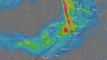
Parts of the South Island's east coast are being battered by hail the size of golf balls and there are forecasts of potential tornadoes as a wild weather front moves north.
WeatherWatch NZ has reported "dramatic downpours" passing over Timaru and Oamaru, with one downpour blanketing Timaru in thick and heavy hail.
There had been confirmed reports of broken windows and roofing from the large hailstorm.
MetService has issued a severe thunderstorm warning for Selwyn and Ashburton, which are expected to be accompanied by large hail and possible tornadoes.
Over 4️⃣5️⃣0️⃣ lightning strikes from Ashburton to Christchurch between 2:00-3:00 pm ⚡ pic.twitter.com/EF7NIRo2Kj
— NIWA Weather (@NiwaWeather) November 20, 2019
Tornadoes could blow out windows, lift roofs, break large branches off trees, generate dangerous flying debris and blow vehicles off the road, MetService said.
Timaru local Ray Bailey said he'd never seen hail this big - and it was causing damage.
He said the spouting on his house looks like it had been hit by bullets.
He said the sky turned black - leaving him wondering where the tornado was, but he couldn't see one.
Forecasts suggest there could be more tornadoes and golf-ball-sized hail for the South Island's east coast.
"The downpours may contain thunder as well, but should ease this afternoon," WeatherWatch NZ said.
/arc-anglerfish-syd-prod-nzme.s3.amazonaws.com/public/JKZKLM7Z7VHW3NSD3ZYF6QJR7A.jpg?width=476&height=640&mode=max)
Large hailstones that fell in Timaru. Photo / Ann-Marie Ferguson
"Already the downpour that produced the hailstorm has tracked east, out to sea."
MetService had issued a severe thunderstorm warning for the area from midday to about 1.15pm.
These thunderstorms were expected to be accompanied by large hail that could cause significant damage to crops, orchards, vines, glasshouses and vehicles, and make driving conditions hazardous.
The system was moving to the northeast, and a severe thunderstorm watch remained in force for Christchurch, Canterbury Plains and High Country, and North and Central Otago.
/arc-anglerfish-syd-prod-nzme.s3.amazonaws.com/public/U4V73ISTDNGVPJIGVLV5ULEQI4.jpg?width=413&height=413&mode=max)
There is a severe thunderstorm warning in force for parts of the South Island, with massive hailstones raining down. Photo / Roselyn Fauth
Niwa meteorologist Seth Carrier said the conditions were similar to those that caused Monday's tornado in Christchurch.
He said the hot sun was causing rising columns of air - which form serious thunderstorms.
Take your Radio, Podcasts and Music with you