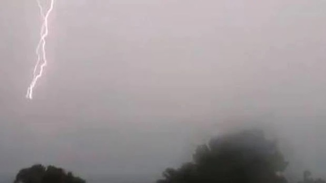
Lightning has struck a plane as the wild weather heading for Auckland batters the country.
An Air New Zealand flight has been diverted to Christchurch after being struck by lightning, as foul weather strikes the country.
NZ681 from Wellington to Dunedin was forced to land at Christchurch airport this morning, after encountering the strike.
A spokesperson for the airline says lightning strikes are not uncommon and aircraft are designed with this in mind.
Passengers on the flight have been accommodated on other services.
The strike was one of hundreds to hit the country today. According to MetService, in the North Island predominately around Welllington and Taranaki there have been 111 lightning strikes this morning, while in the South Island there have been about 1200 in the past 24 hours.
/arc-anglerfish-syd-prod-nzme.s3.amazonaws.com/public/U5FVJ4LA2ZCDTG3MDO5ECAHV7Q.jpg)
The latest MetService rain radar. Image / MetService
Wild and wet weather wreaked havoc this morning, flooding many parts of Wellington as the capital was hammered by gusts of up to 117km/h.
Fire and Emergency NZ shift manager Murray Dunbar said they had received about tens calls in relation to surface flooding in Wellington.
In one instance a person drove into the floodwater on Kenmore St and could not move the vehicle, or get out of it, until the flooding was cleared, he said.
"There has been a little bit of surface flooding around Kenmore St and Bracken Rd in Newlands - that's been cleared by clearing the drains."
There was also a bit of flooding on Hutt Rd and in Tawa, he said.
Strong wind gusts will move across the North Island and upper South Island on Sunday, particularly from mid-morning to early afternoon.
— NIWA Weather (@NiwaWeather) July 13, 2019
Wind gusts may exceed 80 km/h, while coastal locations and higher elevations may reach 100 km/h.
Secure any loose outdoor items this evening! pic.twitter.com/XAXLuE71bJ
Police are advising motorists on State Highway 5 that high winds are currently affecting the area while a campervan on its side is blocking southbound lane about 2km south of Te Haroto.
"This partial blockage may remain for some time until the winds subside and the campervan can be removed," a police spokeswoman said.
MetService meteorologist Andrew James said the active front was now slightly east of Great Barrier Island, which was still experiencing a few lightning strikes.
Active fronts moving across the upper South Island and onto the North Island this morning. Severe Weather Warnings and Watches are in effect for many places for heavy rain and strong winds with todays weather system. Find the details at https://t.co/qHyE5zhh6X ^HM pic.twitter.com/SgoDvvs8eH
— MetService (@MetService) July 13, 2019
"There is still a risk of some thunderstorms this evening and tonight" but they would be localised, he said.
Meanwhile, Vector readied power crews in Auckland as the active cold front carrying a band of heavy rain charged quickly north towards the City of Sails.
MetService has advised a period of strong winds is expected in Auckland this afternoon, with gusts over 70km/h possible and winds that may approach severe gale in exposed places.
Vector's Head of Network Field Services Marko Simunac said Vector was keeping a close eye on the weather and has readied crews to respond to any power outages.
"As always, our objective is to do this as quickly as, while ensuring the safety of our crews and the public," he said.
"We remind people to stay away from damaged electrical equipment and report issues by phoning us on 0508 VECTOR."
Simunac said that if the weather caused any power lines to come down, Vector would remotely shut down power to that area as a public safety precaution until crews arrive on site.
"All lines should be treated as live at all times. If you see any damaged power equipment or power lines down, please keep a safe distance away and report it to us as soon as possible on 0508 VECTOR."
Vector advises that regular planned network maintenance over the coming days could be rescheduled if crews were required to respond to prolonged outages caused by the weather.
Ideal conditions today for the formation of the Northwest Arch cloud east of the South Island ranges. There is a MetService blog on Mountain waves and clouds associated with turbulence here https://t.co/WoDXsi0gRT. ^AB pic.twitter.com/TLls4joD41
— MetService (@MetService) July 13, 2019
Main centre forecast
Cloudy periods and a few showers, but rain around midday. Strong northerlies turn westerly afternoon. High 18C, low 8C
Auckland
Rain around midday, otherwise showers. Thunderstorms and hail possible from evening. Strong northerly gust 90 km/h turning westerly. 17C, 10C
Hamilton
Rain around midday, otherwise showers. Thunderstorms and hail from afternoon. Strong northerlies turning westerly afternoon. 16C, 6C
Tauranga
Showers, but a period of afternoon rain. Strengthening northerlies turning westerly afternoon. 17C, 8C
Wellington
Morning rain, briefly heavy, then a few showers, possibly thundery with hail. Northerly gales, gusting 120 km/h, easing from afternoon. 14C, 9C
Nelson
Rain, briefly heavy, easing to showers late morning as strong northerlies turn southwest, then becoming fine. 15C, 3C
Christchurch
Cloudy periods. A few showers developing afternoon as northeast turns southwest, possibly heavy and thundery with hail. 16C, 0C
Dunedin
Occasional showers. Strong northeasterlies turning southwest in the morning. 13C, 3C
Source: MetService
Take your Radio, Podcasts and Music with you