Pelting rain, damaging gales and monster waves are expected this weekend as Cyclone Cody heads toward New Zealand.
Many holiday hotspots are bracing for "significant impacts" as soon as tomorrow with huge waves set to swamp eastern coastal areas ahead of the cyclone, which is expected to arrive on Sunday.
The "dangerously large waves" could range from 5-8m high from Friday in many parts of the North Island, MetService warned.
It's still unclear where Cody will make landfall, with forecasters working to provide more certainty for coastal communities in the cyclone's path.
Lifeguards are warning beachgoers to take extra care, with large, unpredictable waves and strong rip currents expected in popular holiday swim spots as soon as tomorrow.
The heavy swells were one of the earliest indicators that Cyclone Cody was on its way, MetService said.
Potentially flooding rain and damaging wind would arrive early next week. People on holiday in unfamiliar parts of the country, especially near the east coast of the North Island, should seek out the MetService forecast for their location.
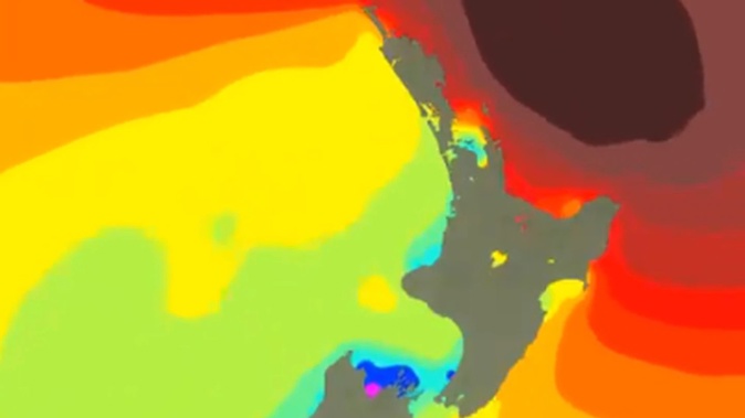
Cyclone Cody entered the MetService area of responsibility as it crossed a latitude line of 25S this morning - previously it was the responsibility of the Fiji Meteorological Service.
Before leaving Fiji the then-category 1 storm left one person dead, caused widespread flooding and forced close to 2000 people to flee their homes.
While there is still some uncertainty about exactly where the storm will make landfall, forecasters say the east coast of the North Island will be affected.
MetService meteorologist Raveen Das told Newstalk ZB this morning the cyclone's track was being closely monitored and where it made landfall could change.
The system would lose its tropical cyclone characteristics before arriving here but would still maintain its momentum - with the same windspeed and potential heavy rain.
"We are still taking it very seriously," he said.
MetService has since tweeted that "5-8m waves with long period swell from the east has potential for significant impacts about the coast", while Gisborne has been warned it's at high risk of heavy rain.
"Tropical cyclone Cody is expected to move south-southeast over the next couple of days, over open waters to the north of New Zealand. Cooler seas and strong winds aloft mean the system will lose its tropical cyclone characteristics, but it will still remain a deep low as it moves south," MetService said in a bulletin issued just before midday.
"Cyclone Cody is expected to approach New Zealand this weekend and should move across the North Island on Monday, although there still remains some uncertainty regarding the path of the system across the country and how quickly it will move past."
Surf Life Saving New Zealand national search and rescue manager Allan Mundy warned the conditions created by Cody were likely to pose great risk to swimmers and other people in coastal areas.
"They create strong rip currents, strong winds and large surging waves inundating the beach, which are a hazard for would-be swimmers and walkers alike."
All eastern North Island beaches are expected to be impacted to some extent including those in Northland, Auckland, Coromandel, the Bay of Plenty, Gisborne and possibly Hawke's Bay. Civil Defence teams along the coast are on standby.
Niwa said this morning modelling showed there would likely be "significant impacts" in parts of New Zealand.
"This includes heavy rain, damaging winds and large waves," Niwa said. "However, the exact track will determine where the worst impacts occur, which remains uncertain."
Tairāwhiti Civil Defence said yesterday the cyclone was predicted to arrive in the region late on Sunday.
Campers and people living in coastal communities were warned there could be heavy swells up to 6m high, as well as heavy rain that could affect roads and inland areas.
Those in coastal locations and areas that have previously been prone to flooding should be keeping an eye on Metservice updates, Civil Defence said.
Further north, Thames Coromandel District Council warned that the Coromandel area was in line for "huge surf and wind" at a minimum - regardless of where the storm headed.
Wave heights next Monday could reach 5m with wind gusts of 25 knots.
"If the system comes close there is the potential for flooding, rain, damaging winds and coastal inundation," MetService warned.
The council would be activating its emergency management team today and would be making people aware if they could be affected when Cody hit.
Take your Radio, Podcasts and Music with you


