Snow to 300m, rain and bitterly cold southerlies are all doing their best to drag the country back into winter.
A deepening low just east of the South Island and associated fronts were moving slowly east, spreading strong cold southwesterlies over the country today.
The strongest winds were about eastern parts of the lower South Island, and parts of the North Island Tuesday and even into early Wednesday.
Snow was expected to lower to 300m about eastern parts of Otago and Canterbury, with large amounts possible about the Canterbury high country.
Heavier snow could fall above 400m.
What will make Tuesday's chill feel even sharper? The wind! 🌬️
— NIWA Weather (@NiwaWeather) September 24, 2018
Effective temps are forecast to be in the 0-10°C range for the North Island and in the -5-5°C range for the South Island.
Dress like it's July! 🧥🧥🧥 pic.twitter.com/zMrKGLopVE
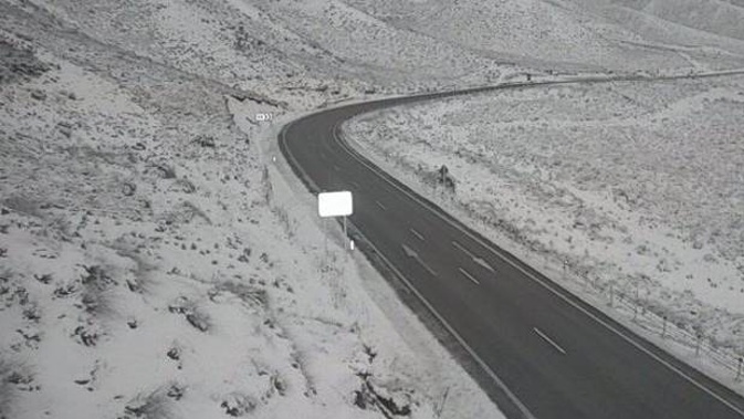
MetService meteorologist Philippa Murdoch said at 5.30am there had been no reports of how much snow had fallen yet, but snow could be seen on most of the South Island's alpine passes, and even the Desert Rd (State Highway 1) had a dusting.
Road snow warnings were in place for the Desert Rd (SH1) in the North Island, and in the South Island Lewis Pass (SH7), Arthur's Pass (SH73), Porters Pass (SH73), Lindis Pass (SH8), Crown Range Rd and Milford Rd (SH94).
The southwest gales were expected to be accompanied by wintry showers in the far south, and although significant snowfall was not expected, conditions could pose a challenge for stock and make driving hazardous.
An unstable westerly flow would cover much of the North Island Tuesday morning, while a cold front crossed the top of the South Island and moves on to Wellington and Wairarapa towards midday.
There was a moderate risk of thunderstorms about western parts of the North Island from the Kapiti Coast up to the west coast of Waikato, and also about the Kaikōura Coast before dawn and the south coast of Wairarapa during the morning.
These thunderstorms could produce brief heavy rain, hail and in western parts of the North Island strong wind gusts around 90 km/h.
If you're not a fan of the chilly weather, give it a week! 🌡️
— NIWA Weather (@NiwaWeather) September 24, 2018
A northerly air flow pattern is possible next weekend and during the following week, giving way to above average temperatures.
Temperature difference from average over the next 10 days 👇 pic.twitter.com/yvMkAHYqHS
The southwesterlies and showers should ease later on Wednesday, and a ridge of high pressure would move east over the country Thursday and Friday.
Late Friday northwesterlies would increase over the South Island ahead of an oncoming front.
This front was expected to reach the South Island on Saturday, bringing rain to the West Coast and alps, and strong northwesterlies to eastern areas.
Today's weather
Occasional showers, easing evening. Brisk, gusty southwesterlies. 14C high, 10C overnight.
Occasional showers, some heavy with chance hail, easing evening. Strong southwesterlies. 14C high, 10C overnight.
Occasional showers, some heavy and possibly thundery with hail, easing from afternoon. Brisk southwesterlies. 13C high, 8C overnight.
A few showers until evening, then becoming fine. Brisk westerlies, gusting 90km/h from afternoon. 14C high, 9C overnight.
New Plymouth Showers, some heavy and chance thundery with hail, gradually clearing by evening. Strong, gusty southwesterlies. 13C high, 10C overnight.
Napier Cloudy periods. Chance afternoon shower. Westerlies. 16C high, 7C overnight.
Whanganui Showers, some heavy and chance thundery with hail, clearing in the afternoon. Westerlies strengthening in the afternoon. 14C high, 9C overnight.
Wellington Showers, some heavy with chance hail, clearing to fine towards evening as strong, gusty southerlies turn lighter northwest. 11C high, 6C overnight.
Nelson Fine, chance shower before dawn. Southwesterlies, strong at times. 16C high, 7C overnight.
Christchurch Rain clearing and becoming fine by afternoon as strong southwesterlies ease. 14C high, 3C overnight.
Dunedin Partly cloudy. A few showers clearing early and returning evening. Cold southwesterlies, becoming strong afternoon. 11C high, 4C overnight.
Take your Radio, Podcasts and Music with you