Fast-approaching Auckland thunderstorms and active weather are set to wreak havoc for the remainder of the school holidays.
Squally thunderstorms and hail with localised heavy falls are expected to kick off for Auckland and Northland from tomorrow evening.
A bout of rain is passing over the country today, with just about everyone expected to see some rain.
“The more interesting weather comes Friday and Saturday,” MetService said.
“With things moving so quickly at the moment, if you see the sun out there, go grab some rays while you can.”

Squally thunderstorms and hail with localised heavy falls are possible for Auckland and Northland from tomorrow evening. Photo / Michael Craig
From tomorrow, periods of rain and showers move from the northwest over the North Island and the top of the South Island.
This wild weather is brought on by a series of active rain bands associated with a low-pressure system, MetService said.
MetService meteorologist Katie Hillyer said rain will be heavy at times in places in the top half of the North Island.
“The speed at which these bands are moving means total rainfall accumulations might struggle to climb,” Hillyer said.
“However, we’ll be keeping an eye on shorter, more intense falls.”
As the weekend kicks off, showers are set to spread over the rest of the country on Saturday as the low-pressure system moves over.
“The whole country really becomes a swirling mass of scattered showers,” Hillyer said.
While everyone will be affected by these showers at some point this week, the places expected to bear the brunt tomorrow and Saturday are the top half of the North Island and the Tasman Region.
The southeast coast of the South Island will be in the firing line on Saturday and into Sunday.
Hillyer said these regions will see more persistent rain and showers, as well as some heavier ones, particularly up north.
“This is the sort of dynamic situation where it’s hard to pin down where the heavy showers will form,” MetService said.
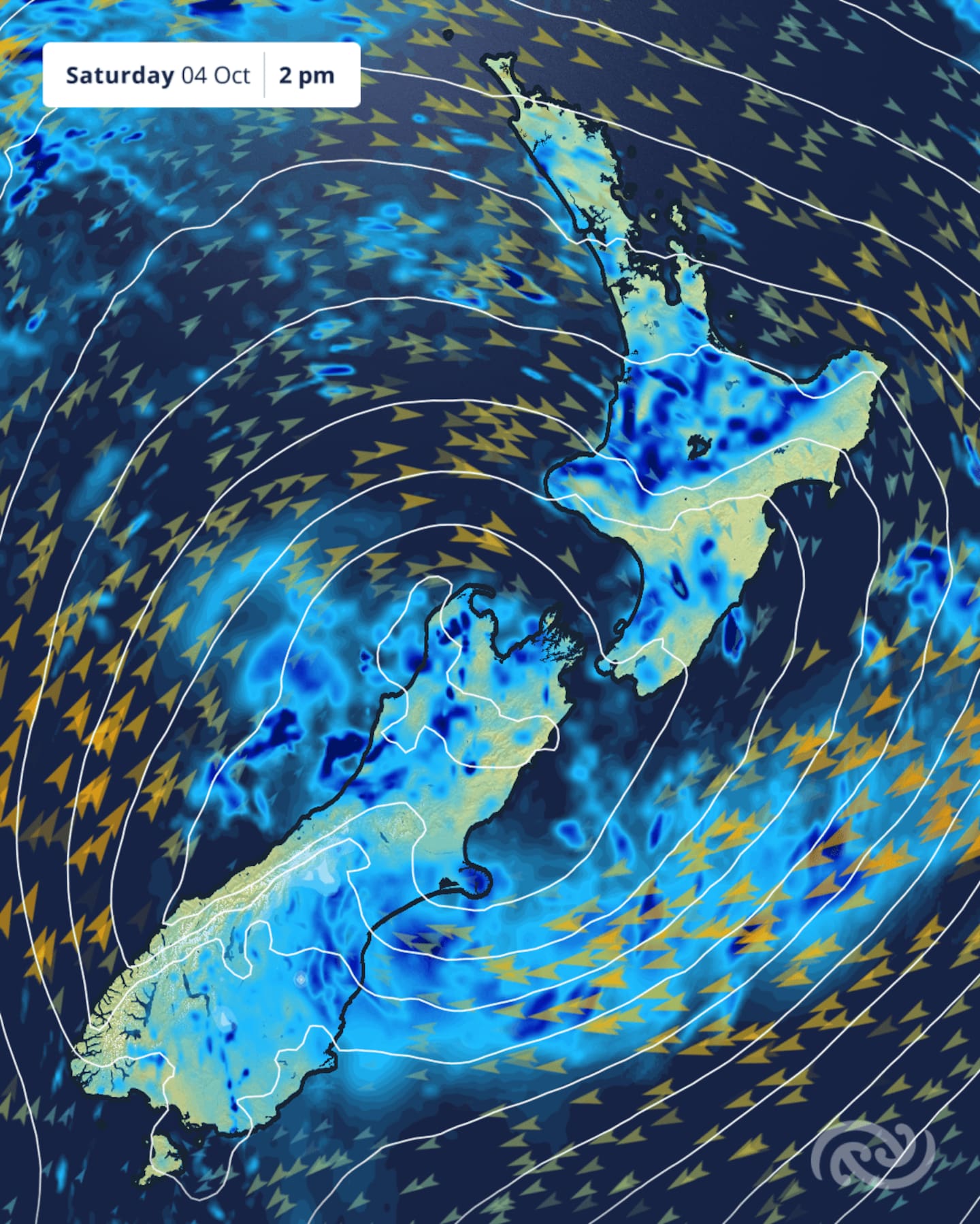
Fast-approaching Auckland thunderstorms and active weather are set to wreak havoc for the remainder of the school holidays. Image / MetService
Winds and temperature
Strong winds will be picking up from tomorrow, but are not expected to surpass what is typical during spring weather, Hillyer said.
During the remainder of the week, temperatures will rise at first.
Warm double-digit minimums are forecast for tomorrow night, before they drop again over the weekend.
A few areas in the South Island will likely see frosts develop, she said.
The next weather system is due later on Monday next week as students head back for Term 4.
No severe weather watches or warnings are in place at this stage.
Take your Radio, Podcasts and Music with you