Light snow is now falling across Wellington suburbs as an ice-laced wind sends temperatures in the capital plunging below zero.
Snow flurries and icy showers are now peppering suburbs from Karori through to Broadmeadows as the bitterly-cold polar blast lashes the bottom half of the North Island.
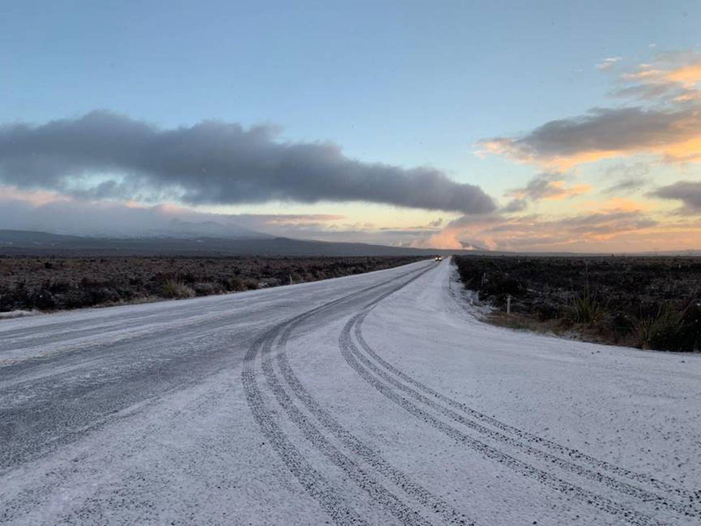
Snow has also been falling in Taranaki this morning and the Desert Rd is remains closed, made impassable by the stormy weather.
At the same time the worst is still to come for coastal residents at the bottom of the North Island who are being warned the largest swells will hit after dark tonight and they should be prepared to leave at a moment's notice.
The capital's regional emergency management office this morning updated it heavy swell warning with a stern message for people to avoid the shoreline where possible.
It said it was currently monitoring the situation and making preparations for the expected impacts this evening.
In a Facebook post it says from 9pm the swells will be at their heaviest.
MetService has forecast powerful swells up to 8 m high will pound the capital coastline today.
For those living on Wellington's south coast and south and east Wairarapa coast people are advised to have grab bag to leave at short notice and an alternate place to stay away from the danger.
While large waves were expected in the inner harbour area along the Petone and Eastbourne coastlines it said the impacts were not expected to be as significant as that for the South Coast.
Civil defence reiterated a warning to stay out of the water after two kayakers feared missing in Wellington harbour were found 22km away after a search was mounted in mountainous seas off Wellington's south coast.
An extensive hunt on sea, land and air was earlier launched for the two men who had been seen in trouble off Wellington's coast at Seatoun.
The pair were found safe in Petone.
Search efforts police walking along the shoreline while the Police Maritime Unit, Coastguard and a rescue helicopter looked for the duo on the water and in the air.
"Police urge people to avoid or delay any unnecessary outdoor activities given the severe weather conditions in Wellington at the moment," said a spokesperson.
"Conditions are dangerous on the water and on the roads due to high winds, and we urge people to take precautions and keep safe."
It comes as the Antarctic blast that swept up the South Island, bringing freezing temperatures, dumping snow and grounding Air New Zealand flights, moves over the North Island and temperatures drop below zero.
With snow blanketing much of the south, leaving numerous highways closed and even falling to sea level in Christchurch overnight, the focus is now on the north, which is feeling the brunt of the polar air.
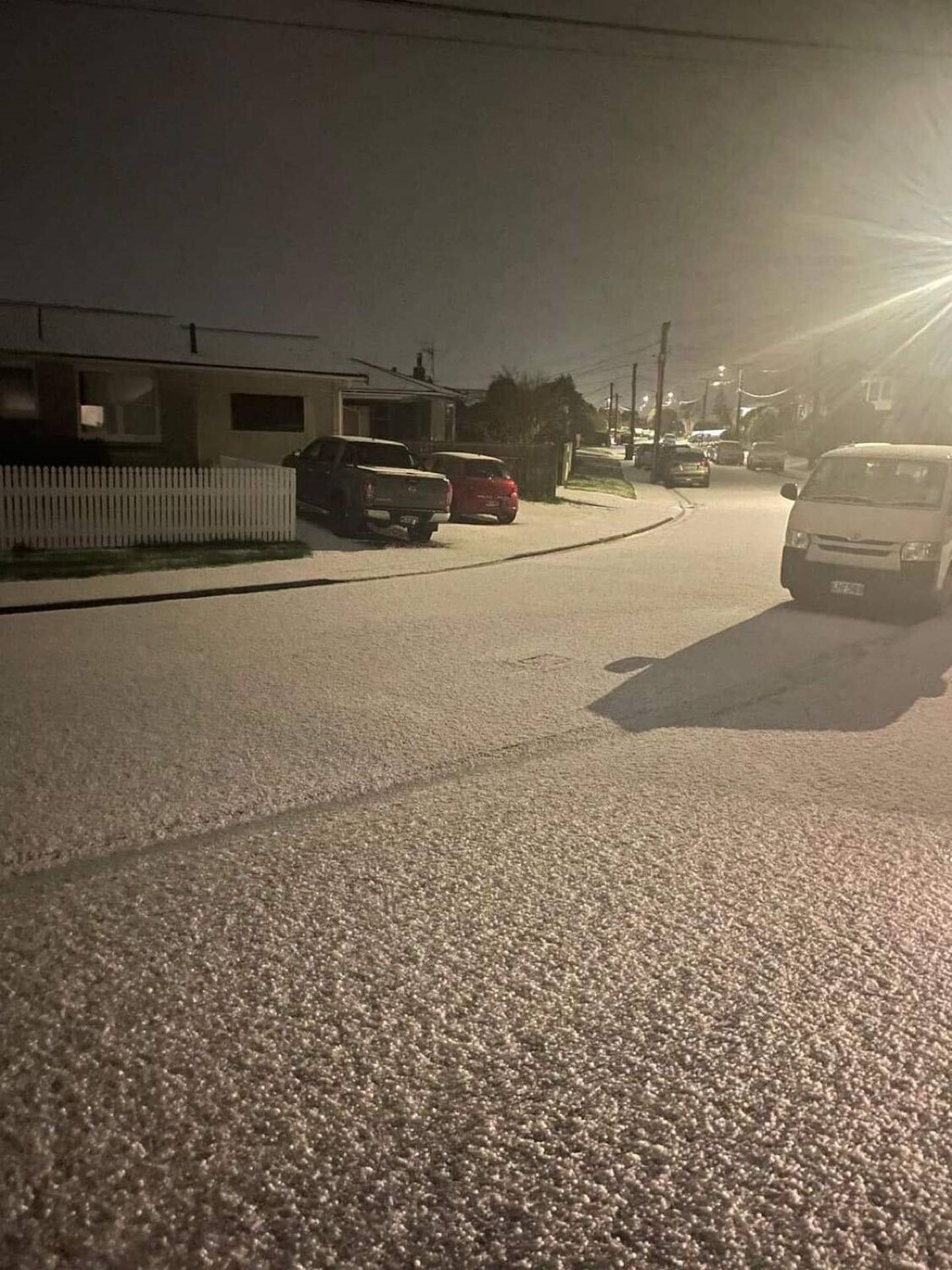
Snow blanketed Frankton this morning. Photo / Courtney Winter
Icy showers and sleet are now hitting upper slopes of Wellington with snow expected on the capital's eastern hills and the Remutaka and Orongorongo Ranges across the rest of the day.
Twenty-five flights have been cancelled in and out of Wellington Airport as stormy weather bears down.
"Moa Point road is currently experiencing some surface flooding and other local roads are also likely to be impacted by the weather," a spokesperson said.
"We are working with Wellington Regional Emergency Management Office to keep an eye on developments and are regularly inspecting our runway and seawalls to ensure they are not damaged. We are advising travellers to contact their airline or keep an eye on Wellington Airport's Live Flight Information for latest updates. We also advise taking extra time and care getting to and from the airport.
"We will provide further updates on our social media pages."
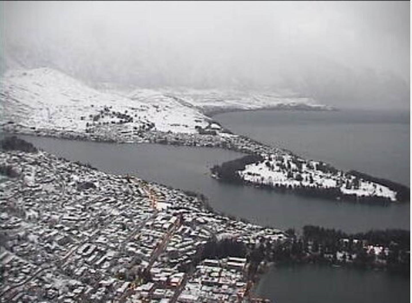
Queenstown this morning, frosted in white. Photo / Skyline
Heavy snowfall warnings are in place for regions across the lower half of the North Island, with Wellington already experiencing hail storms earlier this morning. Wellington City Council said a Johnsonville bus became stuck due to ice just after 6.30am.
At 7.40am the main shock of the freezing polar blast was centred halfway up the North Island, according to weatherwatch.co.nz.
Major highways in the centre of the North Island are now closed by heavy snow including the Desert Rd and State Highway 4 from Tohunga Junction to National Park. Those travelling on State Highway 5 between Napier and Taupo have been warned of treacherous driving conditions, but at this stage the road is open.
Snow has even started falling in Taranaki, with Stratford getting a rare dusting this morning.
Forecaster Angus Hines said snow was falling in the region, and more would come in the next hour. He said it was "pretty unusual" for this part of the North Island to get a coating.
As the mercury continued to drop, MetService has also issued a threat of damaging waves to the country's entire coastline.
MetService forecaster Gerard Bellam said they were very large, high-energy waves that posed a threat to any seaboard location over the coming 24 hours.
These powerful waves had the potential to catch people unawares if walking on beaches or driving along coastal roads. There was also the potential for waves to affect land or property near any coastline.
/cloudfront-ap-southeast-2.images.arcpublishing.com/nzme/4FCZ3YB36KLH4PRIHCTD2VUPZQ.jpg)
Big swells are hammering Ōwhiro Bay this morning in Wellington.
A heavy swell warning is in force for Wellington's south coast from Baring Head to Sinclair Head.
The southerly swell was expected to reach 6m on Tuesday evening, with the highest risk period coinciding with high tide at 8.24am and 8.54pm.
By Wednesday night the swell is likely to ease to around 4m.
MetService meteorologist Angus Hines warned today's waves could be damaging to low lying properties and roads. People in the area are urged to stay out of the water and be prepared to leave their properties if they are at risk.
The Wellington Region Emergency Management Office said the impact of today's morning high tide could be similar to what was experienced in Ōwhiro Bay in April last year when 6m waves battered roads and flooded properties.
The agency said people who lived in homes that had been impacted by past swells and storm events should be prepared for these potential impacts again.
The wild weather has disrupted travel in both islands – with the Interislander ferry cancelling all sailings for today, while Air New Zealand cancelled 33 flights in and out of Dunedin, Invercargill and Queenstown yesterday.
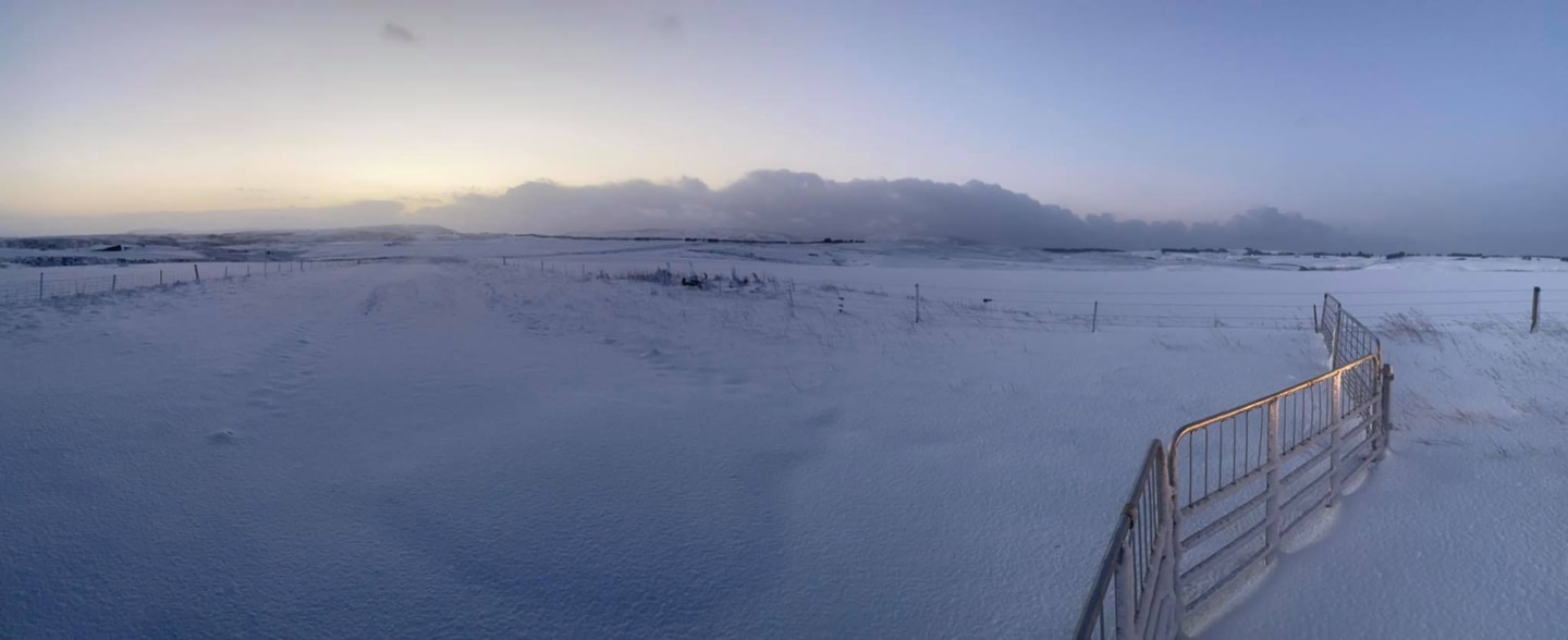
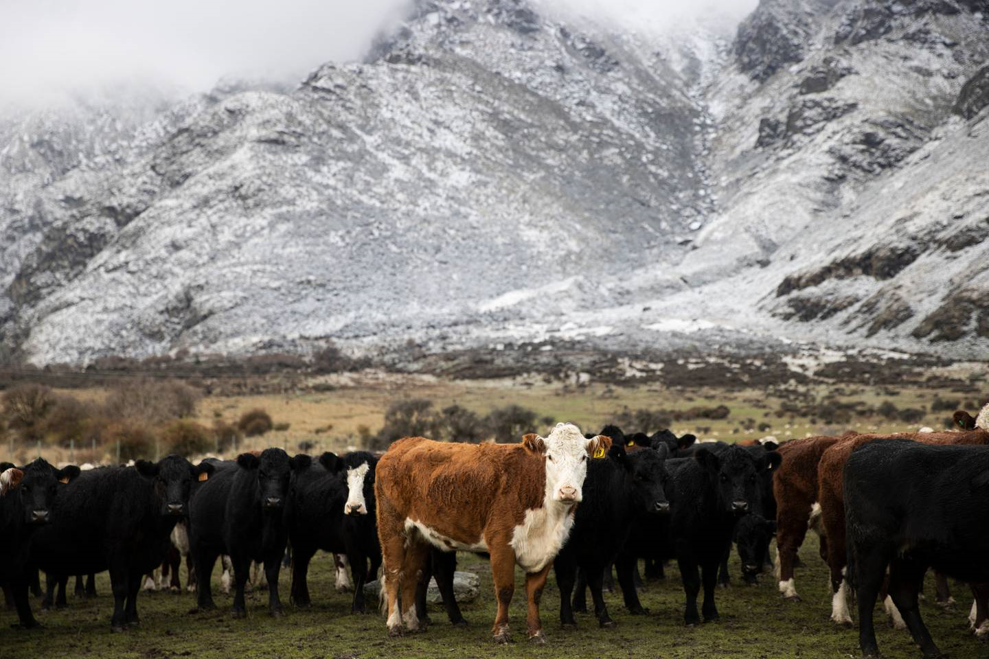
The outlook at Barewood Station, near Middlemarch in Otago. Photo / Will Kirkness
The polar blast brought snow to sea level in parts of the south yesterday, as well as huge seas and gales laced with a bitterly cold -20C windchill.
An active cold front and south-to-southwesterly winds will track north across the remainder of the country, with numerous weather warnings in force.
Heavy snow was possible in Taihape, around the Tararua Range and Banks Peninsula today.
A road snowfall warning is in place for the Napier-Taupō Rd (until midday Tuesday), Desert Rd (until 5pm Tuesday) and Remutaka Hill Rd (until 4pm Tuesday) in the North Island.
Bellam said snow had fallen to low levels across the Southland and Otago, with blizzard-like conditions in alpine areas.
The polar outbreak had left snow falling down to sea level in Christchurch.
The bitterly cold air mass was now continuing on its northern track, bringing with it severe gales and large seas.
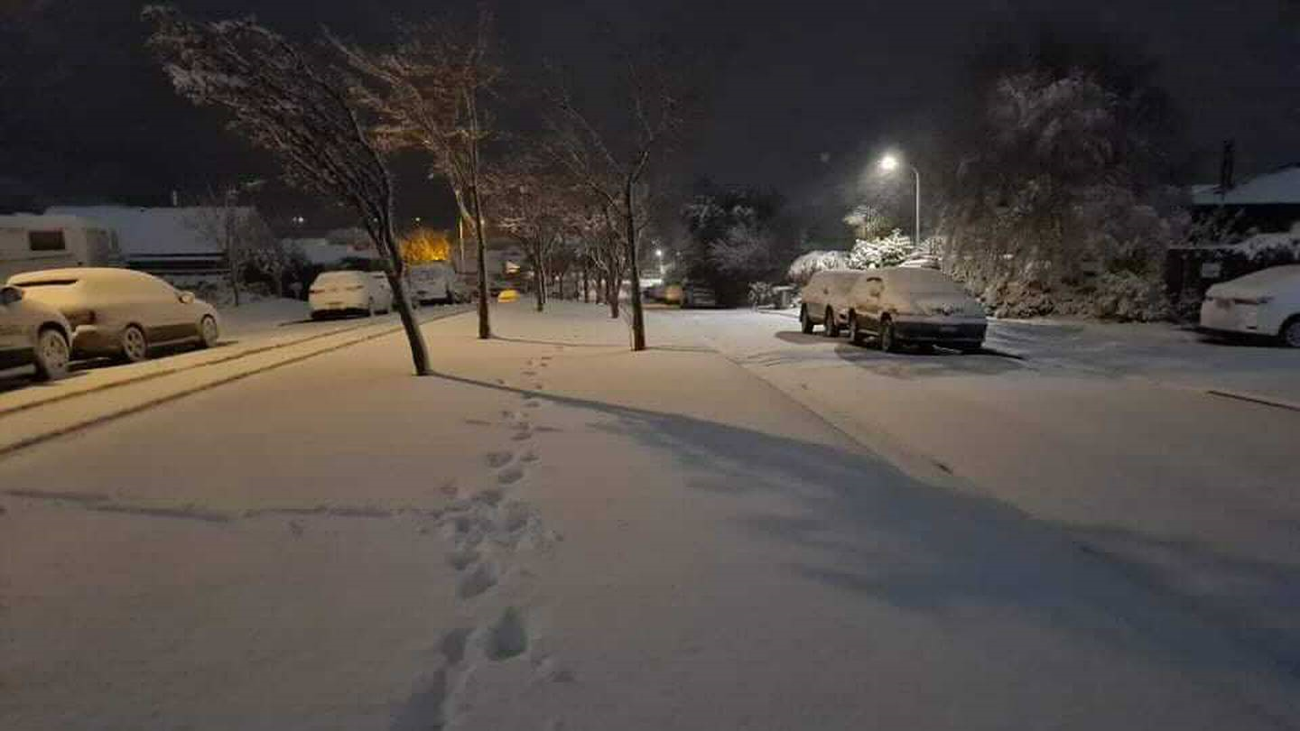
Oswald Crescent in Newlands, Wellington. Photo / Supplied
Snow and ice in Queenstown yesterday forced some drivers to carry chains and motorists across the Wakatipu Basin and in Wanaka were urged to watch for rockfall.
Yesterday morning, Treble Cone was coated in 15cm of snow on the upper slopes and Cardrona had received around 10cm.
Moke Lake in Queenstown, the Crown Range Summit and Ben Nevis Range were coated in snow.
State Highway 1 Desert Rd is closed this morning between Rangipo and Waiouru. Photo / NZTA
Meanwhile, Waka Kotahi has urged motorists driving on SH11/Desert Rd and SH5 Napier- Taupō Rd today to prepare for winter driving conditions, including snow and ice.
Waikato system manager Cara Lauder said further road closures were possible and motorists should plan ahead and drive prepared with a spare tire, charged cellphone, blankets, snacks and a bottle of water in case they break down.
"Plan ahead, allow extra time for your journeys and drive to the road and weather conditions. Maintain a greater following distance between your vehicle and the one in front, slow down and be prepared for unexpected hazards."
SH94 Milford Rd and SH87 between Kyeburn and Outram were both closed overnight while in the North Island SH56 between Opiki and the Manawatu River Bridge was closed due to flooding.
Get out the woollies in Wellington today, as snow is forecasted to 300m with the chilly high of 8C and low of 6C while strong southwesterly and gale winds gusting to 90km/h are expected.
Queenstown's Remarkables mountain range during Monday's polar blast. Photo / George Heard
In Auckland, a high of 13C and low of 4C is on the cards, with frequent showers in the morning, possibly turning heavy before clearing to fine weather in the afternoon.
The rain clouds would clear by Wednesday but the temperature would stay cool in Auckland, with a high of 14C for the rest of week and lows of between 4C-6C.
The weather is less severe in Whangārei today, with a few showers forecasted before clearing and turning fine.
Meanwhile, as one part of the country is coated in snow, those in Horowhenua are facing the possibility they may run out of water.
The Horowhenua District Council has pleaded for thousands of residents in Levin, Tokomaru and Shannon to reduce or stop using water immediately.
Due to the recent rain, water-treatment plants have struggled to effectively treat the muddy river water for the region's drinking water supplies.
"If residents don't act to reduce water usage or stop completely if they're able, there is a real risk that the water supply will run out and the community will need to rely on bottled water or water tanker supplies to service their minimum requirements," the council said.
Take your Radio, Podcasts and Music with you