Months of painstaking work has revealed the staggering scale of Cyclone Gabrielle’s impact on our landscapes, with scientists mapping 140,000 slips - and counting.
Their exhaustive analysis has created one of the world’s largest datasets of landslides stemming from a single storm event, which will now be used to build sophisticated new forecast models for the entire country.
Wreaking an estimated $250 million in damage each year, landslides pose one of our biggest natural hazards - and are considered significantly more dangerous than earthquakes.
That was dramatically shown by the thousands of slips that came down in Auckland alone over our extreme summer, leaving hundreds of properties condemned.
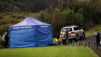
In some of the most serious recent incidents, Remuera resident Dave Lennard was killed when a landslide crashed into his Shore Rd home on January 27, while several people were injured inside a collapsed seaside bach at Manukau Heads on February 1.
Three people were injured after a building collapsed in Orua Bay Beach at Manukau Heads on February 1. Photo / Michael Craig
Further south, February’s Gabrielle left hill country dramatically scarred by slips across the North Island’s East Coast, where big deluges have grown up to four times more common over recent decades and now drop up to 30 per cent more rain.
Forecasters have warned that an atmospheric river expected to drench parts of Tairawhiti and Bay of Plenty today and tomorrow could bring one to two months of rain in just 48 hours.
GNS Science engineering geologist Dr Saskia de Vilder said the risk of landslides and their impacts, too, were expected to increase with climate change; one recent study projected a major leap in rain-driven slips under a worst-case, end-of-century scenario.
A warming world also meant more rockfalls and rock avalanches in alpine areas - and coastal cliffs tumbling with erosion from rising seas and storm surge.
Despite this rising danger, New Zealand still only had a “limited patchwork” of information about its landslide risk, de Vilder said.
Discussions with government and councils over recent years had raised the need to build new models to better gauge the threat.
Then came Gabrielle, leaving de Vilder and her colleagues an enormous number of fresh landslides to assess.
Such was the extent of damage that GNS deployed five different expert teams to collect aerial imagery from an area of 50,000sq km, spanning from Northland and Auckland to Waikato, Gisborne, Hawke’s Bay and Tararua.
While gathering nearly 17,000 photos from the air, the teams also swept the areas for hidden hazards like landslide dams and failing slopes.
More than six months on from the cyclone, several of these potential hazard sites – including a landslide dam near Tokomaru Bay, and two slow-moving landslides in Piha and Waiatarua near Auckland - are being closely monitored.
There also remained more than 1500 landslide-affected homes that required more risk analysis.
Slips scar hills in forest country near Devil's Elbow, on State Highway 2 north of Napier. Photo / Warren Buckland
All the while, GNS scientists and experts from Nema, Manaaki Whenua-Landcare Research and Auckland and Canterbury universities have been building up a detailed national landslide inventory.
The data they’re collecting would ultimately form the basis for next-generation, probabilistic models that could be used to simulate how many landslides future storms might trigger.
GNS engineering geologist Dr Chris Massey noted New Zealand had some of this capability already, with models built on years of scientific research.
“While the models performed reasonably well to forecast the most likely affected areas ahead of Cyclone Gabrielle’s arrival, with the addition of more than 140,000 landslides there is now a richer dataset to test and retrain current models to better forecast future events,” Massey said.
“As mapping continues, the team are concurrently testing how well the modelled forecasts trained on the pre-Gabrielle landslide inventory perform against the actual landslides triggered by Cyclone Gabrielle that have been mapped.”
/cloudfront-ap-southeast-2.images.arcpublishing.com/nzme/33XK3ZAXBZEKVCHHGJNGFQWUDY.jpg)
Auckland's disastrous anniversary weekend storm on January 27 left these Colwill Rd, Massey, homes in a precarious position. Photo / Brett Phibbs
So far, this had shown that as much as 30 per cent of the landslides had been missed by automated mapping – most of them about the size of a house or smaller.
“In some cases, there were mapped landslides that were either bare ground or some other feature unrelated to landslides,” Massey said.
“This supports the decision to have ‘humans’ map the landslides for this event to better ensure they were fully captured, accurately.”
De Vilder said the new programme – bringing together collaborators from Manaaki Whenua, Market Economics, Massey, Auckland and Canterbury Universities, along with iwi partners Te Runanganui o Ngāti Porou and international researchers – would also assess the threat of earthquake-triggered landslides.
“A national picture of landslides and their impacts for multiple scenarios can support emergency preparedness and response to a disaster event, as well as longer-term planning and investment decisions that underpin where and how New Zealanders live,” de Vilder said.
“This will reduce deaths, enable critical access routes, and protect vulnerable individuals and communities from the direct and long-term stressors of landslide events.”
Jamie Morton is a specialist in science and environmental reporting. He joined the Herald in 2011 and writes about everything from conservation and climate change to natural hazards and new technology.
Take your Radio, Podcasts and Music with you

/cloudfront-ap-southeast-2.images.arcpublishing.com/nzme/ECOIA76DDRHYPEUARBIXRF3YD4.JPG)
/cloudfront-ap-southeast-2.images.arcpublishing.com/nzme/R3YPXYNEZVDDXOTCNCVXIKBKRQ.JPG)


