The Prime Minister's street in one of Auckland's central suburbs has been hit by flooding.
Photos seen by the Herald show surface water swamping the street.
During today's post-Cabinet press conference, Jacinda Ardern addressed the flooding amid the wild weather in Auckland today.
"There was a lot of water. But I believe it's fine."
A major thunder and lightning storm caused widespread flooding across Auckland and northern regions today, forcing several schools to close and leaving streets and motorways awash with flooding.
There have been several reports of people trapped in cars.
The city recorded one of its wettest hours on record this morning. Between 8am and 9am, Auckland's Albany weather station recorded 76.88mm, said Niwa.
"This seems likely to become the wettest hour across the Auckland region on record, but we'll need to scour the record books."
Meanwhile, more than 4000 lightning strikes were recorded in one hour earlier today – with 700 in just five minutes as massive thunderclaps and lightning filled Auckland skies since 7am.
Metservice said this afternoon that the active front that produced the downpours and thunderstorms across the North Island would move away to the east of Aotearoa overnight.
But wet weather would continue for many this week as a low-pressure system approached from the west.
High winds upended a trampoline in Mount Maunganui earlier today while large parts of Keith Hay Park in Auckland's Mt Roskill were flooded.
Fire and Emergency NZ said they received around 300 flooding-related callouts in Auckland this morning. By 11am, they had attended 95 flooding related callouts while around 40 crews responded to the remaining call outs.
Northern Fire and Emergency shift manager Colin Underwood said most of Auckland, Orewa and Whangaparāoa were battling with flooding. He said they were swamped with calls for help.
Orewa College and Red Beach School have been forced to closed due to surface flooding. In an email to parents, Orewa College said learning would continue online today. Children already at the school who were unable to be collected would be supervised they said.
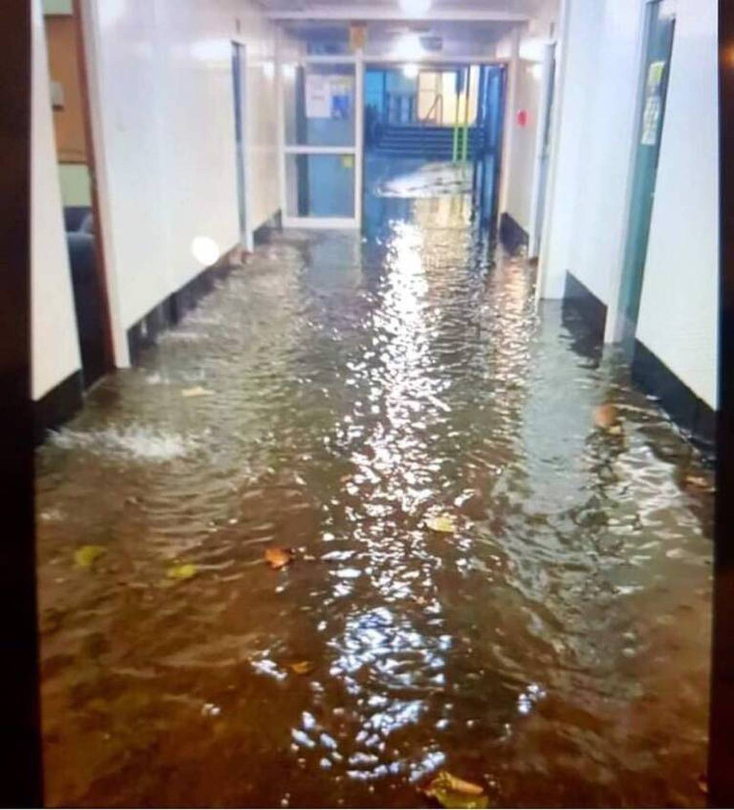
Flooding at Orewa College this morning. The school has closed. Photo / Supplied
At Westlake Boys' High School students are sitting tight in their classrooms this morning waiting for the rain to end with movement around the campus restricted due to flooding.
Principal David Ferguson said he'd never seen flooding like it in nearly 20 years at the school.
The forecaster says the electrical storm would hit the entire region - from Piha in the west, across the metropolitan area and northeast to the Hen and Chicken Islands and Warkworth.
Earlier - and overnight - torrential rain led to flooding across areas in Whangārei and surrounding areas with the bulk of it hitting near the Bay of Islands.
The MetService said the storm would be moving southeast, accompanied by torrential rain.
The severe weather reached Auckland before dawn, with residents urged to take shelter and prepare for the possibility of flash flooding.
Within a five-minute window, the city was lashed by over 700 lighting strikes according to Niwa. Between 7am and 8am more than 4000 strikes were recorded, it said.
MetService also issued a storm warning for people living in Kaipara, Whangārei, Rodney and Albany, Waitākere and Franklin.
In Puhoi, north of Auckland, a tree has fallen and blocked Ahuroa Rd in both directions. Police advised motorists that the road will be blocked for at least an hour.
At 6.30am, MetService detected a line of severe thunderstorms lying from Whakapara to Ruakaka to Tauhoa. It said the thunderstorms were moving towards the southeast, and were expected to lie from Hikurangi to Waipu to Ahuroa from 7am, and from Ngunguru to Waipu Cove to Orewa at 7.30am.
Heavy rain warnings and severe thunderstorm watches are also in place for all of Northland, Auckland, Great Barrier Island and the Coromandel Peninsula with the worst to hit later this morning. MetService has issued a heavy rain warning for Bay of Plenty, west of Ōpōtiki, from 10am Monday through to midnight.
Such storms bring torrential rain that can cause flash flooding and slips. People should take shelter indoors and away from trees when they approach, MetService says.
They should also be prepared to slow or stop driving.
Localised tornadoes are also possible and could cause damage to trees and powerlines.
Heavy rain warnings and watches are also in place for a swathe of the North Island from Auckland through Waikato down to Taranaki, along with Tasman west of Motueka.
Auckland is also under a strong wind watch till 2pm. The worst of the rain is set to hit the city from 8am.
Strong northeasterly winds buffeted the city yesterday, combining with high tides to bring waves crashing over Tamaki Drive in the eastern bays.
The current weather system looks to dominate until the end of the working week, according to MetService.
It is due to a slow-moving low-pressure system that lies to the west of the country, directing a strong, moist north-to-northeast flow across the country.
Take shelter, stop driving: Emergency advice in thunderstorms
MetService pointed people to advice from the National Emergency Management Agency, which said when storms approached, they should take shelter indoors away from windows and avoid standing under trees.
They should get off the water, move cars under cover or away from trees, check drains and gutters were clear and be ready to slow or stop driving.
During and after the storm, you should also beware of fallen trees and power lines, it says.
"Avoid streams and drains as you may be swept away in flash flooding."
The line of thunderstorms was first spotted offshore as it approached the Bay of Islands just after 1am, and has been moving south through the small hours of the morning.
Take your Radio, Podcasts and Music with you