Did you miss out on the Milford Track? Or do you want to tick off a Great Walk but not sure where to start? This expert guide to New Zealand’s Great Walk Network will help you get on the right track.
New Zealand’s Great Walks are well loved and while popular times (like the summer holidays) and tracks (such as the Milford) can sell out quickly, there’s always availability if you’re flexible around which one you do and when you go.
And it's not just walking. You can run, bike or paddle; camp or stay in a hut; do the whole thing or just part of it. Whatever way you do it, be sure to do your homework and find out which Great Walk is most suitable for you and your group beforehand. It's also important to know what fitness, skills and equipment are required, expected track and weather conditions, and how to limit your impact outdoors.
Here, Department of Conservation (DoC) senior service designer, Brian Dobbie, compares the DoC-managed tracks.
Tongariro Northern Circuit: Tongariro National Park, Ruapehu
What's the terrain like? Volcanic, which is different to any other multi-day walk in the country. It shares a section with the popular day hike, the Tongariro Alpine Crossing, but the full circuit is a more immersive experience with constant views of Mt Ruapehu and Mt Ngauruhoe.
How much time should you allow? Two nights. Spend the first night at Waihohonu Hut and the second at Oturere Hut, then walk out to the Mangatepopo Rd end and catch transport back to Whakapapa village.
What are the hardest points on the trail? The section of track between Mangatapopo Rd end and Whakapapa village is quite eroded and tough going. On the uphill section from Oturere Hut to Emerald Lakes, you gain an elevation of 500m, but most of the trip does not involve steep climbs.
/cloudfront-ap-southeast-2.images.arcpublishing.com/nzme/OSKAYOT7MLMB7TZNBDXJJDBRUA.jpg)
The unique volcanic landscape of the Tongariro Northern Circuit makes it different to the other Great Walks. Photo / Bevan Conley
Best places to stop for a break? Taranaki Falls, and the upper Tama Lakes Track has a good view of the Lower Tama Lake on a fine day, plus a toilet. On the third day, join Tongariro Alpine Crossing and stop at Red Crater and Soda Springs, where there are toilets.
- Great frustrations: Milford Track fills up after DoC website issues
- Francesca Rudkin: Spending the night in our national parks is a privilege I don't mind paying extra for
- Software developer explains how new app improves Great Walks booking system
Three words to describe the walk Volcanic, stark, otherworldly.
Whanganui Journey: Whanganui National Park, Ruapehu
What's the terrain like? A totally unique Great Walk that is steeped in history and culture. The journey is usually done via Canadian canoe or kayak. Experienced paddlers can use their own gear or hire equipment, whereas new paddlers should choose a guided option. It's mostly grade one river with some grade two rapids, and safety is key.
How much time should you allow? Three days, starting at Whakahoro to Pipiriki. Spend the first night at John Coull Hut and the next at Tīeke Marae, and there's no need to carry a tent. For a longer trip from Taumarunui, add two more days.
What are the hardest points on the trip? To do the trip safely without a guide, you should be a confident swimmer, have experience with kayaking and be fit enough to paddle for six-seven hours a day. Most people will find the rapids the most challenging part, so you need to know what to do if you roll or fall out.
Best places to stop for a break? There isn't always a place to easily pull off the river for lunch, so its best to break at campsites and huts.
Three words to describe the walk River, culture, slow-pace
Abel Tasman Coast Track: Abel Tasman National Park, Nelson/Tasman
What's the terrain like? Coastal. There are golden beaches with clear water, lush bush, headlands and rocky outcrops. It has a tropical feel.
How much time should you allow? It's the most flexible walk with timings, but I recommend two nights, three days, Marahau to Totaranui, with time to spend at the beaches.
What are the hardest points on the trail? This is a less challenging walk with plenty of stopping options. At Awaroa Harbour you need to time around the tides and also crossing the mud flat can be more tiresome.
Best places to stop for a break? Medlands Beach. Any beach! There are so many to choose from.
Three words to describe the walk Sun, sand and sea
/cloudfront-ap-southeast-2.images.arcpublishing.com/nzme/AHFZCU47NIJMRUFIIUHTFA4XVI.jpg)
The Abel Tasman Coast Track is one of New Zealand's most famous walks. Photo / Oliver Weber, nelsontasman.nz
Heaphy Track: Golden Bay/West Coast
What's the terrain like? It's the longest Great Walk with the most diverse landscape. There's lush forest, limestone karst and wild West Coast beaches. You can sometimes see takahē, and great spotted kiwi/roroa at twilight.
How much time should you allow? Four to five days on foot (once fully open). You can take three to four nights, although four is recommended for most trampers otherwise it's quite a challenge.
What are the hardest points on the trail? From Collingwood to the West Coast, the hardest point is the first section heading up to Perry's Saddle, which is a constant climb up to 800m. In the other direction it would be Lewis Shelter up to James Mackay Hut.
Best places to stop for a break? The outlook at Aorere Shelter has great views. Scott's Beach (just watch out for sandflies), and Lewis Shelter are also good for a break.
Three words to describe the walk Variety, wild, coast
Paparoa Track and Pike29 Memorial Track: Paparoa National Park, West Coast
What's the terrain like? Wonderful open tops with incredible long wide vistas right down the West Coast and Southern Alps/Kā Tiritiri o te Moana to Aoraki/Mt Cook. In good weather it's amazing, with ever changing views of the West Coast, Paparoa Range and Southern Alps.
How much time should you allow? Two nights, three days. Spend the first night at Moonlight Tops Hut and the second at Pororari Hut. It can also be done over three nights and four days.
What are the hardest points on the trail? The climb from Smoko-ho car park up the Croesus Track to Ces Clark Hut.
Best places to stop for a break? Ces Clarke Hut for the stunning views, Escarpment Shelter, and anywhere beside the Pororari River.
Three words to describe the walk West Coast wonder.
/cloudfront-ap-southeast-2.images.arcpublishing.com/nzme/5TKXPPDFB2ZWEJP4JMFLCHBR64.jpg)
Moonlight Tops Hut on the Paparoa Track. Photo / Thomas Bywater
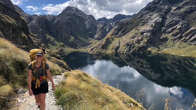
Routeburn Track: Fiordland National Park
What's the terrain like? It's a beautiful, elevated track with amazing mountain scenery as it moves around Mt Aspiring and Fiordland National Parks. There are incredible views of the Darran Mountains when you move across the Main Divide.
How much time should you allow? Three days, two nights. Staying first at either Routeburn Flats or Routeburn Falls hut, then Lake Mackenzie Hut. You can also camp.
What are the hardest points on the trail? The walk up to Harris Saddle on day two. There's less climbing and distance to cover if you're staying at Routeburn Falls Hut.
Best places to stop for a break? Routeburn Flats Hut, Harris Saddle Shelter, the former site of Howden Hut.
Three words to describe the walk Majestic mountain views.
Milford Track: Fiordland National Park
What's the terrain like? Two magnificent glacial valleys and one magnificent mountain pass. Towering mountains, crystal-clear rivers, and spectacular waterfalls.
How much time should you allow? This one takes four days and three nights and is only done in one direction: Lake Te Anau to Milford Sound.
What are the hardest points on the trail? MacKinnon Pass both up and down. Downhill goes on and on, but in a spectacular way!
Best places to stop for a break? At the many shelters and toilets provided along the way.
Three words to describe the walk Pristine, glacial, beauty
Kepler Track: Fiordland National Park
What's the terrain like? Two large lakes, impressive tussock tops and ridges, and two big river valleys.
How much time should you allow? Three or four days. It's best walked from Lake Te Anau to Luxmore to Iris Burn. Choose either Lake Te Anau via a night at Moturau (four days) or finishing at Rainbow Reach (three days).
What are the hardest points on the trail? The walk up to Luxmore Hut from Brod Bay, as it's a 900m altitude gain. Some find the long and steep descent from the tops down to Iris Burn hard on the knees, too.
Best places to stop for a break? Brod Bay beside Lake Te Anau on day one, the two shelters on the tops on day two, Rocky Point on day three – these all have toilets too.
Three words to describe the walk Lakes, views, rivers
/cloudfront-ap-southeast-2.images.arcpublishing.com/nzme/F7TPDL5B3FDCRDHWIMVT3QF6H4.jpg) Hiking above Lake Te Anau on the Kepler Track. Trips and Tramps offers an easier option to get there. Photo / Supplied
Hiking above Lake Te Anau on the Kepler Track. Trips and Tramps offers an easier option to get there. Photo / Supplied
Rakiura Track: Rakiura National Park, Stewart Island/Rakiura
What's the terrain like? It's beside the coast and along sandy beaches, and also takes in low altitude forest and a large inland estuary. Plus, you have more chance of seeing kiwi on this walk than any of the others.
How much time should you allow? Three days, with nights at Port William and North Arm.
What are the hardest points on the trail? The second day is all in enclosed forest and it can get muddy, but it isn't steep and there is no long climb.
Best places to stop for a break? Māori Beach has lovely white sand, a shelter with a toilet and a milling heritage site. Also, anywhere beside or above Paterson Inlet on the third day.
Three words to describe the walk? Coastline, kiwi, forest
Lake Waikaremoana Track: Te Urewera, East Coast
Managed separately from the other Great Walks, Lake Waikaremoana Track offers stunning back-country scenery in the homeland of Ngāi Tūhoe.
What’s the terrain like? An ancient mountain range of lakes, valleys and peaks, with dense rainforest and incredible views. A place of significant cultural and spiritual history for the Tūhoe people, the area is the first natural feature to be recognised in New Zealand law as a legal entity in its own right.
How much time should you allow? Three nights, four days. Lake Waikaremoana is not a circuit track, but can be walked either from Onepoto in the south or Hopuruahine in the north.
The Waikaremoana trail is currently undergoing flood repairs, but bookings for the coming 23/24 season are expected be announced soon.
What are the hardest points on the trail? Onepoto to Panekire Hut. This section takes between four-six hours to complete and starts with a steady climb from Onepoto Shelter, up to the top of Panekire Bluff. From there, it follows the undulating ridgeline to Puketapu Trig (1180m) and on to Panekire Hut.
Best places to stop for a break? Panekire for the spectacular views, and Marauiti Hut, where you can sometimes hear the call of kiwi at Puketukutuku Peninsula at dusk. A slight detour from Korokoro campsite, Korokoro Falls are a must-see.
Three words to describe the walk Wilderness, remote, spectacular.
The Hump Ridge Track: Tuatapere, Southland / Fiordland
The newset addition to the Great Walks, the Hump Ridge Track joins the network from October this year. Climbing from Te Waewae bay to epic views of untouched Southland forest, warm showers and stocked hut bars are welcome additions you’ll not find anywhere else on the network.
What’s the terrain like? The breathtaking - and often chilly - Southland coastal trail leads through regenerative forest up to the top of the sub-alpine Hump Ridge. The Trail was originally set up by the Hump Ridge Charitable Trust who oversaw the transfer of the land from forestry to wilderness area. Topping out at 1040metres, it is a trail that offers a little bit of everything.
How much time should you allow? The loop can be done in three days. Averaging 20km a day, it’s quite long by Great Walk standards. Allow 7 to 9 hours a day, sarting and finishing from the Rarakau car park.
What are the hardest points on the trail? There’s a lot of up hill. Depending on which direction you tackle it in, the Okaka Lodge is at the highest point on the trail. Most make this the first stop to get the uphill out of the way. Once you’ve gained altitude there’s spectacular views over the bay and - on a clear day - out towards Rakaia / Stewart Island.
Best places to stop for a break? You can soak the scenery on the South Coast Track at Te Waewae bay or at the aptly named ‘Luncheon Rock’ half way along the ridge track. Trampers are spoilt for choice when it comes to scenic stops.
At the end of the day, the huts too are a cut above the rest. You’ll find hot showers, tuck shops and a licensed bar in both Okaka and Port Craig lodges. There’s even an optional upgrade to beds with linen. Luxury!
Three words to describe the walk Surprising southern luxury.
To learn more about DoC tracks, huts and campsites, visit doc.govt.nz/parks-and-recreation
When the Great Walks open for booking
Bookings will open in four tranches, with the Milford opening first on Thursday.
Thursday 20 April 2023, 9.30am
Milford Track
Wednesday 26 April 2023, 9.30am
Abel Tasman Coast Track, Kepler Track, Rakiura Track, Whanganui Journey
Thursday 27 April 2023, 9.30 am
Paparoa Track, Routeburn Track, Tongariro Northern Circuit
Friday 16 May 2022, 9.30 am
Heaphy Track - partially open due to trail damage.
The Lake Waikaremoana Track is currently closed by flood damage and booking dates are yet to be confirmed.
This story originally appeared in New Zealand Herald Travel here.
Take your Radio, Podcasts and Music with you
Get the iHeart App
Get more of the radio, music and podcasts you love with the FREE iHeart app. Scan the QR code to download now.

Download from the app stores
Stream unlimited music, thousands of radio stations and podcasts all in one app. iHeart is easy to use and all FREE


