UPDATED 8.55am Christchurch could see a rare patch of snow, when the worst of the severe weather arrives later today.
It's snowing above 400 metres in Canterbury and there's been snow overnight in Southland, Otago and the Mackenzie Country.
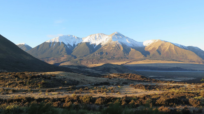
MetService forecaster Mads Naeraa-Spiers said the main falls will be inland from Christchurch today.
"Most snow is likely, at the moment, in Canterbury where there's quite steady rain on the plains, but it looks like it's snowing above 400 metres so they could get a decent dumping of snow there today."
Mr Naeraa-Spiers said the snow's easing in the lower south but will be back tomorrow and Saturday.
He said the ice, rain and snow across South Island roads will be treacherous today.
"Where it has snowed it remains really really cold. The roads re likely to remain slippery so be careful anywhere in Southland, Otago and Canterbury."
Small parts of Otago, Southland and Fiordland had a flurry of snow yesterday, but not as much as initially predicted.
MetService has issued a severe weather watch for Canterbury, which is expected to be upgraded to a warning for inland parts of Canterbury.
The coldest temperatures of the weather event are expected for the region tonight as part of south-easterly winds.
Weather expert Richard Green said the surprising lack of rain in the area could be leading to something else.
"That does suggest that snow levels close to sea level, and Christchurch could see the white stuff for the first time in about four years."
Mr Green said the front will be hanging around for some time.
"By the weekend it does slowly move out of Canterbury and Marlborough, then Central New Zealand might see it clear through by the end of the weekend."
Avalanche Advisory forecasters are predicting some lower altitude areas could be vulnerable to storm slab avalanches over the next 36 to 60 hours.
Heavy snow is falling at low elevations, which will become warm and unstable above backcountry roads, tracks and farms.
Mountain Safety Council chief executive Mike Daisley said this could increase the risk of storm slab avalanches in areas that never usually get them.
"If you've ever been skiing and you've ended up with snow on the roof of your car over the day, and you're driving along and you suddenly stop, and that whole lump slides off the roof at once, that's probably the most visual way to describe what happens."
Up to a metre of snow could fall in some localised regions.
Mr Daisley said heavy snow falls at low elevations could expose roads, tracks and farms that aren't usually vulnerable.
"Walking tracks, tramping tracks, even farming tracks, particularly in the South Island. A lot of farming goes on in those lower altitudes."
Meanwhile, Dunedin residents are to expect bitterly cold temperatures to continue.
Dry spells act as an interlude for Dunedin this morning, before more severe weather sets in later this afternoon.
Mr Green said the day might not be too bad, but temperatures are set to plummet.
"For Dunedinites today, even though temperatures might be four fives and sixes at their peak, it will feel more like one two or three in that cold southerly that's coming with this system."
Take your Radio, Podcasts and Music with you