An unsettled Sunday is expected across much of New Zealand with a front delivering rain to the lower South Island and West Coast, along with high elevation snow.
MetService meteorologist Sarah Haddon said there are a series of fronts coming from the south-west which will be moving over the South Island first, and then on to the North Island this evening.
"This will bring periods of rain to most areas, apart from eastern parts which are slightly more sheltered like the Canterbury Plains, coastal Marlborough, Gisborne, Hawkes Bay and the Bay of Plenty area which wont be affected so much - just some high cloud around.
"Almost everywhere else will be experiencing periods of rain or showers and we do have quite a lot of thunderstorm risks out, with squally thunderstorms and hail expected. These will be everywhere in the west, from Southland all the way up to the Waikato" Haddon said.
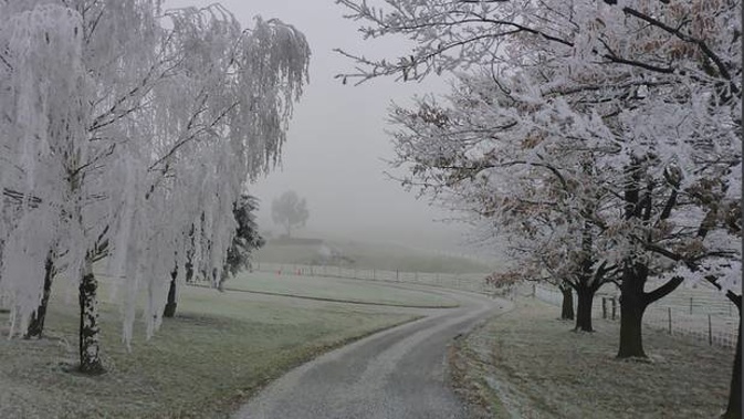
"There is quite a lot of cold air coming behind these fronts, so we are also expecting some snow as well."
Heavy rain watches are in place for Fiordland and Westland south of Otira, with possible thunderstorms in western areas and Stewart Island as well.
These thunderstorms have the potential to bring localised heavy rain of 10 to 25 mm per hour, small hail, strong winds gusting 90 to 110 km/h and also the possibility of a localised small tornado, mainly to coastal areas.
Northwesterly gales are expected in exposed parts of the Canterbury High Country, additionally, a cold southwest change behind this front may bring snow down to low levels across the lower South Island, with some heavy falls above 400 metres.
This watch also covers the likelihood of snow accumulations reaching warning criteria above 400m in Fiordland.
Road snowfall warnings are in place for Lewis Pass (SH7), Arthur's Pass (SH73), Haast Pass (SH6), Lindis Pass (SH8), Crown Range Rd, and Milford Rd (SH94).
On Monday and Tuesday, there is moderate confidence of warning amounts of snow in Fiordland, Southland and parts of Otago above 400 metres.
People are advised to keep up to date with the latest forecasts in case parts of these watches are upgraded to a full warning or new areas are added.

Today's forecast
• Whangarei: Partly cloudy, a few showers. Northwest picking up evening. High 16C / Low 11C.
• Auckland: Cloud increasing with a few showers, turning to rain tonight. Northwest picking up afternoon. High 16C / Low 11C.
• Tauranga: Partly cloudy. Brisk westerlies. High 16C / Low 10C.
• Hamilton: Showers turning to rain this evening. Brisk westerlies. High 15C / Low 8C.
• New Plymouth: Showers turning to rain afternoon, possibly heavy with thunderstorms from evening. Brisk northwesterlies. High 15C / Low 9C.
• Napier: Fine. Cloudy increasing from afternoon. Gusty northwest. High 18C / Low 8C.
• Palmerston North: Often cloudy. Occasional light rain after midday, setting in at night. Northwesterly picking up. High 14C / Low 8C.
• Wellington: Showers developing about the Hutt Valley this morning, spreading elsewhere from midday. Strong gusty northwesterlies. High 14C / Low 8C.
• Nelson: Partly cloudy, a few afternoon showers. Northwesterlies. High 14C / Low 2C.
• Christchurch: High cloud. Northerlies, gusty in the morning, turning westerly overnight. High 15C / Low 1C.
• Greymouth: Periods of rain, possibly heavy with hail and thunderstorms. Northwesterlies strengthening. High 13C / Low 3C.
• Dunedin: Cloudy with chance morning shower, then becoming fine. Gusty northwesterlies. High 11C / Low 4C.
• Queenstown: Cloudy with occasional rain, then fine spells developing from afternoon. Gusty westerlies easing. High 9C / Low -1C.
• Invercargill: Rain at times. Squally thunderstorms with hail possible from afternoon. Strong westerlies. High 9C / Low 2C.
Take your Radio, Podcasts and Music with you