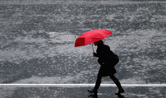
It might be time to dig the thermals out as many parts of the country are expected to hit minus temperatures and bitterly cold gales are forecast.
Southerly gales are due to hit eastern coastal areas today and tomorrow. Strong wind watches are in place for the Hawkes Bay and Gisborne, Marlborough, Wellington and Wairarapa, and Canterbury from Banks Peninsula northwards.
MetService meteorologist Brian Mercer said the entire country was experiencing a cold southerly airflow.
"From about 11am this morning we are expecting southerly winds to approach severe gales at times," he said.
"It is mostly going to be offshore, but certainly some of those exposed coastal valleys could get some stronger winds.
"Those strong winds will spread up the east coast from about 1pm this afternoon, and then up to Hawkes Bay and Gisborne from about 7pm this evening."
Mercer said some showers and very cold temperatures were also expected, and snow to relatively low levels.
"Lindis Pass and Arthurs Pass have had snow overnight, and we are expecting snow to drop down to about 500m on the eastern side of the Canterbury Plains this afternoon.
"Moving up we would expect some of those showers to develop snow to about 600-700m in Wairarapa and the Wellington hills, and possible even into the Hawkes Bay ranges."
Southerlies over the South Island mean temps are looking chilly this Sunday but not as cold as overnight Monday when skies are clear. Why do clear skies make a difference to overnight minimums? Find the answer here https://t.co/aKlFbSUdAC ^AC pic.twitter.com/PtdVWYdcmc
— MetService (@MetService) May 26, 2018
One of the best parts of the country to be today is the West Coast of the South Island, where light cloud will clear this morning and a nice afternoon is expected.
Auckland will experience some showers, potentially quite heavy, and has a maximum temperature of 15C and an overnight minimum of 7C.
Hot water bottles and extra blankets are in need tonight as much of the country is set to get a temperature drop.
"In the North Island we would expect places in inland Waikato to get down to about 1C and some of those higher areas like Rotorua and Taupo will get down to about 1C as well.
"In the South Island there is an improving trend tonight and into tomorrow where they are getting some fine weather. Wanaka we are expecting to get down to -1C tonight, Alexandra and Blenheim to about 0C, and even Nelson could get down to about 2C."
The winter snap is expected to ease over the next few days; there will be a few showers but mostly fine weather on the horizon.
Take your Radio, Podcasts and Music with you