Sydney is set to swelter today, suffering through its hottest day of summer so far and the most blistering for more than a year. At 12.30pm it had alreday reached above 35C.
In Tasmania, bushfires are still raging while in northern Queensland the monsoon continues to do its worst with warnings of the “worst flooding ever experienced in the region”. More than 350mm fell in some parts of the state in just 24 hours yesterday.
On Thursday, Sydney’s CBD is forecast to top out at 40C. In summer, Sydney’s west can surpass the 40C mark regularly — and will likely do so today — but sea breezes usually moderate CBD temperatures to sometimes as much as 10 degrees cooler.
But not today where the west and CBD will share the same 40C max. According to the Bureau of Meteorology (BOM), the highets temoperature Sydney has reached thsi month was 37.8C on January 5. You have to go back to January 7 2018 to surpass 40C in Sydney, when the city reached 43.4C.

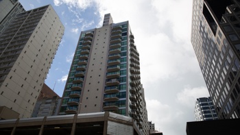
Dark orange marks the spot. Sydney is set to swelter on Thursday. Photo / Supplied
“The fire danger drops significantly on Thursday in most areas but in New South Wales there will be very, very hot temperatures in Sydney pushing 40C in some areas,” Sky News Weather channel meteorologist Tristan Meyers said.
Newcastle could hit 39C and Penrith 40C with inland areas slightly cooler in the mid to late 30s. Stormy and 35C in Canberra.
Then, towards evening, things should change with the cold front that swept through South Australia, Victoria and Tasmania yesterday making its way north.
“Thankfully, the southerly change will come for NSW clearing out the mucky humid air for the coast with Sydney, Wollongong and Hunter seeing milder air coming through,” Mr Meyers said.
It could be accompanied by some wild weather however with the BOM warning that a southerly buster could bring damaging winds.
The cooler conditions will see a high of just 25C in the city on Friday, slowly creeping up towards 30C through the weekend. Penrith will be on 26C on Friday, Wollongong 21C and Newcastle 23C. Inland areas will still be hot though with Dubbo on 36C and Moree peaking at 37C in the run up to the weekend.
Further south, the fire danger was not over, said Mr Meyers.

Searing temperatures are likely to effect Sydney before a cool change comes through on Thursday. Photo / BSCH
HEAT SET TO RETURN
“In Tasmania, we’ve seen major bushfires, tens of thousands of hectares in size, affecting homes and properties. While cooler weather is on the way what we will see is more fire danger on weekend.”
Hobart is looking at 18C today slowly rising to 31C by Sunday.
Health authorities in the state are asking people to evacuate their homes as dense smoke blankets Hobart from bushfires burning in Tasmania.
State Public Health director Mark Veitch issued a statement warning smoke levels at Cygnet and surrounding areas could cause serious health issues.
“Bushfire smoke is harmful and can trigger fatal health conditions.”
The Tasmanian Fire Service has warned the Huon Valley fires are nearing urban areas and could throw embers up to 1km ahead.
Melbourne will see two days of highs in the low twenties before the mercury heads up again to a maximum of 31C on Saturday and then a whopping 38C on Sunday as the heat returns with a vengeance.
It’s a similar story in Adelaide, but sooner, with a high of 25C today and then 37C on Saturday. Residents of Perth will see 38C today, although the Western Australian capital has already had three days this month exceeding that. But the mercury is heading down in Perth and will get into the twenties on the weekend.
It will be around the 30C mark and stormy for Darwin with heavy rain as it feels some impact form the monsoon. Falls of between 30mm and 45mm are possible.
QUEENSLAND DELUGE
Into Queensland, Brisbane remains persistently in the low thirties with the possibility of a touch of rain.
That’s nothing like the deluge in the far north of the state: “We’re not even halfway through this rainfall event with hundreds of millimetres still to fall,” Mr Meyers said.
“This is potentially the worst flooding ever experienced in the region.”
Cairns is looking at torrential rain every day for the next week with 60mm to as much as 120mm or even 150mm up to and during the weekend. There will be highs of around 28C.
Innisfail could see up to 200mm and Townsville not much less.
Residents at Bluewater, just north of Townsville, are mopping up after more than a metre of rain swept through homes on Wednesday.
Cars were washed away and some homes suffered severe inundation, with water almost reaching the level of kitchen benchtops.
Authorities have been going door-to-door checking on and rescuing stranded residents after Bluewater Creek burst its banks, unable to contain the 365mm of rain in the area since 9am on Wednesday.
Residents from north of Tully to south of Townsville are subject to a severe weather warning that includes the possibility of more flash flooding.
Take your Radio, Podcasts and Music with you