As a storm bears down on central New Zealand, tornadoes, thunderstorms, power cuts and flooding are predicted as wild weather batters the country.
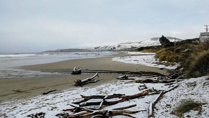
MetService has extended the heavy snow warning in force for South Canterbury and North Otago to include Dunedin, as roads in the heart of the South Island close because of the dumping of snow.
A heavy snow watch remains in force for the remainder of Canterbury south of Rangiora and Central Otago.
Road closures include SH73 from Springfield to Arthurs Pass (Porters Pass). SH73 from Arthurs Pass to Otira is closed to towing vehicles.
MetService meteorologist Peter Little said there had been some snow on the Crown Range and Lindis Pass in Otago overnight and more was expected. At 9am today the temperature at the top of the Crown Range Road was -1.4C.
Heavier dumps today could bring as much as 40cm of snow in areas above 500m and snow warning are in place for areas above 300m.
NZTA has urged drivers to plan ahead and take precautions.
The director of Civil Defence and Emergency Management for Otago, Chris Hawker, said the situation was being closely monitored for travel and access to areas, but no weather responses were being activated at this point.
"We've been very fortunate this winter because it's been an extremely mild one, so it's obviously a little bit more of a shock when it does arrive," he said.
Meanwhile, a severe thunderstorm watch remains in place for much the country as conditions could become severe from northern Westland to coastal Waikato later today.
A heavy rain watch is in place for Waikato, Waitomo, Taumarunui, Taranaki, Nelson west of Motueka and Buller and the Bay Of Plenty ranges east of Whakatane.
MetService predicts there could be localised downpours of 25mm to 30mm an hour, especially inland, and damaging wind gusts of 110km/h or stronger.
Rainfall of this intensity could cause flooding, especially in low-lying areas.
There was also the possibility of small tornadoes near the coast.
The view from space shows the South Island cloaked in cloud, with rain & snow affecting most places. Not quite as cloudy over the North Island, but the line of bright looking cloud extending northwest from Waikato contains thunderstorms https://t.co/rcECVuGXOw ^PL pic.twitter.com/OnnsINbhPx
— MetService (@MetService) August 10, 2019
Take your Radio, Podcasts and Music with you