A second round of rain, straight from the tropics, is set to unleash across New Zealand in the coming 24 hours.
After last night's deluge that saturated soil across Auckland, MetService is warning a new low is on its way with Northland to feel the first impact from 3pm tomorrow.
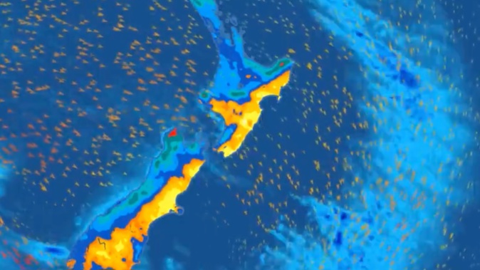
The coming storm is being described as a "significant event" which could bring rainfall and wind strengths exceeding warning criterias.
Niwa weather is describing the coming rain as a "plume of moisture" extending southward from the Coral Sea.
It is expected to bring far heavier rain than yesterday.
Rain watches have been issued for Northland, Coromandel, Bay of Plenty, Mt Taranaki and western regions of the South Island.
The low, which is expected to deepen rapidly tomorrow, will bring strong winds and heavy rain to both islands.
"Keep up to date with the latest forecasts as parts of the watches are likely to be upgraded to warnings, and more areas are added," said MetService.
Rain was expected to start falling tomorrow afternoon, worsening on Friday.
MetService said the heaviest falls were reserved for northern and western regions. Gales were also likely about northern and central New Zealand, while strong winds developed in the far south.
Northland could also expect thunderstorms.
Today was seen as the calm before the storm with rain in some areas not expected to let up until early Saturday morning.
"It has the potential to bring impacts to New Zealand," said meteorologist John Law.
Weatherwatch.co.nz said the North Island would bear the brunt of the most unsettled weather in half a decade, with at least six lows bringing bursts of rain and wind in the next 10 days.
At least three were expected to produce "severe weather risks".
The unfolding winter pattern follows five years of general rain shortage across the top half of the island, said the forecaster.
Take your Radio, Podcasts and Music with you