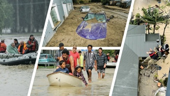
Heavy rain continues to pelt the South Island this afternoon with emergency services remaining on standby.
A number of roads and schools have been forced to close with rivers throughout the West Coast running high, many reaching alarm levels.
Haast has faced the brunt of the heavy rain, with over 70mm of rain falling today and 90mm expected by the end of the day.
Westland District Council has activated its emergency operations centre in the local offices and they are continuing to monitor river levels.
Contractors are assisting with road management, with a number of roads and highways being closed in sections due to slips and surface flooding.
Localised flooding on the South Turnbull Rd in Okuru and south of the Arawhata Bridge has resulted in self-evacuations south of the bridge.
Latest MetService Westland Radar @ 3.22pm, where red & purple highlights areas of heavy rain. There has been 232mm of rain recorded at Franz Josef, 143mm at Haast, and over 400mm in the ranges. Stay up to date at https://t.co/Sd5C6lrsSL and check road closures at @NZTACWC ^Lisa pic.twitter.com/cJYFQ1RCqq
— MetService (@MetService) March 26, 2019
MetService reports a strong and moist northwest flow covering the South Island ahead of an active front over the Tasman Sea is to blame for the weather.
Significant rainfall has already fallen in southern Westland, Fiordland and the headwaters of the south Canterbury and Otago lakes and rivers.
In addition, heavy rain warnings are also in place for Buller, northern Westland and the north Canterbury headwaters.
MetService said the strong front will slide over the South Island today before breaking onto the North Island tomorrow, bringing with it strong winds and heavy rain.
Whataroa deviation, State Highway 6, today as heavy rain falls on the West Coast of the South Island. Photo / Supplied
Westland District Mayor Bruce Smith said rivers had reached heights similar to the 2016 floods which caused around $30 million worth of damage.
"We had 390mm of rain last night, and another 300mm is forecast in the next 15 hours. We have just got to hope it all goes down the river," he said.
/arc-anglerfish-syd-prod-nzme.s3.amazonaws.com/public/A6NPG53YORD6JPJ24PMJ32AE3A.jpg)
River in flood at Waiho River Bridge, Fox Glacier Highway. Photo / Supplied
Meanwhile, the South Islands road network has taken a hammering due to the heavy rain and strong winds which have resulted in flooding and slips.
NZ Transport Agency South Island asks motorists to take extra care with the extreme weather, debris and flooding impacting sections of road.
State Highway 6 between Hokitika and Ross is closed due to flooding and further down the road between Franz Josef to Haast is also closed due to a slip.
Between Ross and Haast motorists are asked to drive with caution with surface flooding impacting the road in many areas.
Slips on SH6 between Haast and Makarora have also closed the road. NZTA South Island said the next update on the roads can be expected at 8am tomorrow.
MetService meteorologist Stephen Glassey said Milford Sound had already had more than 400mm of rain since Sunday.
The heaviest falls were overnight, with 124mm in five hours from midnight, with rainfall rates of 30mm an hour over a few hours.
There would be even larger accumulations in the ranges but there were no rain gauges in the hardest-hit spots, Glassey said.
Farther north, Franz Josef had recorded about 160mm since Sunday, but the heaviest falls were expected today as the front edged up the country.
/arc-anglerfish-syd-prod-nzme.s3.amazonaws.com/public/DET2G54DIZBQBH5D3F5HKNPERI.jpeg?width=501&height=376&mode=max)
The rain would ease about Fiordland but intensify in Westland through the day before reaching Buller and the lower southwest North Island tomorrow.
There were still heavy rain warnings in place for many places including Westland south of Otira, the headwaters of the Canterbury lakes and rivers south of Arthurs Pass, headwaters of Otago lakes and rivers, and Fiordland.
Once the front reached the North Island there could be some heavy falls around Mt Taranaki and the Tararua Ranges, but it would have greatly weakened leaving just some isolated showers on the flats for the end of the week, Glassey said.
Take your Radio, Podcasts and Music with you


