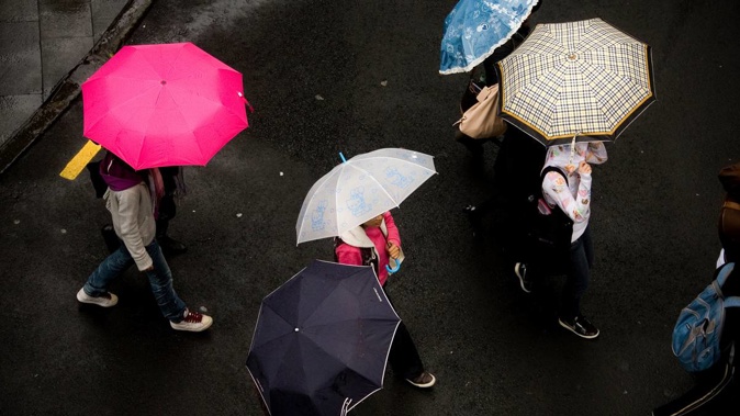
Wet weather will be widespread across New Zealand today, with an impending deluge brewing over the Tasman Sea expected to thrash the country tomorrow.
Rain is expected to develop over the day while winds get stronger as a large low rapidly forms and peaks in power, WeatherWatch says.
Tomorrow the system will move on to New Zealand before weakening but not before the system drenches parts of the country.
MetService had been expecting rainfall with warning criteria from Taranaki to East Cape tomorrow, extending on Thursday about eastern Bay of Plenty and East Cape.
However, it now has a heavy rain warning in place for the Bay of Plenty for the early hours of Wednesday morning, and Taranaki north of Eltham.
A heavy rain watch is in place for the Coromandel Peninsula from 11pm today until 7am tomorrow, along with Taupō, Taumarunui, Waitomo, Waikato south of Hamilton, and Tongariro National Park from 1am to 9pm tomorrow.
Despite the placid weather yesterday, MetService says like today, the rest of the week will be a little rough for most of the country.
Spring weather will continue, with summer weather patterns not yet taking place.
Low weather systems are omnipresent during spring with roaring westerlies bringing them over the country.
Lows mean wet, windy, and often cold weather, and MetService meteorologist Tui McInnes says this week is no exception.
"A low-pressure system is currently developing in the Tasman Sea, near Tasmania," McInnes says.
"This low will bring a complex frontal system with it, and we are forecasting widespread heavy rain and areas of gale winds for most areas north of Canterbury."
Niwa says systems like this are a hallmark of La Niña, the climate system which brings dry weather to the south and wet to the north.
Periods of rain develop this morning for Northland, Auckland, Waikato, the Coromandel Peninsula, and the Bay of Plenty. There will be some heavy falls in Coromandel and western areas of the Bay of Plenty.
Rain will spread south from late morning from Waitomo to Manawatu, including the central high country, with some heavy falls possible in Taranaki.
Elsewhere, there will be a few showers, mainly about the ranges, in Gisborne to Wairarapa and Horowhenua to Wellington, then rain from afternoon or evening.
Isolation showers will develop to rain this afternoon in Marlborough, Nelson, and Buller.
Westland and Fiordland can expect a bit of morning cloud before a fine day.
And in Canterbury, Otago, and Southland, there will be areas of morning cloud then fine weather with scattered afternoon and evening showers.
Southern parts of the South Island may be spared from adverse weather midweek, another rain and cool southwest change is due before the weekend.
Weather forecast
Whangārei: Cloudy. Periods of rain developing this morning. Northerlies strengthening. High 19C, Low 15C.
Auckland: Periods of rain developing this morning, easing at night. Northeasterlies strengthening. 19C, 15C.
Tauranga: Rain developing this morning, heavy at times from afternoon. Northeasterlies developing in the morning, strengthening in the evening. 18C, 13C.
Hamilton: Rain developing this morning, heavy at times from afternoon. Northerlies strengthening. 17C, 12C.
New Plymouth: Rain developing this morning, heavy from afternoon. Northeasterlies becoming strong. 17C, 12C.
Napier: High cloud increasing. Rain setting in from afternoon. Northerlies, picking up in the evening. 18C, 13C.
Wellington: Partly cloudy, chance of a morning shower. Occasional rain developing by evening. Light winds. 17C, 11C.
Christchurch: Fine apart from some cloud about Banks Peninsula. Becoming cloudy everywhere this evening with late drizzle. Northeasterlies. 16C, 11C.
Queenstown: Mostly cloudy this morning with afternoon fine spells and the chance of a shower. Light winds. 18C, 8C.
Dunedin: Morning cloud then fine. Cloud and drizzle developing in the evening. Northeasterlies. 16C, 10C.
Invercargill: Fine spells. Light winds, but afternoon southerlies. 17C, 6C.
Take your Radio, Podcasts and Music with you