A cold blast of air from the Antarctic is bringing sub-zero temperatures and snow down to sea level in some parts of New Zealand.
Huge waves of up to eight metres are also forecast for the west coasts of both the North and South Islands this weekend.
Boaties and anyone keen on fishing from the rocks are being told to stay home until at least Tuesday because conditions are too dangerous.
"For the first time in a long time we've got good southerlies over the country, bringing cold temperatures from the South Pole," Metservice forecaster Tom Adams said.
"They are already bringing cold temperatures and it will stay cold for a couple of days," he said.
Mt Cook fell to -3C last night, Blenheim was -1C and Waiuoru in the central North Island was 1C. Nowhere got out of single-digit temperatures.
But windy conditions have prevented it getting any colder. When skies clear tomorrow evening, temperatures will fall even further.
The coldest spot will be Alexandra, where the thermostat is likely to drop to -6C in the evening. Wanaka will be -5C and Queenstown -4C.
"Those places are a bit more sheltered from the south-westerly winds, not being on the coast, so it's going to be pretty cold. Alexandra is only looking at 4C as a daytime maximum," Adams said.
Southland and Otago farmers should be wary of the "brutal wind chill" that could prove dangerous to newborn lambs and calves by pushing localised temperatures well below zero, WeatherWatch head analyst Philip Duncan said.
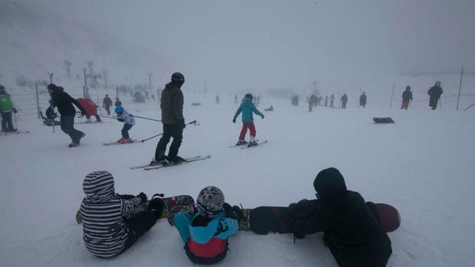
A couple of fronts would bring snow showers over the next two days. Metservice's severe weather outlook warns of likely snow for the central North Island and the north-west and far south of the South Island. Snow could get down to sea level in parts of Southland tomorrow.
"The snow will be good for skifields in the Southern Lakes, and Mt Ruapehu," Adams said, though he warned that there was a risk of gales for the bottom of the South Island on Monday.
A "big pulse of swell" will produce waves up to eight metres on the West Coast of the South Island and the West Coast of the North Island south of Kaipara Harbour. Further north, swells would be around six metres.
Our high-resolution wave model (2 km) shows the largest waves stay offshore.
— NIWA Weather (@NiwaWeather) August 1, 2019
Still, big waves will impact the west coast of both islands over the next 36 hours. And with King Tides this weekend, there's a risk for 'overtopping' in localised areas. pic.twitter.com/dKPfEvVNPA
Metservice is also warning of severe southwest gales for parts of Southland, Clutha and Dunedin on Monday and early Tuesday.
TODAY'S WEATHER:
Whangārei
A few showers clearing, then cloudy periods. Gusty southwesterlies easing evening.
High: 15C
Low: 9C
Auckland
Showers easing through the morning. Strong southwesterlies, gale gusting 80 km/h in exposed places, easing evening.
High: 14C
Low: 10C
Tauranga
Morning cloud and chance shower, then fine. Gusty westerlies.
High: 14C
Low: 9C
Hamilton
Showers easing morning with afternoon fine breaks developing, but return in the evening. Gusty southwesterlies easing afternoon.
High: 13C
Low: 8C
Taupō
Cloudy periods. Few showers easing morning. Strong, gusty westerlies easing afternoon.
High: 11C
Low: 7C
Whanganui
Showers clearing from late morning. Strong, gusty westerlies, easing afternoon.
High:14C
Low: 9C
Wellington
Brief morning shower, then fine. Strong southerlies, turning strong northwesterly afternoon.
High: 12C
Low: 8C
Christchurch
Early showers, with gale southwesterlies and snow to 700m for Banks Peninsula, clearing morning to fine with northerlies. Rain again at night.
High: 13C
Low: 0C
Dunedin
Early showers clearing as winds turn northwesterly. Evening rain with a strong southwest change, and snow lowering to 500 metres.
High: 12C
Low: 3C
Queenstown
Becoming fine morning with westerlies. A period of rain from late afternoon, turning to one or two snow showers with southerlies evening.
High: 10C
Low: -4C
Take your Radio, Podcasts and Music with you