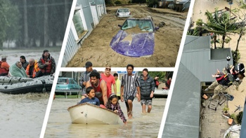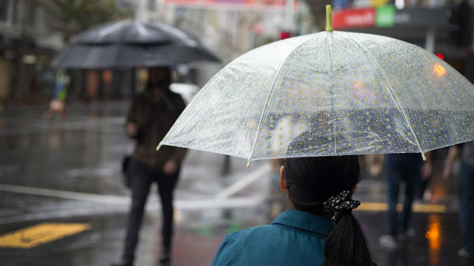
The sunny start to the week was short lived, with severe weather warnings for rain and wind forecast over the lower South Island today.
A complex low system is due to make its way over the country during the next few days, bringing heavy rain, gales and possible thunderstorms.
Heavy rain warnings are in place for Fiordland from 7am this morning until 1pm, and in Westland from 5am to 11am.
Heavy rain may cause streams and rivers to rise rapidly. Surface flooding and slips are also possible and driving conditions may be hazardous.
There is a low risk of thunderstorms over Fiordland and southern Westland during the morning.
Severe Weather Warning and Watch now in place as a NW flow brings rain to the South Island. https://t.co/qHyE5zhh6X ^RK pic.twitter.com/mhfdWyq0wl
— MetService (@MetService) December 16, 2018
Northwest gales are forecast for northern Southland, inland Otago and the Canterbury High Country. A strong wind watch is in place from 1am to 6pm.
There is also a low risk of thunderstorms in South and Mid-Canterbury, and over the ranges of Gisborne during the afternoon and early evening.
This trough over the South Island is expected to move slowly northeast over central and northern New Zealand during Wednesday and Thursday.
Heavy rain, possibly reaching warning criteria, is forecast to persist in Westland, Buller and the ranges of northwest Nelson into Thursday.
For the remainder of Nelson, Marlborough, Canterbury north of Rangiora, and from Wellington to Horowhenua, including the Tararua Range, there may also be warnable amounts of rain on Wednesday and Thursday.
For Manawatu to Waitomo, including the central high country, and across to the eastern ranges of Bay of Plenty, there is a low risk of heavy rain on Thursday.
Although there is a lot of weather between now and Santa's arrival, looking ahead to Christmas day, the forecast for the South Island looks promising, MetService says.
Westerlies will bring a bit of cloud and showers to the west, and warm, dry winds to the east.
Away from the Mainland, a trough over the north and east of the North Island is pushed away as a ridge of high pressure over central New Zealand spreads north.
In terms of weather, the North Island will have generally settled conditions for most, but MetService will keeping a close eye on the position of the trough to the north, in case it decides to sink south and put a dampener on the Christmas BBQ.
Today's forecast
Long fine breaks, chance afternoon shower. Light winds. High 25C / Low 16C.
Auckland: Mainly fine. Some morning and evening cloud and the chance of an afternoon shower north of the city. Southwest breezes. High 25C / Low 17C.
Tauranga: Fine apart from some morning cloud. Light winds and sea breezes. High 27C / Low 16C.
Hamilton: Fine, apart from some low cloud morning and night. Westerly breezes developing afternoon. High 26C / Low 13C.
New Plymouth: Fine, but morning and evening cloud. Westerly breezes. High 22C / Low 15C.
Napier: Fine with light winds and sea breezes. High 28C / Low 15C.
Wellington: Fine spells developing in the morning. Strong northerlies. High 21C / Low 16C.
Nelson: Fine with increasing high cloud and northerlies. High 25C / Low 16C.
Christchurch: High cloud thickening. Chance morning shower, then occasional rain from afternoon. Gusty northwesterlies. High 25C / Low 12C.
Dunedin: Cloud increasing. Occasional rain from late morning, possibly heavy. Gusty northwest turning southerly late afternoon. High 24C / Low 10C.
Take your Radio, Podcasts and Music with you