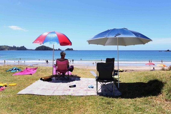
It's beach day right across Aotearoa, with beautiful weather forecast up and down the land of the (usually) long white cloud.
In our land of typically variable climates, MetService meteorologist David Miller said much of this weekend would be similar from Bluff to Cape Reinga.
"It's looking like a fine weekend for pretty much the entire country, with maybe just a little cloud in the morning and drizzle in Fiordland."
The only potential losers might be yachties and those hoping to catch a glimpse of the Prada Cup on Auckland's Waitematā Harbour, scheduled to start today but with light winds forecast to barely reach minimum racing standards.
For Saturday and Sunday, Auckland was in for fine weather and highs of 24C and 25C respectively with light winds.
Races 5 and 6 of the Prada Cup final between Luna Rossa and Ineos Team UK are scheduled to get under way between 4 and 6pm each day, but Miller said they could be "struggling a bit" to reach the minimum 6.5 knots required.
"There might be a bit of a seabreeze from the northeast, and Sunday similar, so hopefully it will reach the threshold."
But if you're not into sailing, both days will offer ample opportunity to get that summer swim in at the local beach, river or lake.
For Saturday, the hottest spot is forecast to be Alexandra, with a high of 31C, and 29C on Sunday, with all of central Otago to see warm conditions.
East coast spots in both islands are also in for some stunning days, with Christchurch in for a high of 27C both days, and Gisborne the top spot in the north with 26C today and 29C tomorrow.
Driving the glorious weather was a large ridge of high pressure sitting over the country, Miller said.
But make the most of it, as once it moves east on Tuesday a large front is expected to move onto the west of the South Island.
It is expected to reach the lower South Island on Tuesday, preceded by a strong, moist, northerly flow, bringing rain to western areas.
The front moves slowly east over the South Island on Wednesday, with warm temperatures expected about eastern areas.
As it will be slow-moving, Miller said it could provide a "decent amount of rain".
The hardest hit are expected to be Fiordland and Westland south of Hokitika, including the Otago headwaters, over Tuesday and Wednesday, with remaining parts of Westland and Buller also affected.
Take your Radio, Podcasts and Music with you