Heavy rain and severe easterly gales are forecast to smash into northern and central New Zealand on Sunday and Monday as the days look to be wet and miserable.
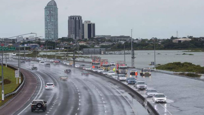
Warnings were already in place for Auckland ahead of a king tide reaching its peak on Sunday evening, bringing potential lane or road closure for motorists.
A low-pressure system was approaching New Zealand from the north, directing a strong and moist northeast flow over the North Island.
MetService said high tide on Sunday would be at 8.53am and 9.19pm, with the tide reaching heights of 3.5m and 3.7m.
Weather Watch said it was the combination of strong northeast winds and the king tide which could cause coastal flooding while heavy rain across the top of the North Island could also cause isolated flooding tomorrow and Monday.
Auckland Transport advised commuters to prepare for delays and closures around Tamaki Drive and Maraetai due to possible coastal inundation.
On Sunday, there was a moderate chance rainfall accumulations would reach warning criteria in Northland, Auckland including Great Barrier Island, Coromandel Peninsula, Bay of Plenty, Gisborne and Nelson (especially northwest Nelson), according to MetService.
Weather Watch said there was likely to be between 30 and 50mm of rain in many northern areas tomorrow afternoon but the slow moving nature of the rain band coupled with the upper North Island hills and ranges meant there may be some isolated spots that could receive mre than double the forecast amounts.
The threat continued through to Monday, with the exception of Northland.
In addition, on Sunday there was a moderate chance easterly gales would become severe about the northern half of the North Island, from Taranaki, Taihape and Gisborne northwards.
Meanwhile, there was a low chance of severe easterly gales for Whanganui, northwest Nelson and Buller on Sunday.
"On Monday, the flow should turn southwest as the low-pressure system moves east of New Zealand," MetService said.
Take your Radio, Podcasts and Music with you