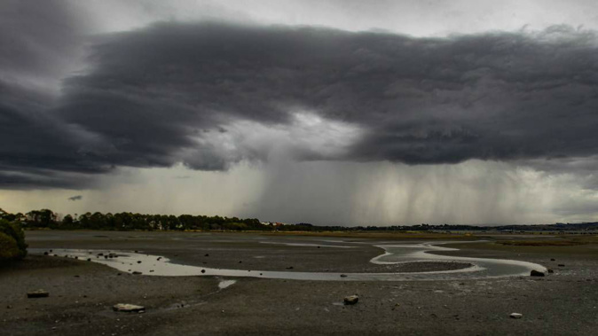
The country has copped a wintry battering overnight with rain, lightning strikes, snow on the southern alpine passes and wind gusts up to 140km/h.
By 10pm yesterday MetService had recorded almost 3500 lightning strikes over the day. Most of these were on the West Coast with 1120 in Westland, while the Southern Alps blocked most of them making it over to the east coast.
Two Air New Zealand flights were diverted to Christchurch after being struck by lightning yesterday on their way to Queenstown.
Overnight thunderstorms laid into areas north of Wellington including Porirua, Upper Hutt and Kāpiti.
The Wild-Wild-West! There have been almost 3500 lightning strikes so far today (to 10pm). The Southern Alps are doing a great job at blocking thunderstorms from getting too far east in the very strong westerly flow. Westland has had 1120 strikes. ^AG pic.twitter.com/WDmZzDOe9r
— MetService (@MetService) May 20, 2018
These had moved over Taranaki and the west coast of Waitomo and Waikato this morning.
There was also a low risk of thunderstorms extending slightly further east and north across Auckland and Northland.
Deep cold air spreading across the South Island in the early hours today is bringing a moderate risk of thunderstorms to Fiordland and coastal parts of Southland, Clutha and Dunedin.
Any thunderstorms there are expected to produce brief heavy rain falling as snow above about 400 metres, small hail and strong wind gusts of about 90km/h.
The weakening front behind all of the severe weather was slowly making its way up the North Island today, MetService meteorologist Stephen Glassey said.
The severe weather was due to ease through the day with just some showers forecast in western areas.
Auckland will see a few showers and a high of 19C. Wellington is in for a mostly fine day with northwesterlies and a high of 16C. Canterbury is slightly cooler with southwesterlies and a high of 13C forecast.
The far south is feeling the brunt of the wintry storms, with Invercargill and Queenstown both struggling to make it past 8C.
Due to the icy southwest winds this was likely to feel even colder, Glassey said.
The weather generally improves moving further east with Tauranga in for some fine spells and a high of 19C, while the east coast looks the pick of the bunch with Napier forecast a fine day with a high of 20C.
Winds reached gale force yesterday about Wairarapa, Wellington, Marlborough and most exposed places in the South Island.
Wellington's suburb of Kelburn recorded a gust of 110km/h while Le Bons Bay on Banks Peninsula near Christchurch got up to 140km/h.
Dunedin Airport recorded a gust of 110km/h.
The heaviest rain was in Arthur's Pass where 113mm fell in the past 24 hours. Milford Sound was a close second with 112mm.
MetService had issued road snow warnings for many of the South Island's alpine passes.
Through to 11am Lewis Pass (SH7), Arthur's Pass (SH73) and Lindis Pass (SH8) may see a few centimetres of snow; Crown Range Rd up to 5cm and Milford Rd (SH94) 12cm, with a few more cm this afternoon.
However, Glassey said due to the strong winds the night did not get particularly cold.
Gore was the coolest at about 5.30am on 1.7C.
Over the next week there are no signs of a change in the wintry weather,
"It is one trough after another at the moment," Glassey said.
"A trough came through on Saturday, another Sunday, and another tomorrow. It is not an unusual pattern, but it is a very stormy period.'
The next week is looking very "unsettled" across the country, as several troughs move over the country, embedded in a westerly flow.
On Tuesday, Thursday, and again on Friday, very active fronts move up the South Island.
Have a look at the expected weather conditions for 8 am Monday for the South Island as we go back to work & school. Note the effective, or feel, temp will be sub-zero for most due to brisk wind & low temp.
— NIWA Weather (@NiwaWeather) May 20, 2018
Waves of cold air/wind for the week ahead, especially SI.
~Chris pic.twitter.com/4M5tbwVpuW
"There are a number of lows passing to the south of New Zealand, and these are bringing troughs over the country, very changeable weather with rain and strong winds, especially in western areas."
Severe weather rain and wind warnings were likely to be issued later today for the South Island's west coast due to tomorrow's front, Glassey said.
Heavy rain and strong winds were likely to reach the North Island by tomorrow afternoon also.
The mountains will likely see a decent amount of snowfall this week with precipitation turning to snow down to 800m at times, possibly even lower in the far south.
Higher parts of the Southern Alps could see significant snow accumulations during this period.
Take your Radio, Podcasts and Music with you