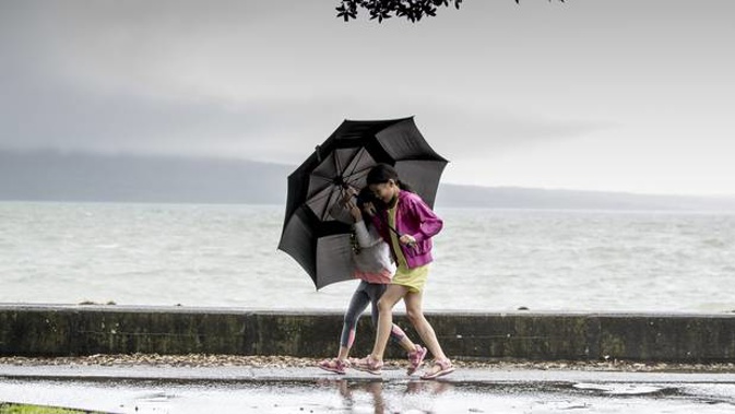
A series of fronts moving over both the North and South Islands this weekend mean it's going to be a wet one, especially in the west.
Metservice had a weather watch for heavy rain in place this morning for the Tararua Ranges, with a front sitting over most of the lower North Island.
"There's some rain in Taranaki, Whanganui and Manawatu through to Wellington," meteorologist Andrew James said.
"The front is going to move north through the day and bring rain to the whole North Island for a time."
he wet weather would be concentrated in the west and lighter in places like Gisborne and the Hawkes Bay, James said.
Meanwhile, another front was moving onto the South Island today.
"You've got some rain and thunderstorms associated with that."
Early this morning that front was sitting around Stewart Island and Fiordland, and while it would move north over the day it would miss areas like Canterbury, staying mainly in the west.
Fiordland would see persistent rain for most of the day.
The pattern would continue through the weekend, with more fronts bringing rain mainly to the west while the east coast of both islands should remain a little drier.
And those down south would have woken to a frosty morning, with temperatures plunging below zero overnight for the likes of Timaru and Dunedin.
A southwesterly flow of wind meant temperatures would stay low in the south for the next few days, James said.
Aucklanders got a shock to the system yesterday when the unseasonably warm May temperatures the Supercity had been enjoying dropped suddenly, and temperatures were going to hover around the 16- 18C mark today as well.
"Today it's looking to be quite similar but not so cold overnight."
Forecast
Whangarei:
Fine spells, showers developing afternoon. Northwesterlies. High 20.
Auckland: Isolated showers, becoming widespread afternoon, with possible thunderstorms. Northwesterlies changing southwest evening. High 18.
Hamilton: Rain developing late morning, possibly heavy, easing evening. Northwesterlies changing southwest evening. High 17.
Tauranga: Fine spells. Afternoon and evening showers. Northwesterlies. High 18.
Wellington: Morning rain, then fine with high cloud. Northwesterlies, gale in exposed places, easing morning. High 16.
Christchurch: Fine with some high cloud. Northwesterlies picking up. High 17.
Queenstown: Cloudy periods. A few late morning showers. Westerlies. High 12.
Dunedin: Fine with high cloud. However, a few late morning showers. Westerlies. High 13.
Invercargill: A period of morning rain, then fine spells with a few showers, clearing evening. Strong westerlies. High 10.
Take your Radio, Podcasts and Music with you