Heavy snow is set to blanket southern and eastern regions of both islands over the next 48 hours and towering seas will surge through Cook Strait.
Extensive warnings have gone out as much of the country is set to freeze in the grip of giant snowstorm.
Skiers and boarders brave the harsh wintry conditions at the Cardrona ski field. (Picture / Jen Houltham)
Civil Defence authorities are telling people to prepare for bone-chilling conditions as the wild weather heads north.
Travel operators across the country are preparing for major disruptions as the storm strikes. The Interislander today cancelled all sailings from tomorrow evening through to Friday because of predicted 7m high waves.
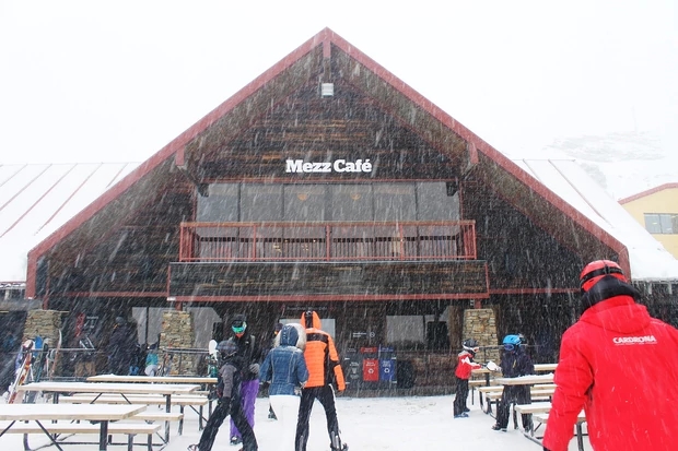
Snow falls on Cardrona Ski Resort today. (Picture / Jen Houltham)
Widespread snow is expected to fall as low as 100m across many southern and eastern areas of the South Island from now until Thursday.
MetService says Southland, Fiordland, Otago, Canterbury and Marlborough should prepare for "significant" snow falling below 500m.
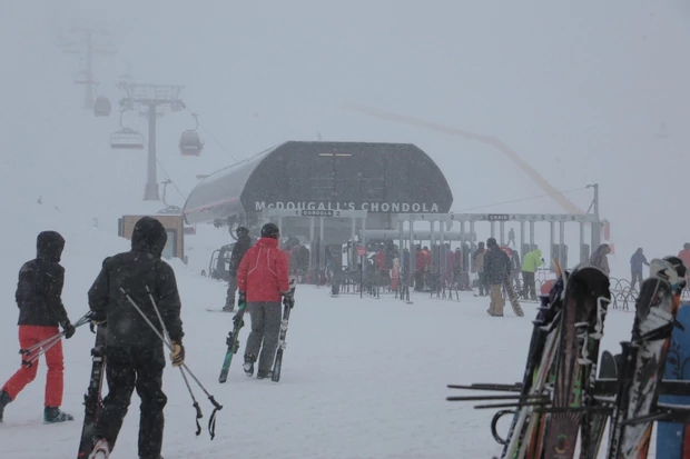
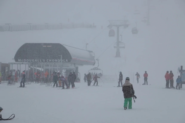
Skiers take refuge in the new Gondola at Cardrona. (Picture / James Mulcahy)
Potentially damaging gales are also expected to whip through North Canterbury, Marlborough and Nelson tomorrow and overnight until Thursday.
Tomorrow the storm is due to hit the lower North Island.
Central and eastern regions are expecting up to 20cm of snow down to 400m.
Road snowfall warnings, which have been issued for all South Island alpine passes and the highway north of Dunedin, now include Wellington's Rimutaka Hill Rd, the Desert Rd and the Napier-Taupo highway.
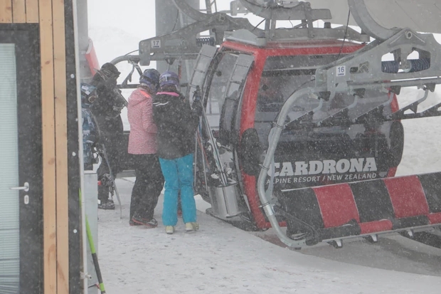
Cardrona gets a good dump of snow today. (Picture / James Mulcahy)
The lower half of the island is also expected to be pounded by gales and heavy rain on Wednesday and Thursday.
This morning snow was falling steadily in Central Otago as the rain band ushering in the frigid weather tracked up the island's east coast.
Ahead of the stormy forecast travel operators began suspending trans-alpine services including the West Coast shuttle bus service, which has suspended its daily return journey tomorrow.
The Interislander said sailings would resume Friday morning.
When and where the worst weather will strike
Snow falling below 500m
Southland and Fiordland: During today through to Wednesday afternoon.
Otago: Until around midday today, and again from tonight until Wednesday evening.
Canterbury and Marlborough: From this evening until Thursday afternoon.
Snow below 1000m
Taihape and Hawkes Bay ranges: From Wednesday afternoon until Thursday morning.
Severe gales:
Northern Canterbury, Marlborough, Nelson, Wellington and Horowhenua Kapiti Coast: From Wednesday afternoon until overnight Thursday.
Heavy rain
Wellington and Coastal Marlborough: During Thursday.
Wairarapa: From Thursday morning until Friday morning.
Take your Radio, Podcasts and Music with you